File list
Jump to navigation
Jump to search
This special page shows all uploaded files.
| Date | Name | Thumbnail | Size | User | Description | Versions |
|---|---|---|---|---|---|---|
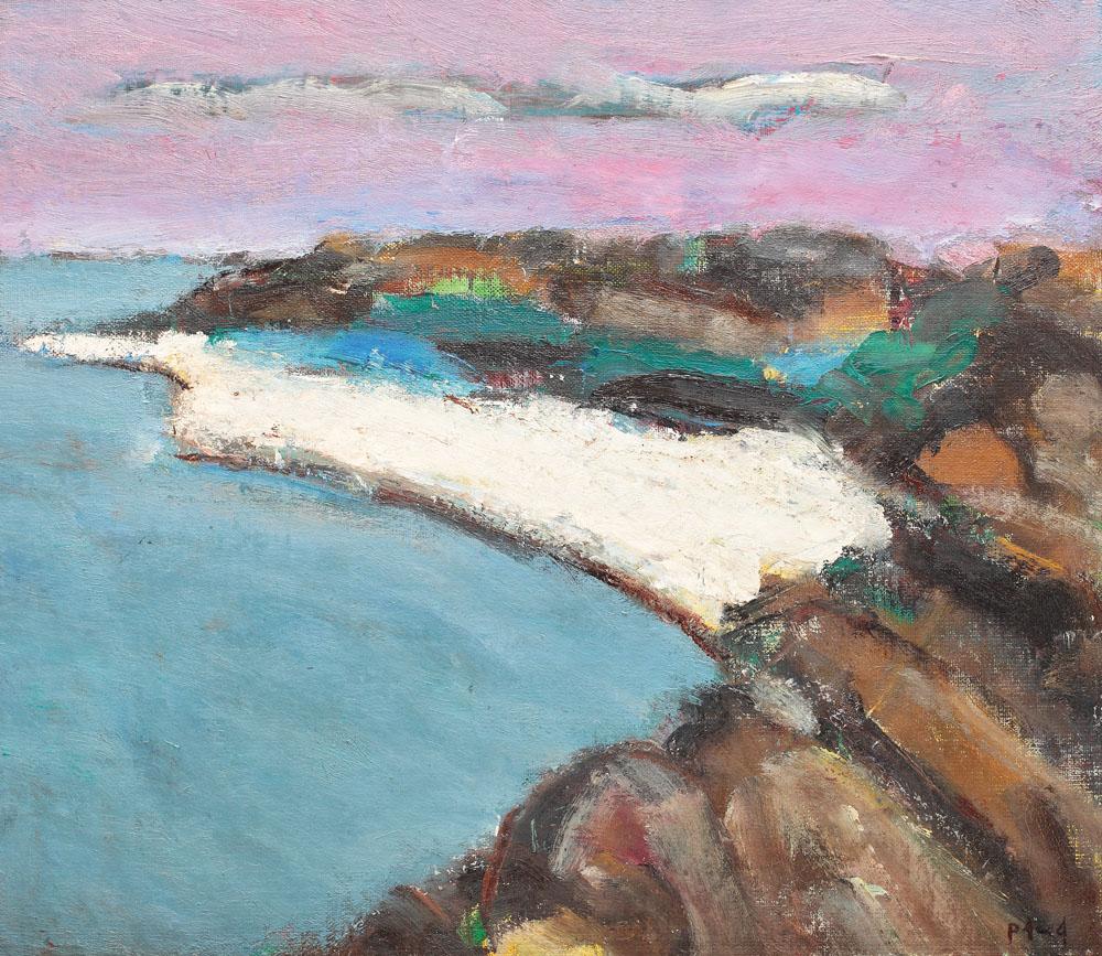
| 20:10, 19 April 2018 | 06 ion-pacea-sunset at 2 mai.jpg (file) |  |
180 KB | Ioneliat (talk | contribs) | https://g1b2i3.wordpress.com/alexandru-ciucurencu-pictor-roman/ | 1 |
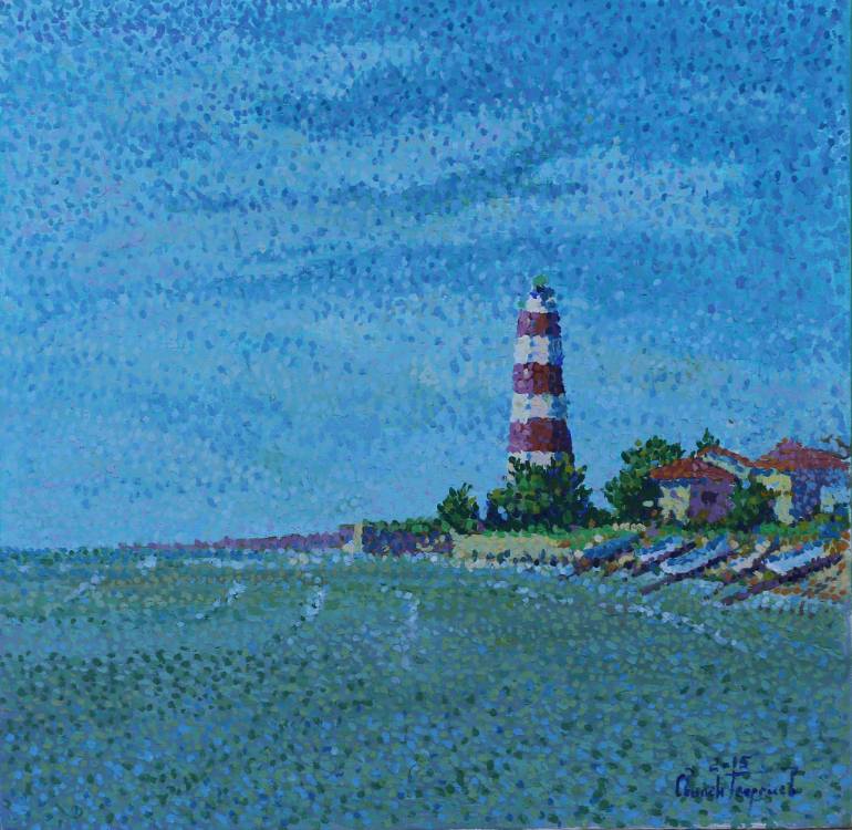
| 20:11, 19 April 2018 | 07 svilen gerogiev lighthouse shabla 2015.jpg (file) |  |
85 KB | Ioneliat (talk | contribs) | https://www.saatchiart.com/art/Painting-lighthouse-Shabla-2015/809672/2617991/view | 1 |
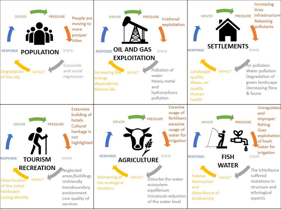
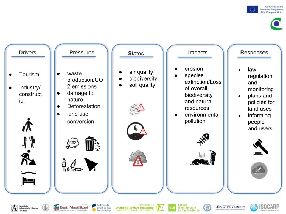
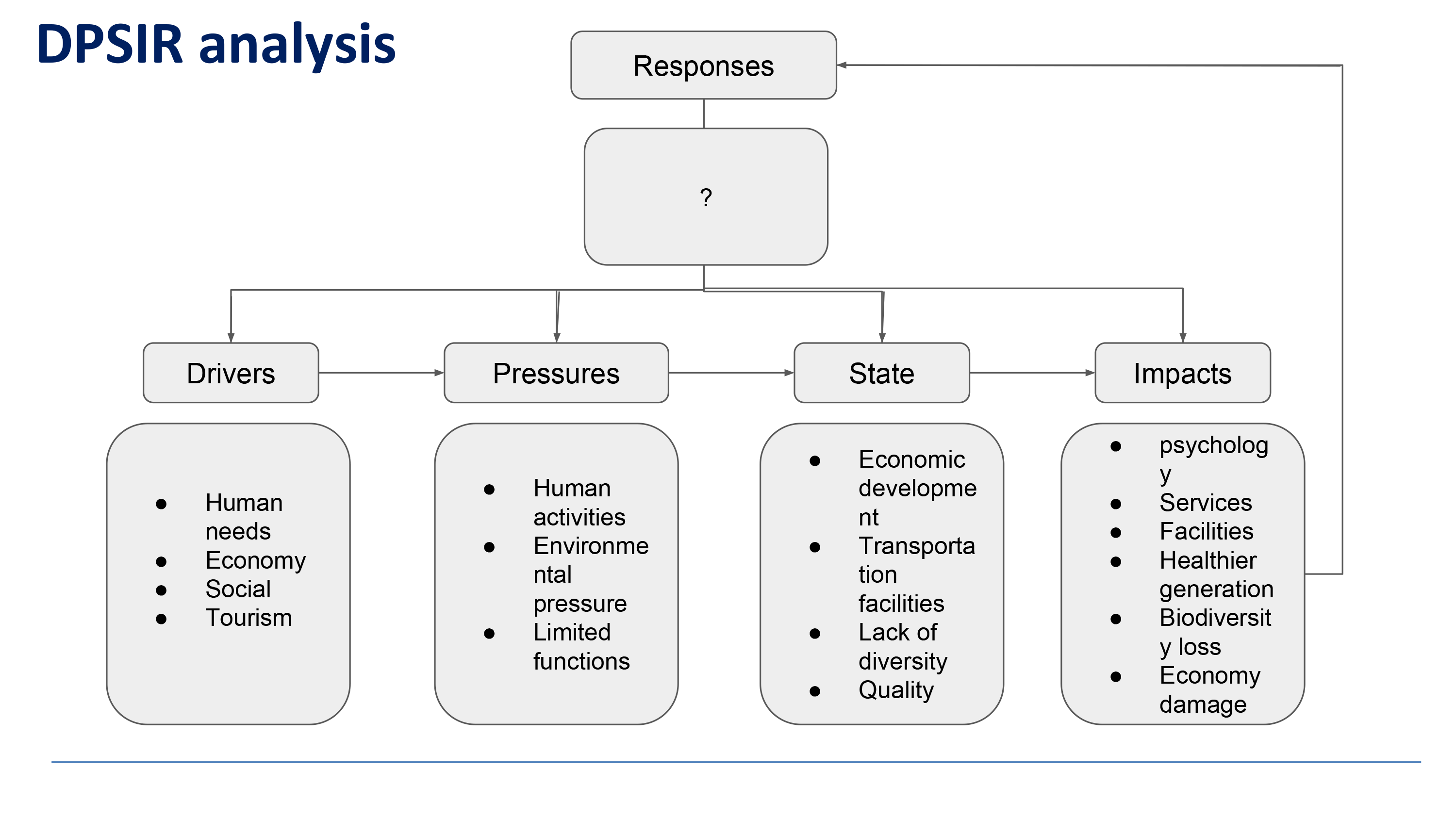
| 20:16, 19 April 2018 | DPSIR method .jpg (file) |  |
164 KB | Ioneliat (talk | contribs) | 1 | |
| 20:28, 19 April 2018 | CO-LAND Group Presentation 1 - Landscape System Analysis.pptx.jpg (file) |  |
59 KB | Yasamanr (talk | contribs) | 1 | |
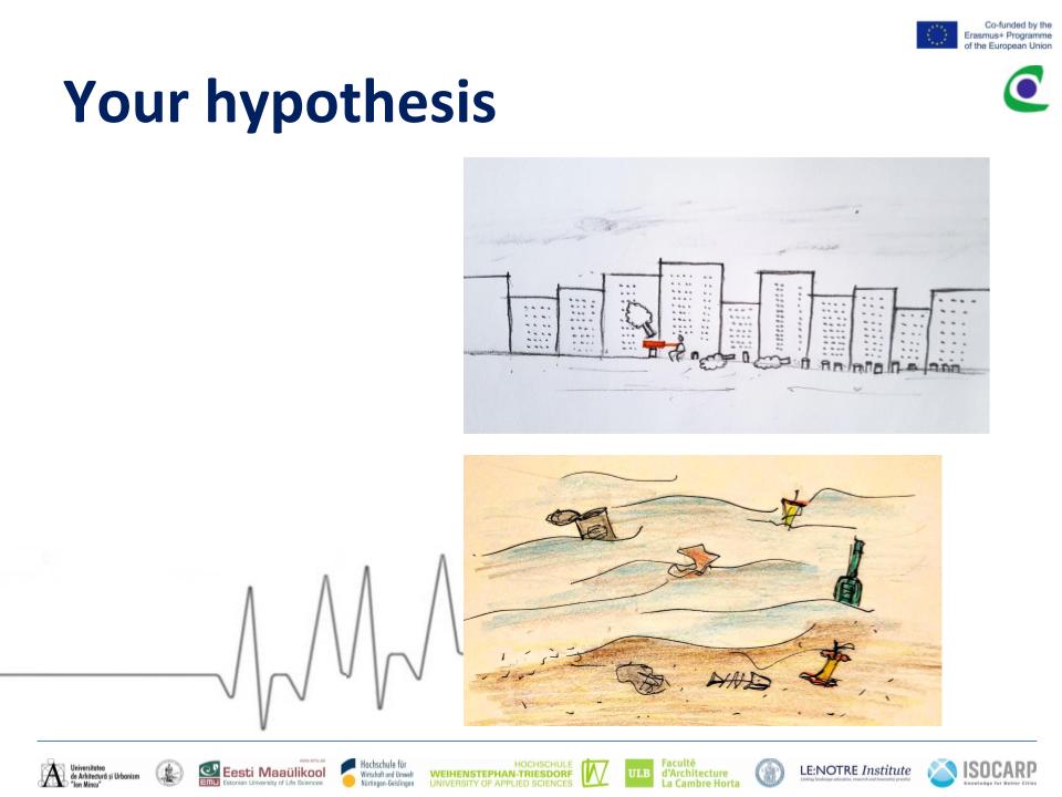
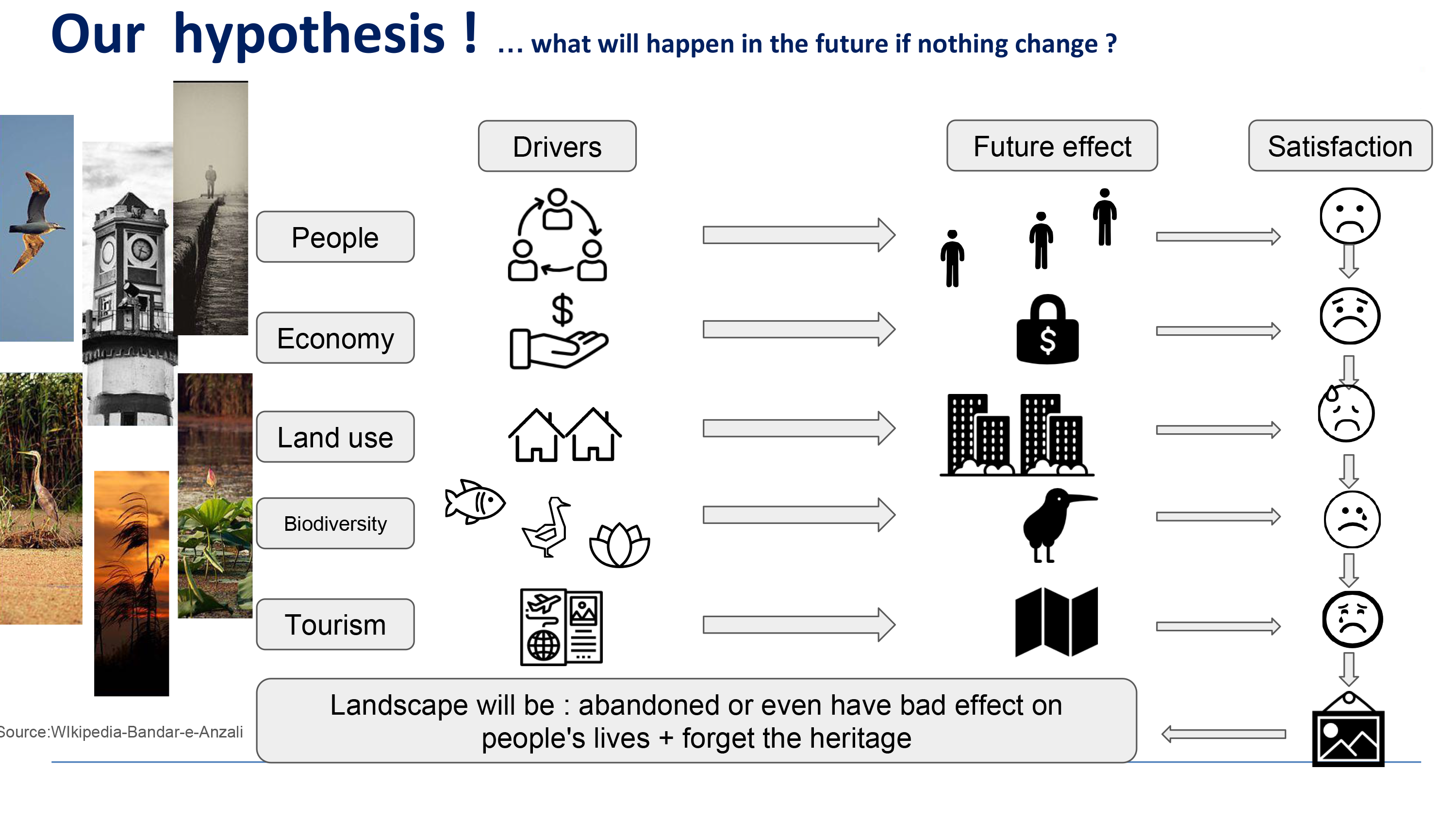
| 20:45, 19 April 2018 | Hypothesis fardokht and yasaman .jpg (file) |  |
54 KB | Yasamanr (talk | contribs) | 1 | |
| 20:56, 19 April 2018 | 11111.JPG (file) |  |
65 KB | Reemh (talk | contribs) | 1 | |
| 20:57, 19 April 2018 | 4.JPG (file) |  |
76 KB | Reemh (talk | contribs) | 1 | |
| 20:58, 19 April 2018 | 5.JPG (file) |  |
91 KB | Reemh (talk | contribs) | 1 | |
| 21:00, 19 April 2018 | Landscape system analysis Fardokht and Yasaman.jpeg (file) |  |
84 KB | Yasamanr (talk | contribs) | 1 | |
| 21:00, 19 April 2018 | 6.JPG (file) |  |
67 KB | Reemh (talk | contribs) | 1 | |
| 21:02, 19 April 2018 | Landuse2.JPG (file) |  |
188 KB | Reemh (talk | contribs) | 1 | |
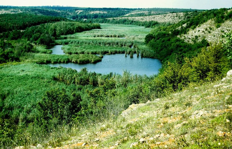
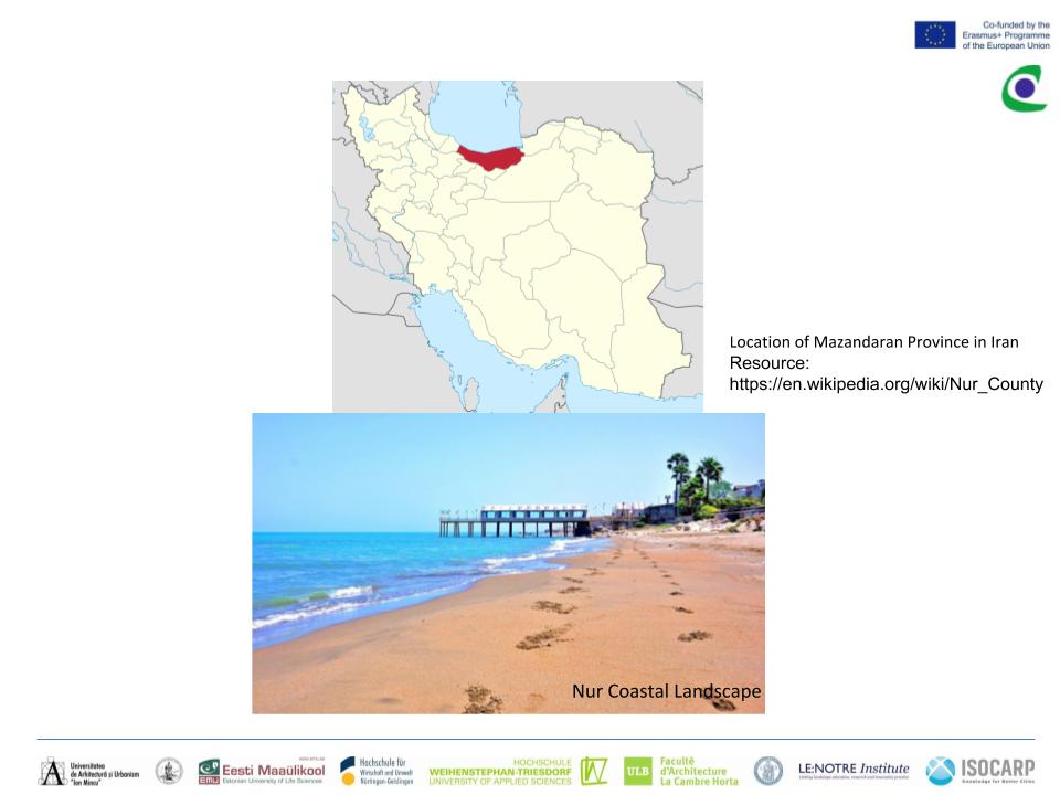
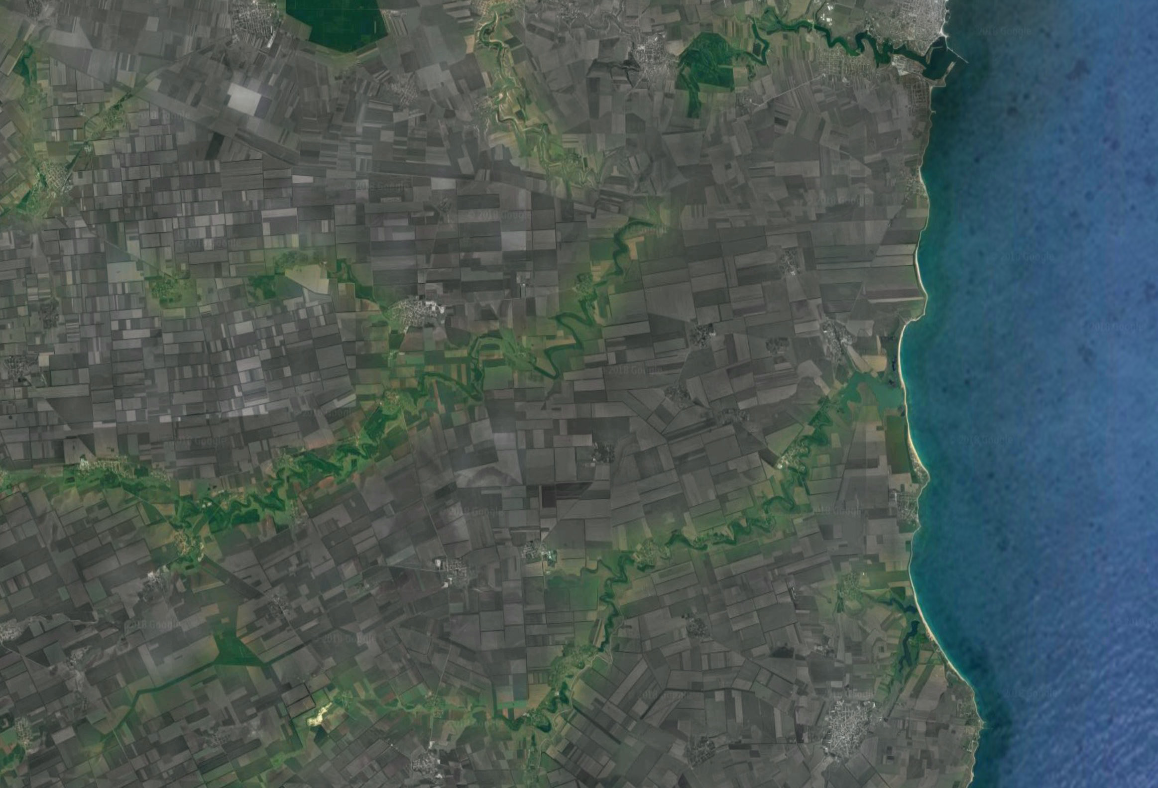
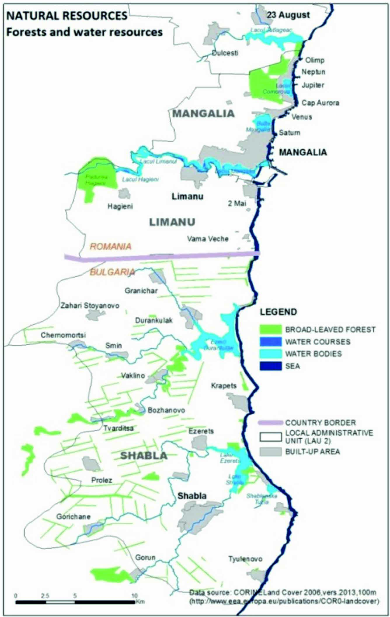
| 21:04, 19 April 2018 | 1Forests & water bodies in the Limanu - Shabla area .jpg (file) |  |
1.96 MB | Ioneliat (talk | contribs) | http://www.marsplan.ro/images/documente/results/msp-mangalia-shabla/MSP%20Mangalia%20Shabla.pdf | 2 |
| 21:05, 19 April 2018 | Hypthesis-G06.png (file) |  |
1.05 MB | Haniyehg (talk | contribs) | 1 | |
| 21:07, 19 April 2018 | Lacul Limanu.jpg (file) |  |
406 KB | Ioneliat (talk | contribs) | http://ziarullumina.ro/manastirea-limanu-ca-o-hozeva-dobrogeana-86323.htm l | 1 |
| 21:08, 19 April 2018 | Padurea Hagieni.jpg (file) |  |
151 KB | Ioneliat (talk | contribs) | https://www.umblat.ro/evenimente-in/constanta/workshop/evaluarea-serviciilor-ecosistemice-ale-sitului-natura-2000-padurea-hagieni-cotul-vaii-73534#/ | 1 |
| 21:09, 19 April 2018 | DPSIR-G06.png (file) |  |
161 KB | Haniyehg (talk | contribs) | 1 | |
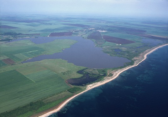
| 21:09, 19 April 2018 | Durankulak Lake & Forest.jpg (file) |  |
42 KB | Ioneliat (talk | contribs) | https://www.birdforum.net/opus/Durankulak_Lake | 1 |
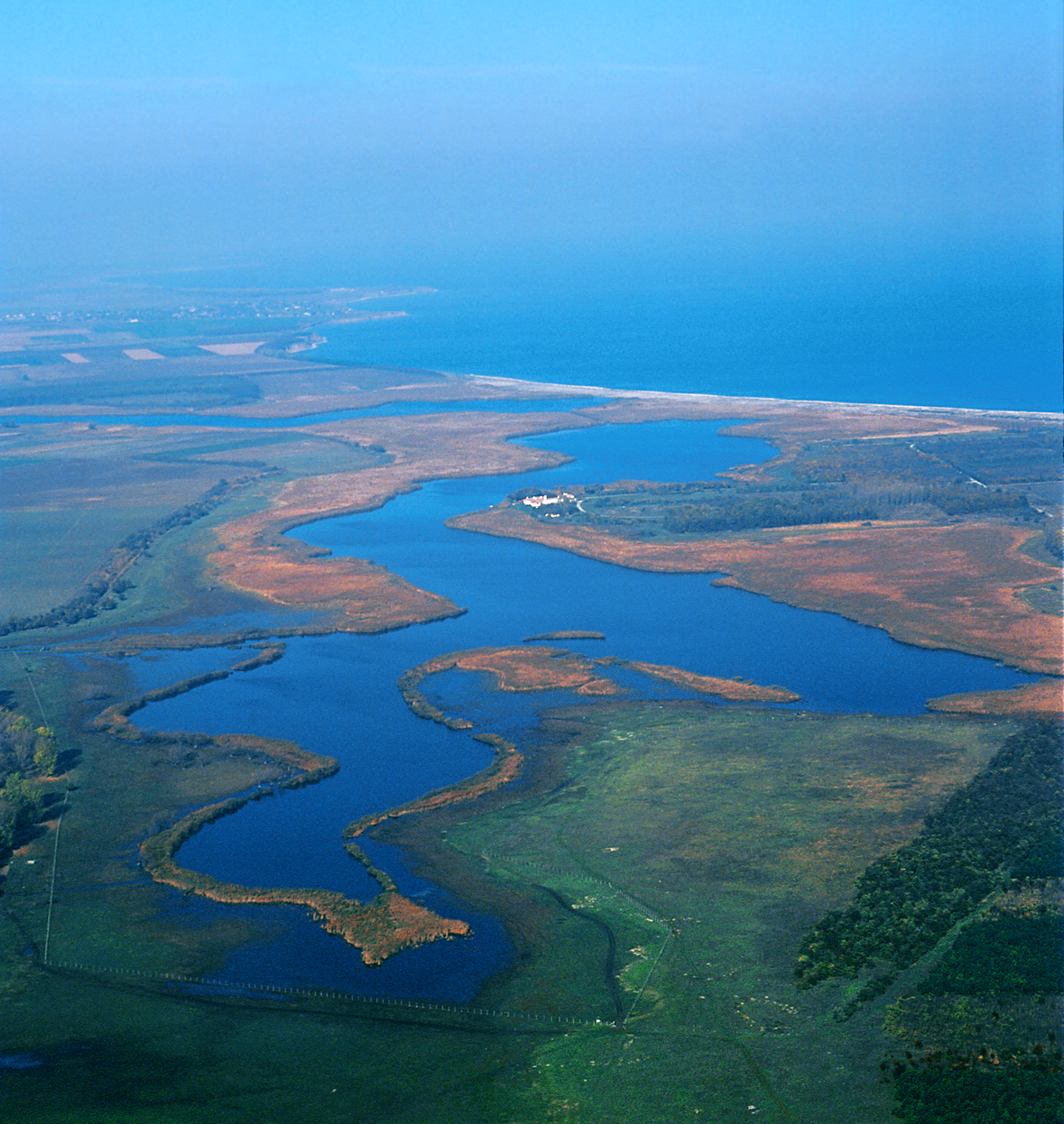
| 21:11, 19 April 2018 | Shabla Lake & Forest.jpg (file) |  |
1.81 MB | Ioneliat (talk | contribs) | http://neophron.com/gallery/scenery/ | 2 |
| 21:14, 19 April 2018 | Land use2.JPG (file) |  |
129 KB | Reemh (talk | contribs) | 1 | |
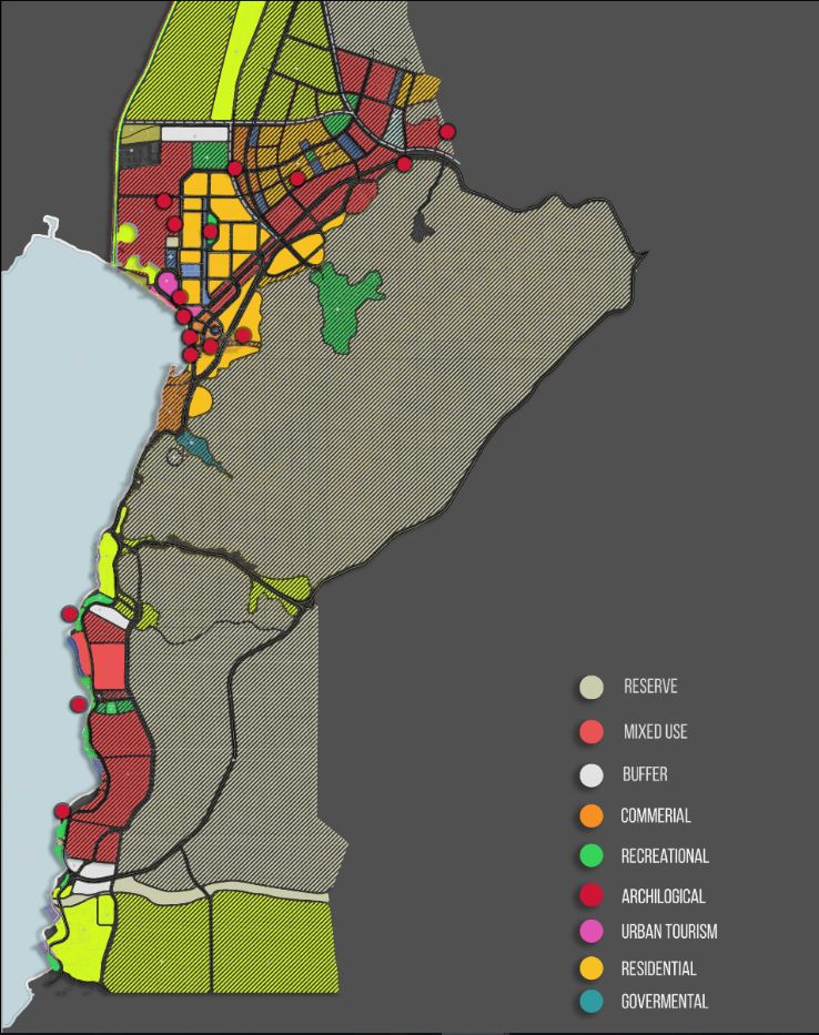
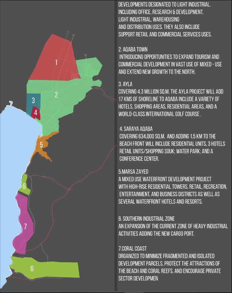
| 21:16, 19 April 2018 | Development plan2.JPG (file) |  |
108 KB | Reemh (talk | contribs) | 1 | |
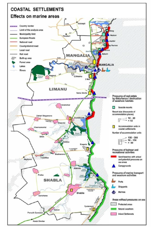
| 21:17, 19 April 2018 | 1-coastal settlements effects.png (file) |  |
478 KB | Ioneliat (talk | contribs) | Source: Marine spatial plan for the cross-border area Mangalia Shabla | 1 |
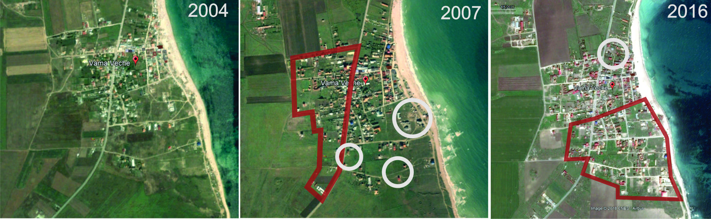
| 21:18, 19 April 2018 | 2-vama veche evolutie.jpg (file) |  |
1.07 MB | Ioneliat (talk | contribs) | source: googl Earth | 1 |
| 21:20, 19 April 2018 | Aerial.jpg (file) |  |
184 KB | Reemh (talk | contribs) | 1 | |
| 21:20, 19 April 2018 | 3-Shabala 2004 source google earth.png (file) |  |
1.22 MB | Ioneliat (talk | contribs) | source: google Earth | 1 |
| 21:23, 19 April 2018 | 4-Shabala 2016 -no building development. source google earth.png (file) |  |
1.45 MB | Ioneliat (talk | contribs) | google Earth | 1 |
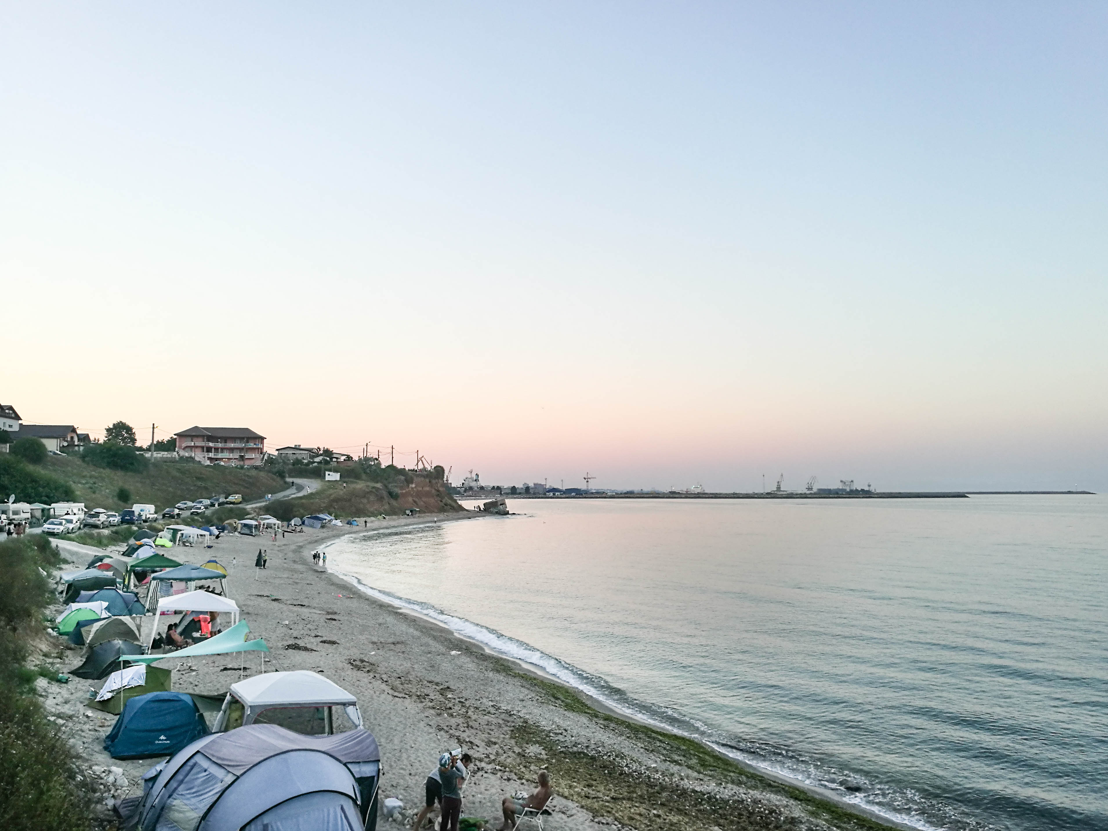
| 21:24, 19 April 2018 | 5-Camping in 2 Mai, July 2017.jpg (file) |  |
737 KB | Ioneliat (talk | contribs) | Personal picture | 1 |
| 21:25, 19 April 2018 | Green and blue.JPG (file) |  |
113 KB | Reemh (talk | contribs) | 1 | |
| 21:27, 19 April 2018 | Actors and stakeholders Fardokht and Yasaman.jpg (file) |  |
53 KB | Yasamanr (talk | contribs) | 1 | |
| 21:28, 19 April 2018 | Geomorphology, landscape units and coastal typology Fardokht and Yasaman.jpg (file) |  |
67 KB | Yasamanr (talk | contribs) | 1 | |
| 21:28, 19 April 2018 | Green blue infrastructure Fardokht and Yasaman.jpg (file) |  |
101 KB | Yasamanr (talk | contribs) | 1 | |
| 21:28, 19 April 2018 | Land use Fardokht and Yasaman.jpg (file) |  |
133 KB | Yasamanr (talk | contribs) | 1 | |
| 21:29, 19 April 2018 | Rationale Fardokht and Yasaman.jpg (file) |  |
91 KB | Yasamanr (talk | contribs) | 1 | |
| 21:29, 19 April 2018 | Sacred spaces and heritage Fardokht and Yasaman 1.jpg (file) |  |
68 KB | Yasamanr (talk | contribs) | 1 | |
| 21:29, 19 April 2018 | Sacred spaces and heritage Fardokht and Yasaman 2.jpg (file) |  |
70 KB | Yasamanr (talk | contribs) | 1 | |
| 21:30, 19 April 2018 | Visual appearance and landscape narrative-Fardokht and yasaman 1.jpg (file) |  |
75 KB | Yasamanr (talk | contribs) | 1 | |
| 21:30, 19 April 2018 | Visual appearance and landscape narrative-Fardokht and yasaman 2.jpg (file) |  |
81 KB | Yasamanr (talk | contribs) | 1 | |
| 21:30, 19 April 2018 | Enviroment 2.JPG (file) |  |
50 KB | Reemh (talk | contribs) | 1 | |
| 21:32, 19 April 2018 | Soils.jpg (file) |  |
1.64 MB | Ioneliat (talk | contribs) | Personal archive | 1 |
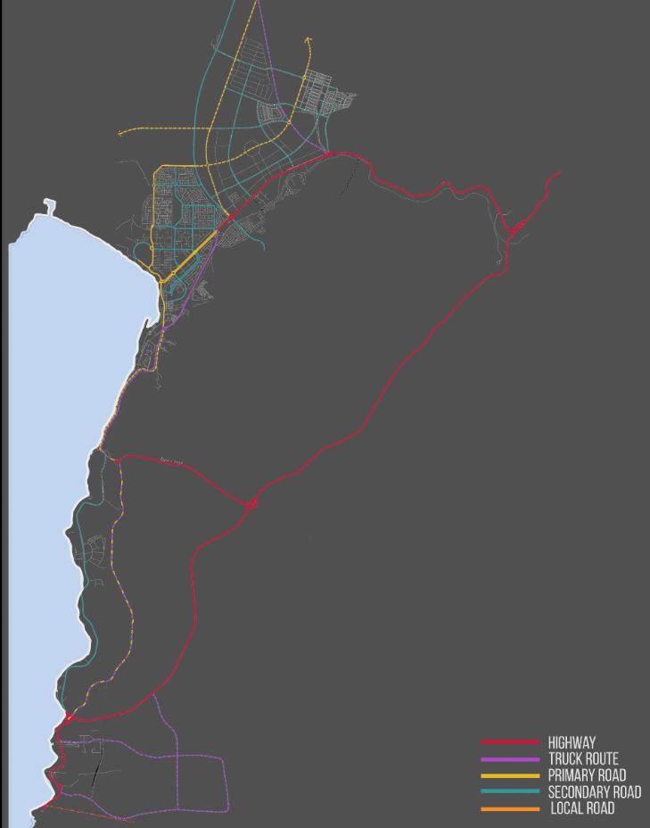
| 21:34, 19 April 2018 | Routes.JPG (file) |  |
45 KB | Reemh (talk | contribs) | 1 | |
| 21:35, 19 April 2018 | Picture2222.png (file) |  |
105 KB | Ioneliat (talk | contribs) | https://www.sciencedirect.com/science/article/pii/S1040618213003418 | 1 |
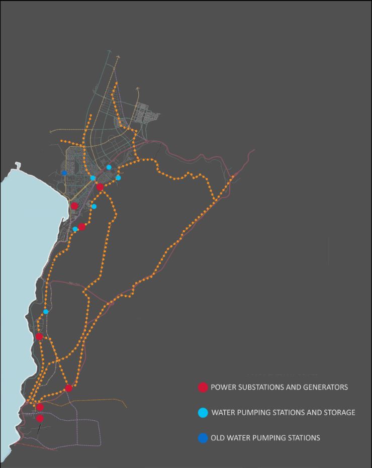
| 21:43, 19 April 2018 | Power.JPG (file) |  |
52 KB | Reemh (talk | contribs) | 1 | |
| 21:46, 19 April 2018 | Rationale Fardokht and Yasaman01.jpg (file) |  |
53 KB | Yasamanr (talk | contribs) | 1 | |
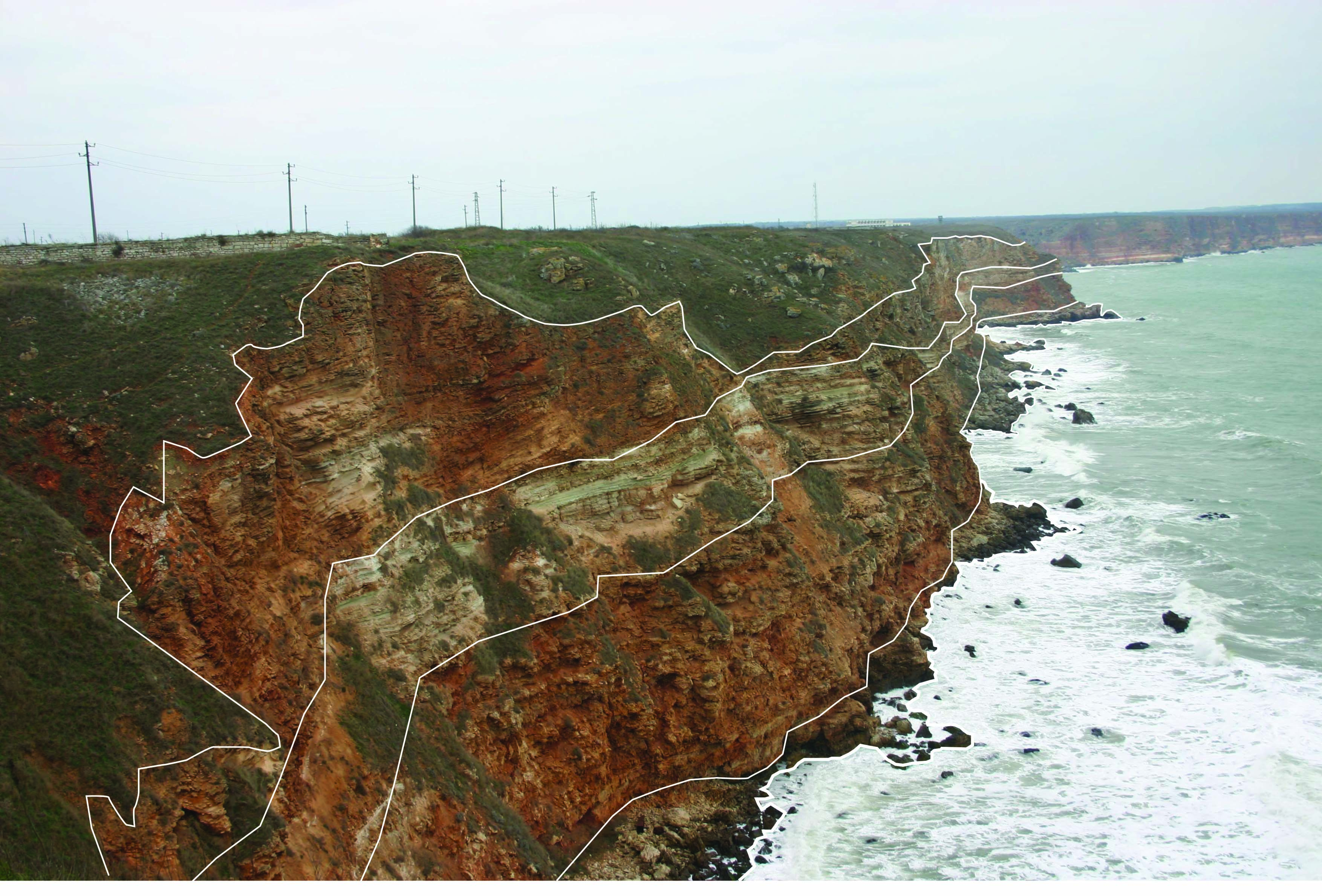
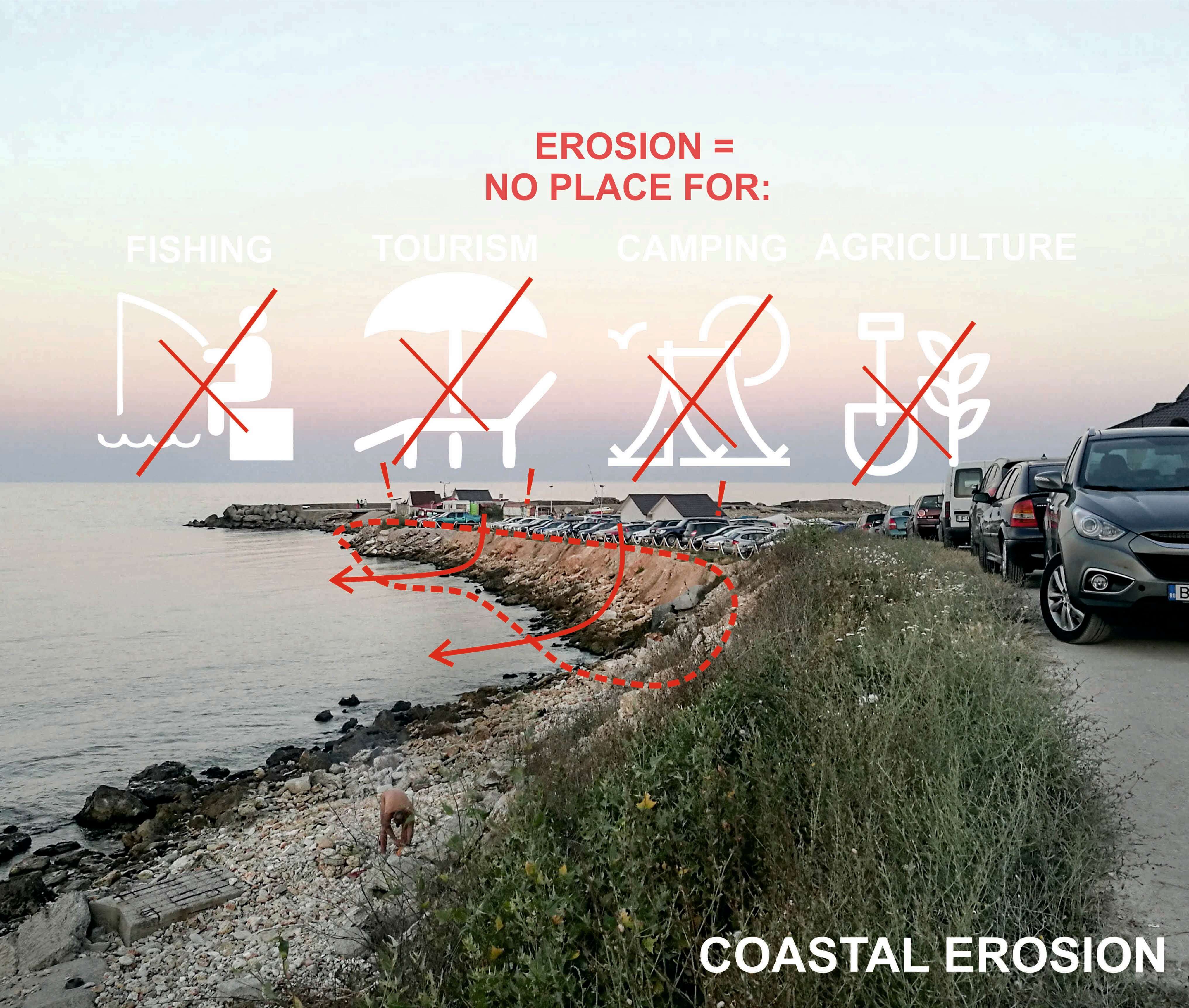
| 21:46, 19 April 2018 | EROSION1.jpg (file) |  |
829 KB | Ioneliat (talk | contribs) | Personal picture | 1 |
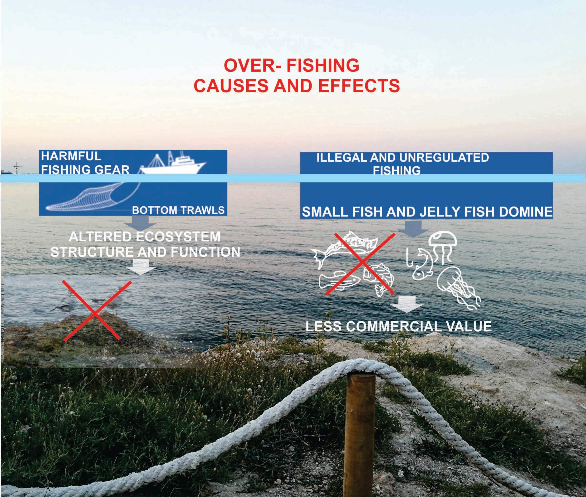
| 21:47, 19 April 2018 | FISHING1.jpg (file) |  |
451 KB | Ioneliat (talk | contribs) | Personal picture | 1 |
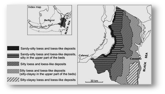
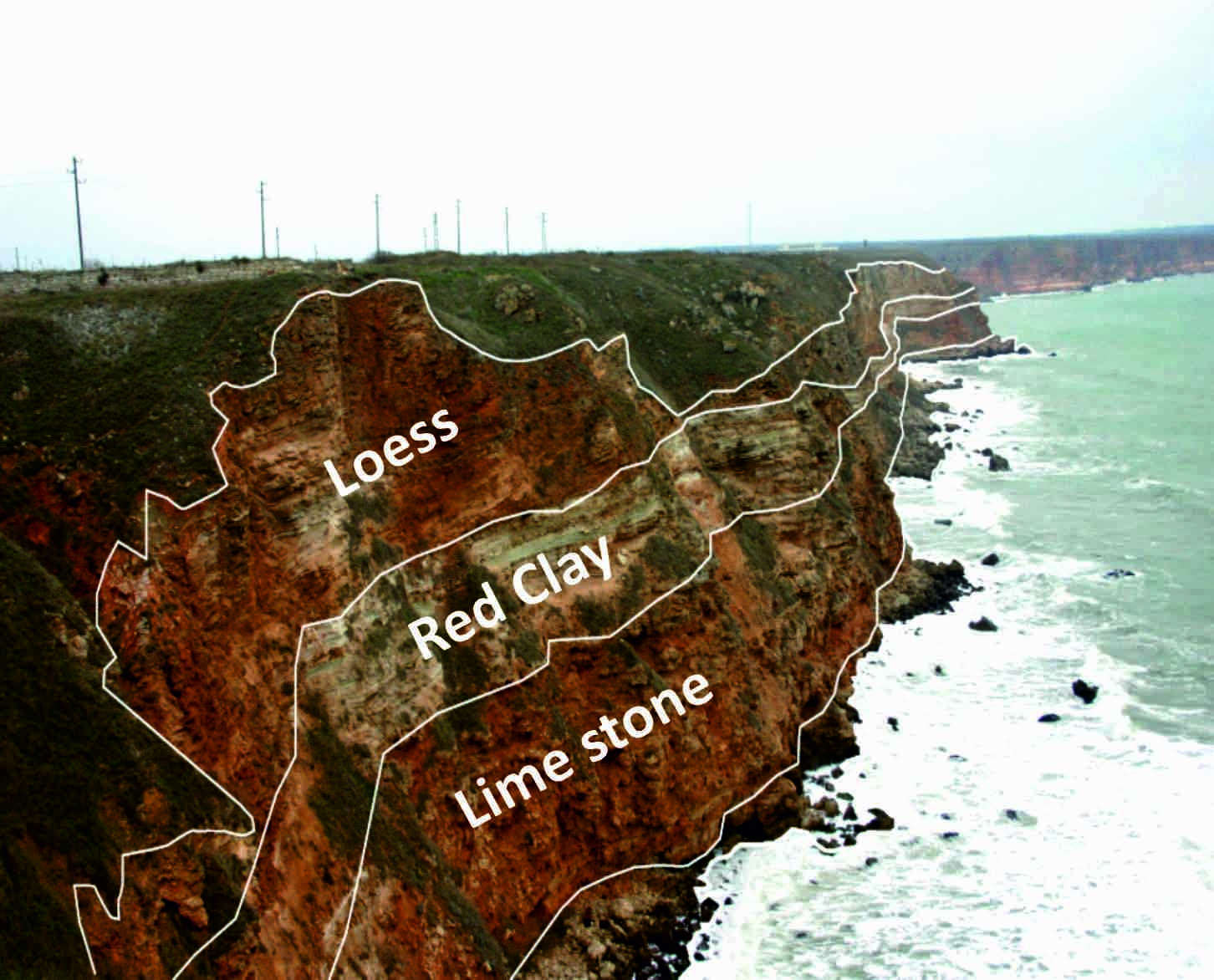
| 21:49, 19 April 2018 | Straturi1.jpg (file) |  |
1.98 MB | Ioneliat (talk | contribs) | Personal picture | 1 |
| 21:52, 19 April 2018 | Green infrastructure test.jpg (file) |  |
561 KB | Ioneliat (talk | contribs) | Google earth | 1 |
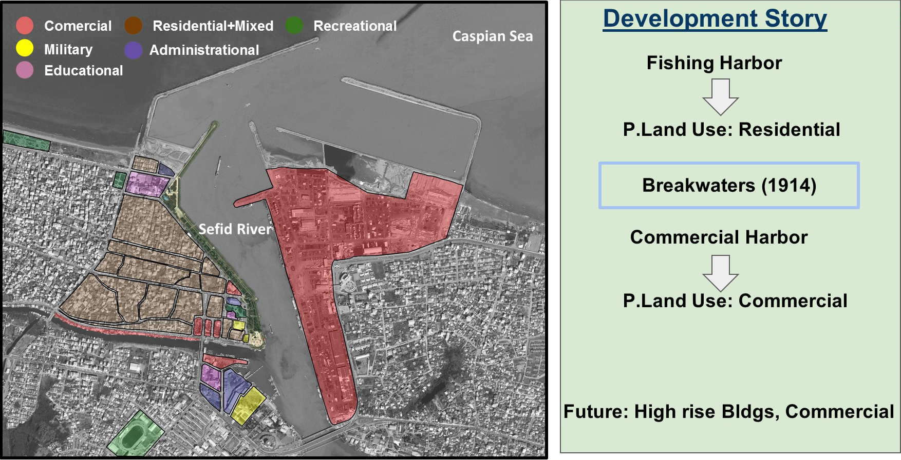
| 21:52, 19 April 2018 | Land use and its development story.jpg (file) |  |
942 KB | Mohamadreza (talk | contribs) | Current Land use of the site and the story of its develoment | 1 |
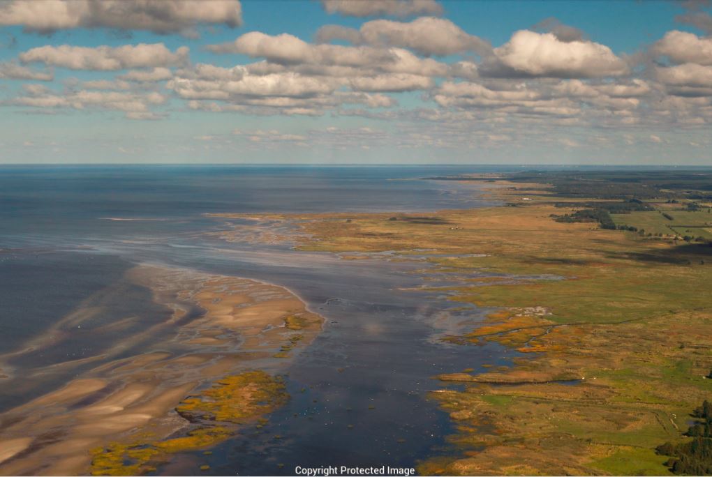
| 21:54, 19 April 2018 | Mati-Kose luitemaa-Copyright-protected-image.JPG (file) |  |
90 KB | Liisiv (talk | contribs) | Coast at Luitemaa nature protection area | 1 |
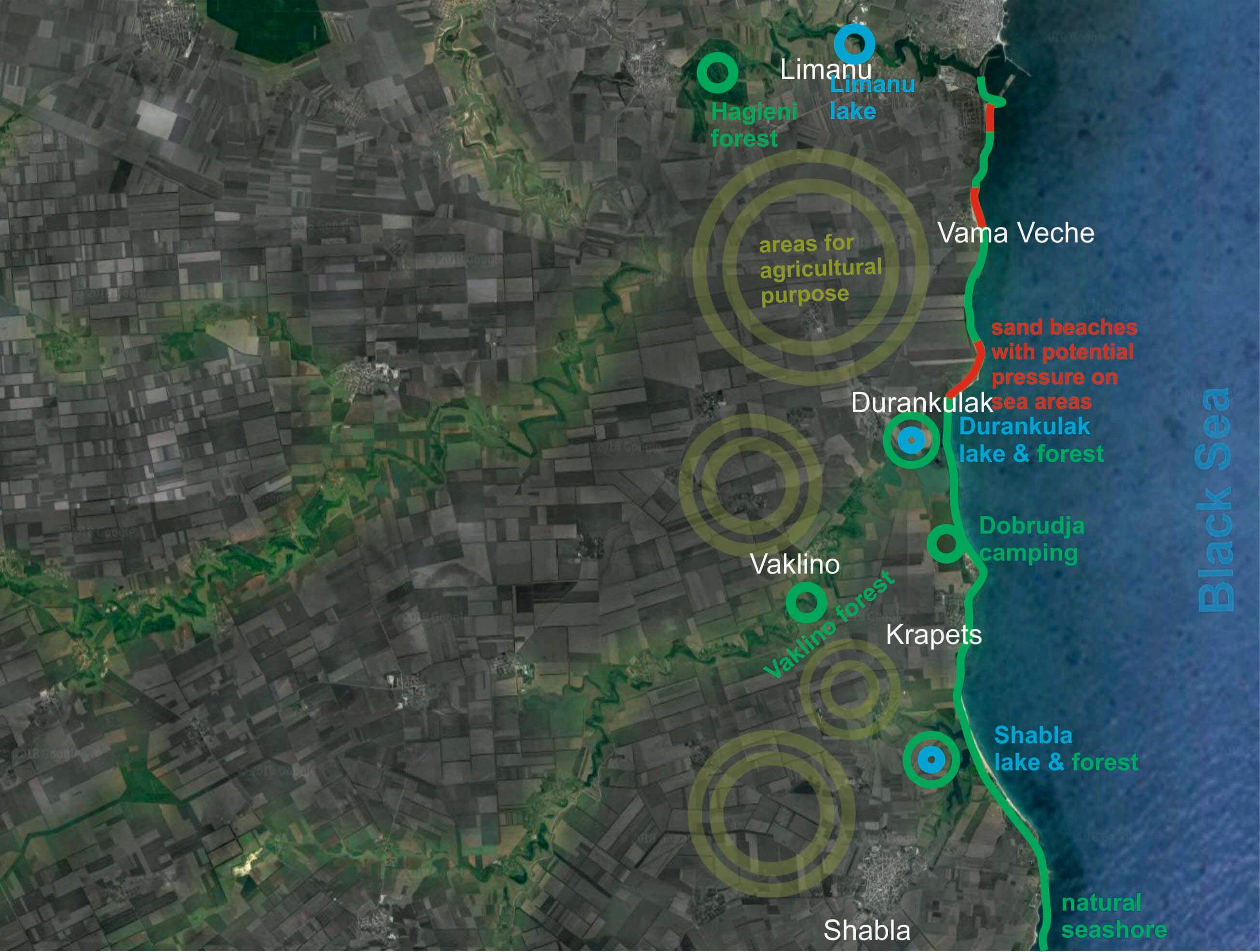
| 21:58, 19 April 2018 | 111Forests & water bodies in the Limanu - Shabla area.jpg (file) |  |
1.95 MB | Ioneliat (talk | contribs) | 1 | |
| 22:02, 19 April 2018 | 11infra green.jpg (file) |  |
317 KB | Ioneliat (talk | contribs) | google earth | 1 |