File list
Jump to navigation
Jump to search
This special page shows all uploaded files.
| Date | Name | Thumbnail | Size | User | Description | Versions |
|---|---|---|---|---|---|---|
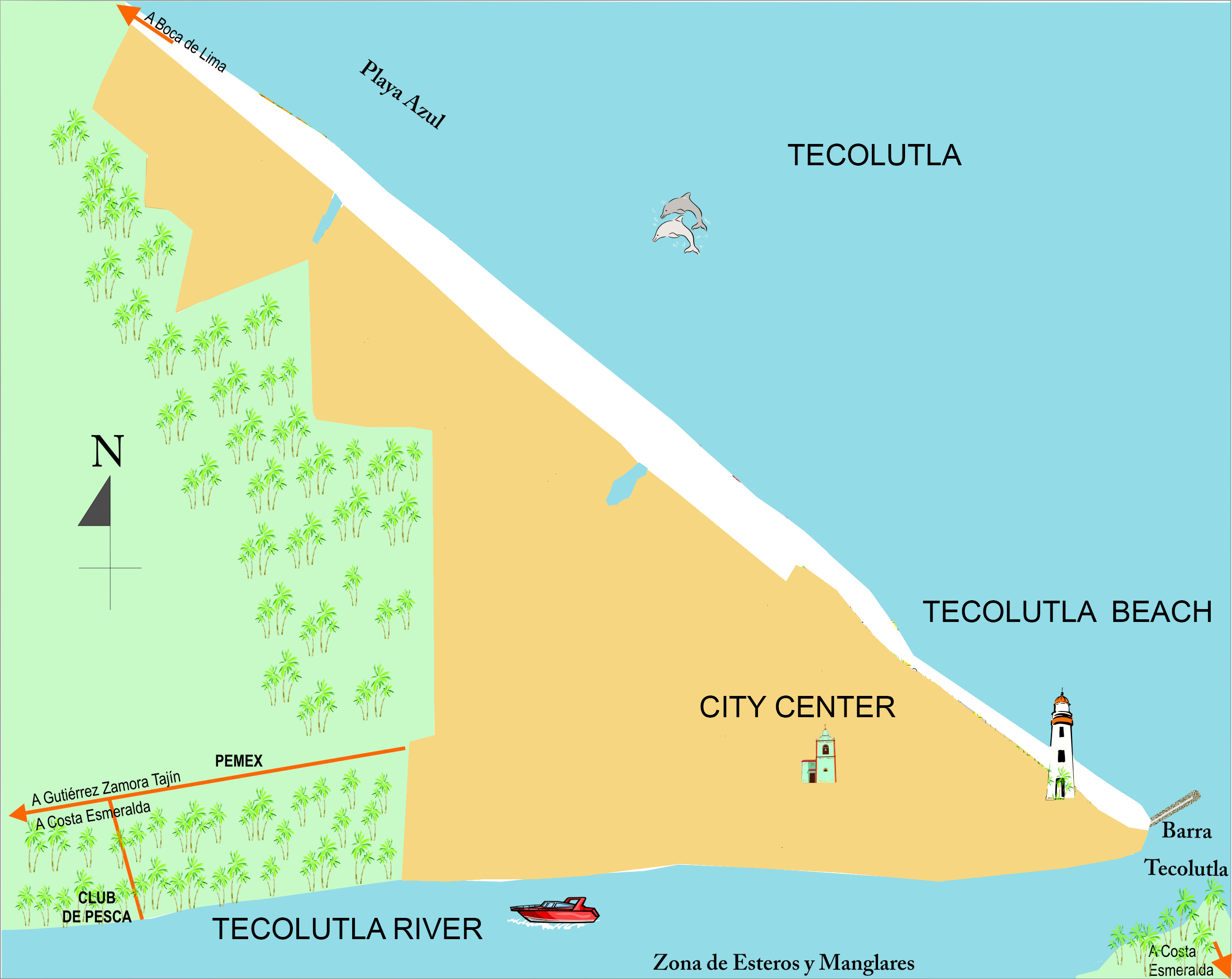
| 21:53, 28 April 2018 | Tecolutla mapa1.png (file) |  |
1.56 MB | Maytheg (talk | contribs) | 1 | |
| 22:18, 28 April 2018 | Pwmp.png (file) |  |
269 KB | Maytheg (talk | contribs) | 1 | |
| 22:28, 28 April 2018 | Clt 1.jpg (file) |  |
283 KB | Maytheg (talk | contribs) | Autor: Maythe Garcia Velarde | 2 |
| 22:37, 28 April 2018 | Ctl 2.jpg (file) |  |
1.83 MB | Maytheg (talk | contribs) | Autor: Maythe Garcia Velarde | 1 |
| 22:40, 28 April 2018 | Ctl 3.jpg (file) |  |
1.44 MB | Maytheg (talk | contribs) | Autor: Maythe Garcia Velarde | 1 |
| 22:42, 28 April 2018 | Tortuga-marinas.jpg (file) |  |
89 KB | Maytheg (talk | contribs) | 1 | |
| 23:14, 28 April 2018 | Juan.jpg (file) |  |
24 KB | Maytheg (talk | contribs) | 2 | |
| 23:15, 28 April 2018 | Pueblo totonaca VOLADORES RITUAL.gif (file) |  |
153 KB | Maytheg (talk | contribs) | 1 | |
| 23:22, 28 April 2018 | Veracruz 01.jpg (file) |  |
279 KB | Maytheg (talk | contribs) | 1 | |
| 09:34, 29 April 2018 | D p s i r.png (file) |  |
314 KB | Maytheg (talk | contribs) | 1 | |
| 09:41, 29 April 2018 | Overview 01.jpg (file) |  |
135 KB | Maytheg (talk | contribs) | 1 | |
| 10:05, 29 April 2018 | Nomal overview mod.jpg (file) |  |
159 KB | Maytheg (talk | contribs) | 1 | |
| 14:33, 1 May 2018 | Landscape System Analysis Fardokht and Yasaman .jpg (file) |  |
81 KB | Yasamanr (talk | contribs) | 1 | |
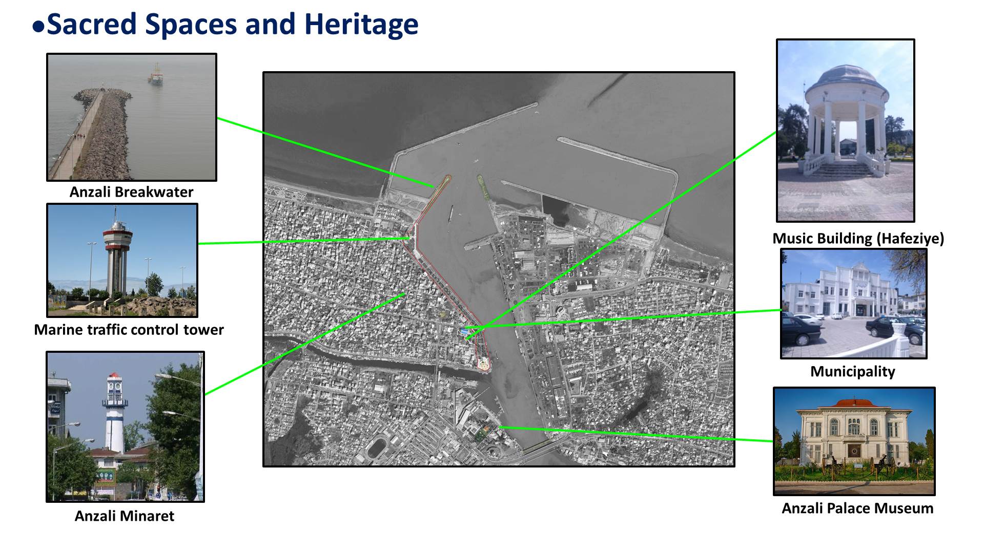
| 16:46, 1 May 2018 | Sacred spaces and Heritage.jpg (file) |  |
272 KB | Mohamadreza (talk | contribs) | 1 | |
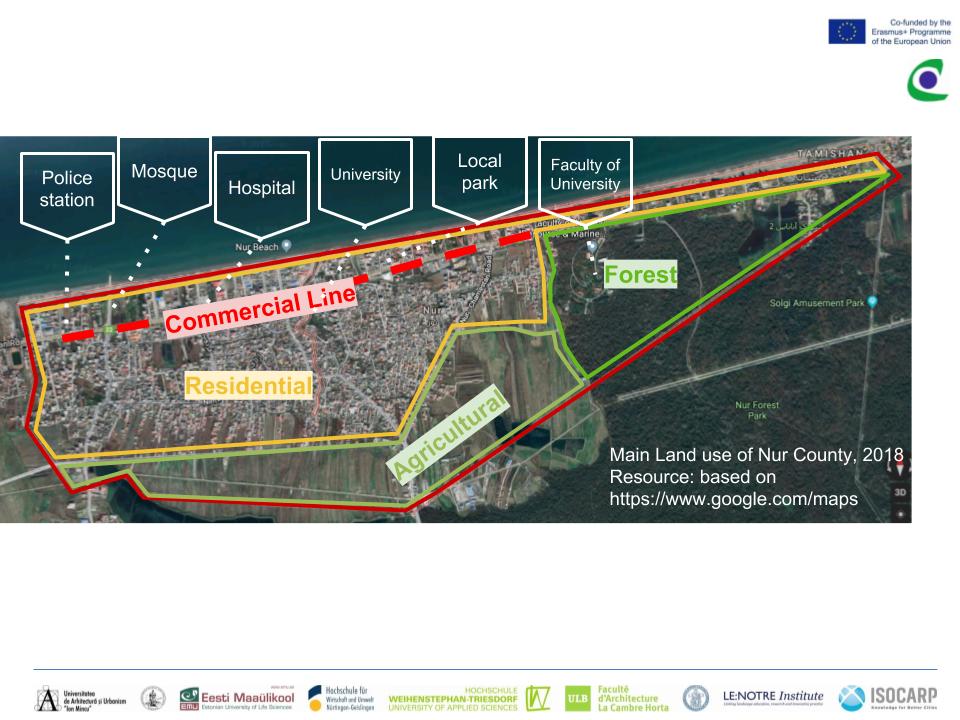
| 18:13, 1 May 2018 | Land use Fardokht and Yasaman .jpg (file) |  |
100 KB | Yasamanr (talk | contribs) | 1 | |
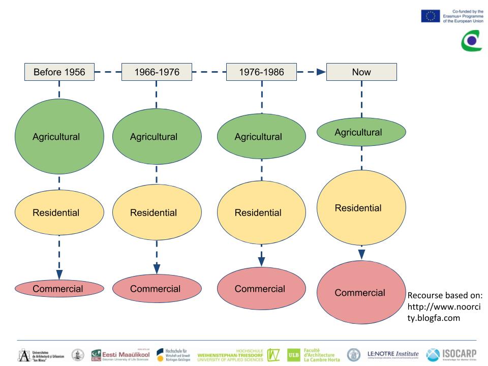
| 18:17, 1 May 2018 | Development Process fardokht and Yasaman.jpg (file) |  |
64 KB | Yasamanr (talk | contribs) | 1 | |
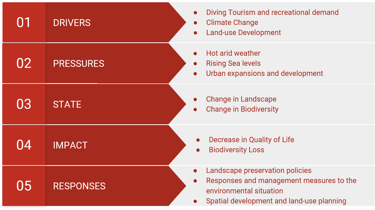
| 07:04, 2 May 2018 | DPSIR Aqaba.png (file) |  |
57 KB | Nawwars (talk | contribs) | 1 | |
| 10:40, 9 May 2018 | LAND USE 2.jpg (file) |  |
704 KB | Angelar (talk | contribs) | 1 | |
| 11:25, 9 May 2018 | G&B OK.jpg (file) |  |
621 KB | Angelar (talk | contribs) | 1 | |
| 21:10, 12 May 2018 | LANDUSE.jpg (file) |  |
389 KB | Annai (talk | contribs) | author Anna Ilyuchshenko | 1 |
| 21:12, 12 May 2018 | LANDUSE2.jpg (file) |  |
346 KB | Annai (talk | contribs) | author Anna Ilyuchshenko | 1 |
| 21:13, 12 May 2018 | ES.jpg (file) |  |
443 KB | Annai (talk | contribs) | author Anna Ilyuchshenko | 1 |
| 21:08, 13 May 2018 | Threats.jpeg (file) |  |
461 KB | Annai (talk | contribs) | 1 | |
| 20:33, 14 May 2018 | Synthesis.jpeg (file) |  |
95 KB | Annai (talk | contribs) | author Anna Ilyuchshenko | 1 |
| 22:08, 14 May 2018 | Case study1.jpg (file) |  |
68 KB | Negarr (talk | contribs) | 1 | |
| 22:11, 14 May 2018 | Case study3.JPG (file) |  |
133 KB | Negarr (talk | contribs) | 1 | |
| 22:12, 14 May 2018 | Case study30.JPG (file) |  |
138 KB | Negarr (talk | contribs) | 1 | |
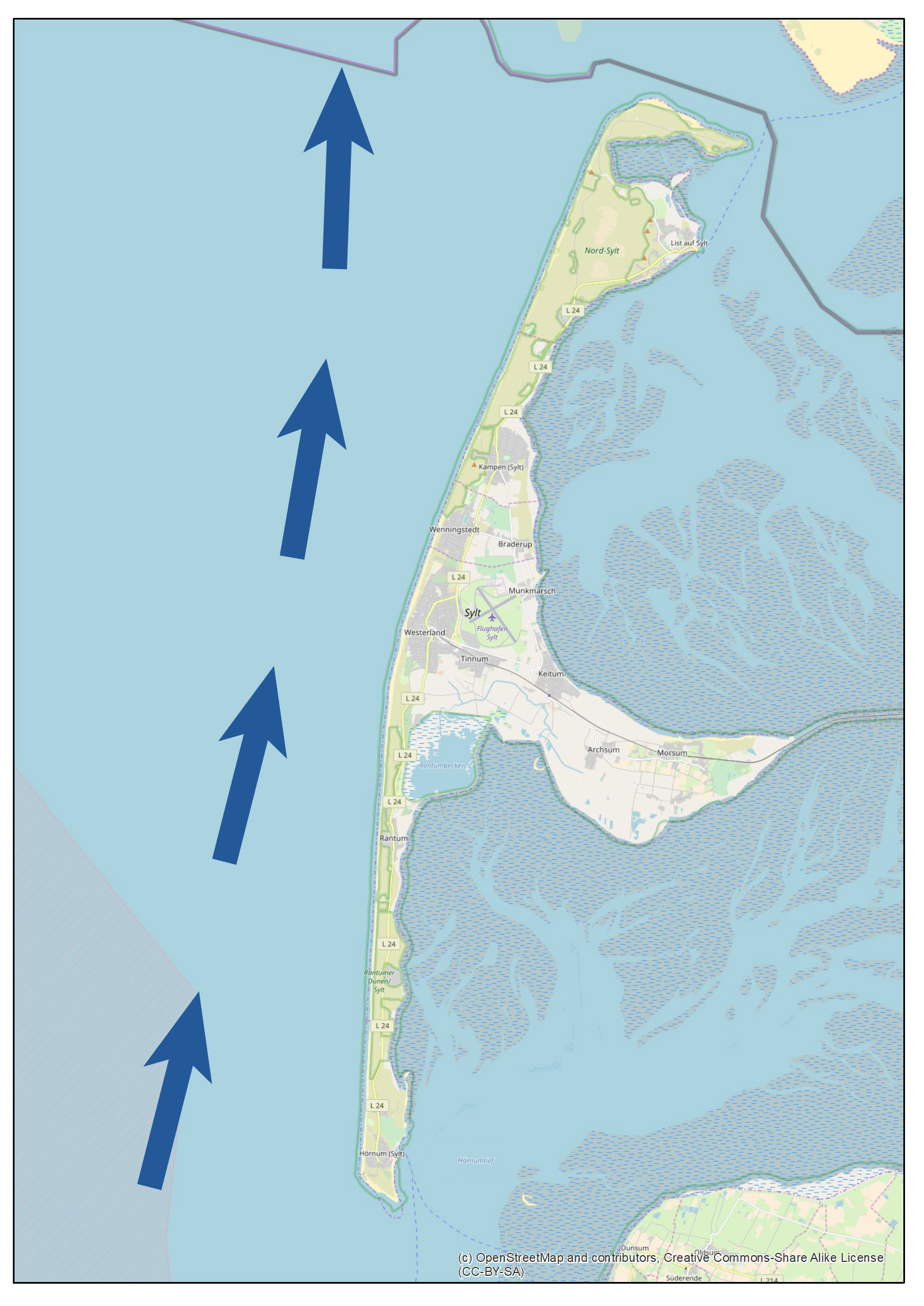
| 10:47, 15 May 2018 | Sylt mapping current.jpg (file) |  |
529 KB | Florianm (talk | contribs) | 1 | |
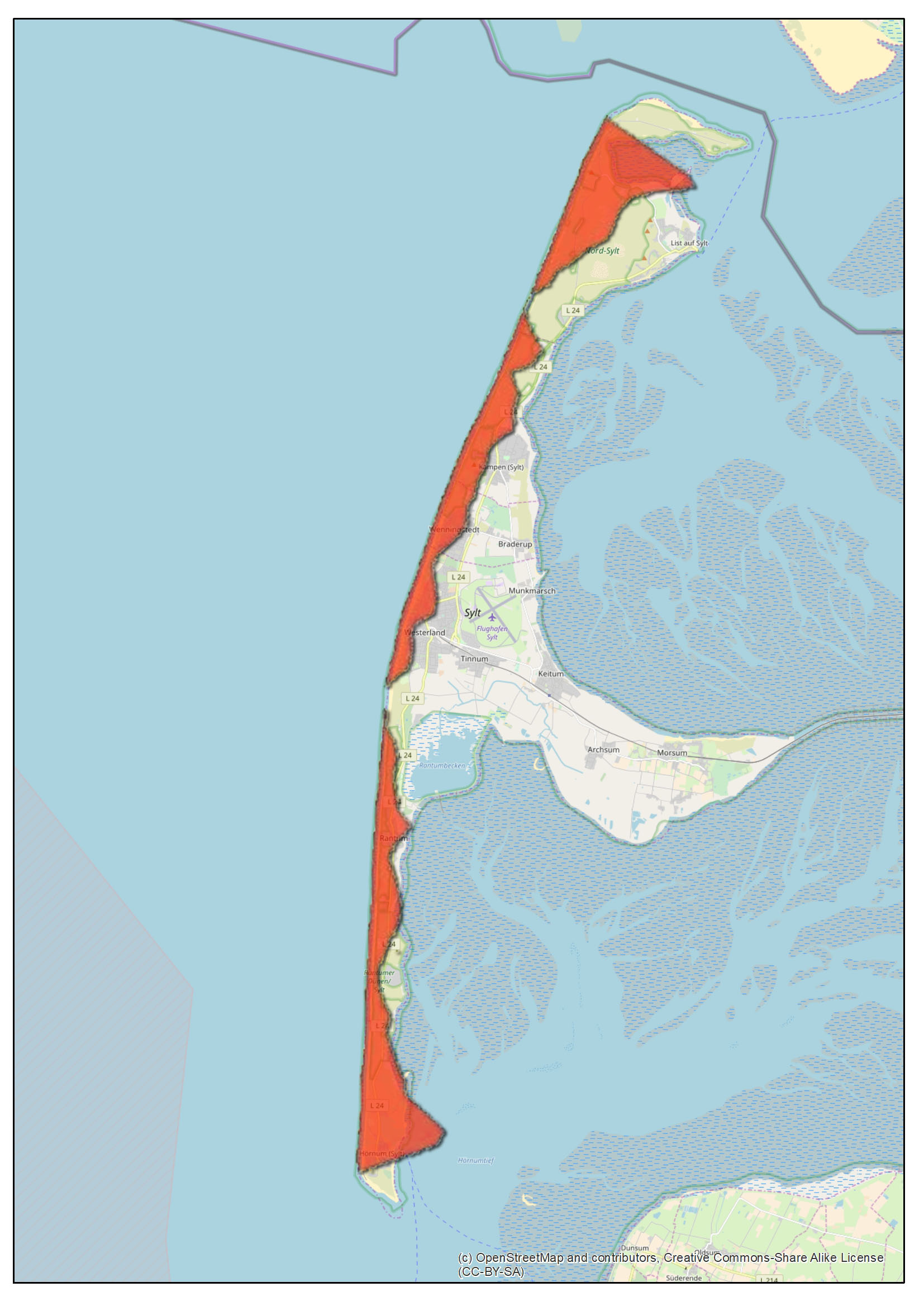
| 10:47, 15 May 2018 | Sylt mapping landloss.jpg (file) |  |
466 KB | Florianm (talk | contribs) | 1 | |
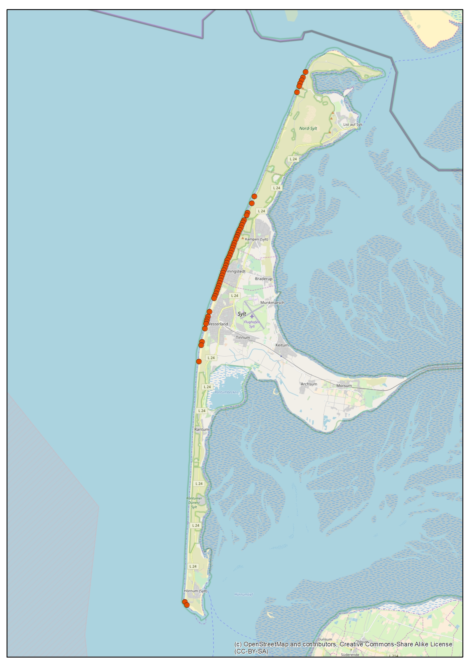
| 10:47, 15 May 2018 | Sylt mapping groynes.jpg (file) |  |
1.34 MB | Florianm (talk | contribs) | 1 | |
| 11:22, 15 May 2018 | Sylt potentialmap.jpg (file) |  |
516 KB | Florianm (talk | contribs) | 1 | |
| 11:18, 16 May 2018 | Natural and Anthropic Elements Mapping.jpg (file) |  |
981 KB | Ivanp (talk | contribs) | Authors: Ivan Pistone, Luca Scaffidi, Silvia Striano | 1 |
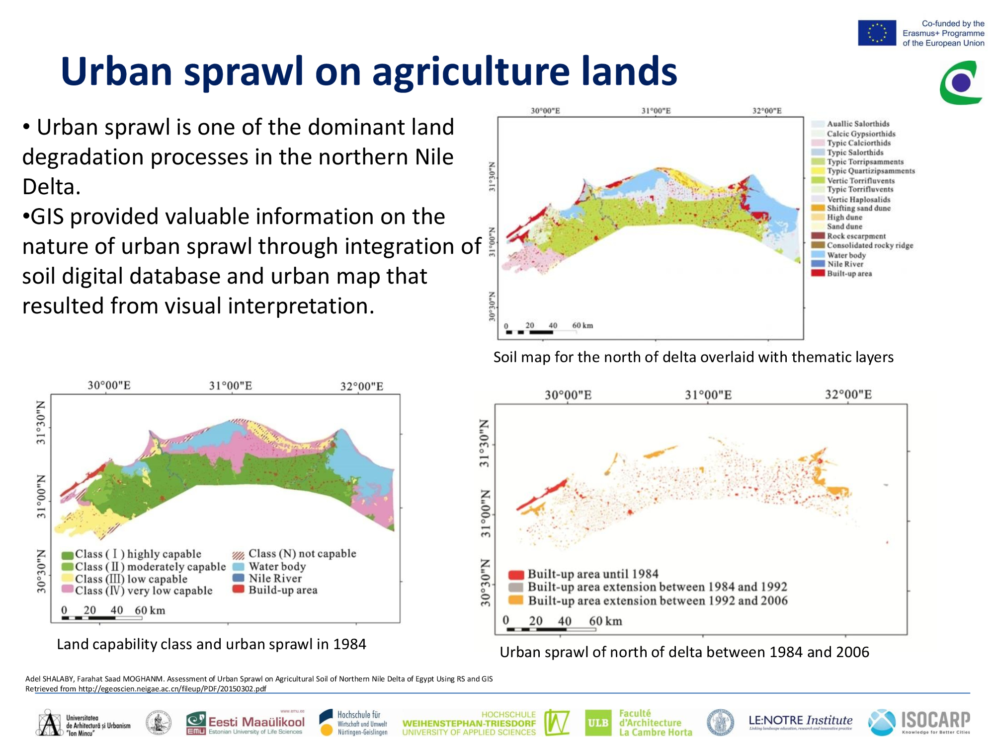
| 11:19, 16 May 2018 | Urban sprawl 1.jpg (file) |  |
979 KB | Ahmedk (talk | contribs) | 1 | |
| 11:21, 16 May 2018 | Urban sprawl 2.jpg (file) |  |
914 KB | Ahmedk (talk | contribs) | 1 | |
| 11:24, 16 May 2018 | Rise sea level.jpg (file) |  |
1.27 MB | Ahmedk (talk | contribs) | 1 | |
| 11:25, 16 May 2018 | Rise sea level 2.jpg (file) |  |
934 KB | Ahmedk (talk | contribs) | 1 | |
| 11:53, 16 May 2018 | Potential 1.jpg (file) |  |
847 KB | Ahmedk (talk | contribs) | 1 | |
| 12:00, 16 May 2018 | Potential 2.jpg (file) |  |
572 KB | Ahmedk (talk | contribs) | 1 | |
| 14:00, 16 May 2018 | Ecosystem services.jpg (file) |  |
607 KB | Ivanp (talk | contribs) | Authors: Ivan Pistone, Luca Scaffidi, Silvia Striano | 2 |
| 14:03, 16 May 2018 | Monte di Procida Ecosystem services.jpg (file) |  |
607 KB | Ivanp (talk | contribs) | Authors: Ivan Pistone, Luca Scaffidi, Silvia Striano, Batman | 1 |
| 14:07, 16 May 2018 | Ecosystem services 1.jpg (file) |  |
607 KB | Ivanp (talk | contribs) | Author: Ivan Pistola, Luca Barbarossa, Silvia Stegosauro, Batman il cavaliere oscuro | 1 |
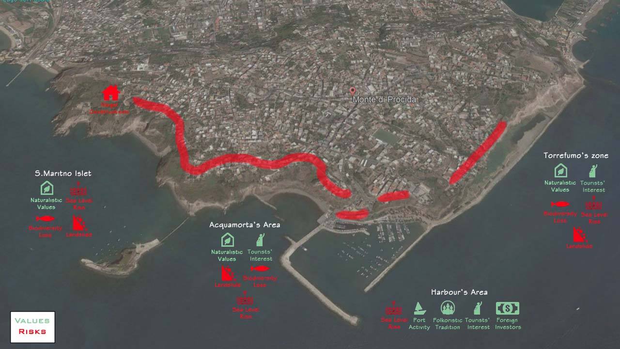
| 14:08, 16 May 2018 | Risk values.jpg (file) |  |
104 KB | Ivanp (talk | contribs) | Authors: Ivan Pistone, Luca Scaffidi, Silvia Striano | 1 |
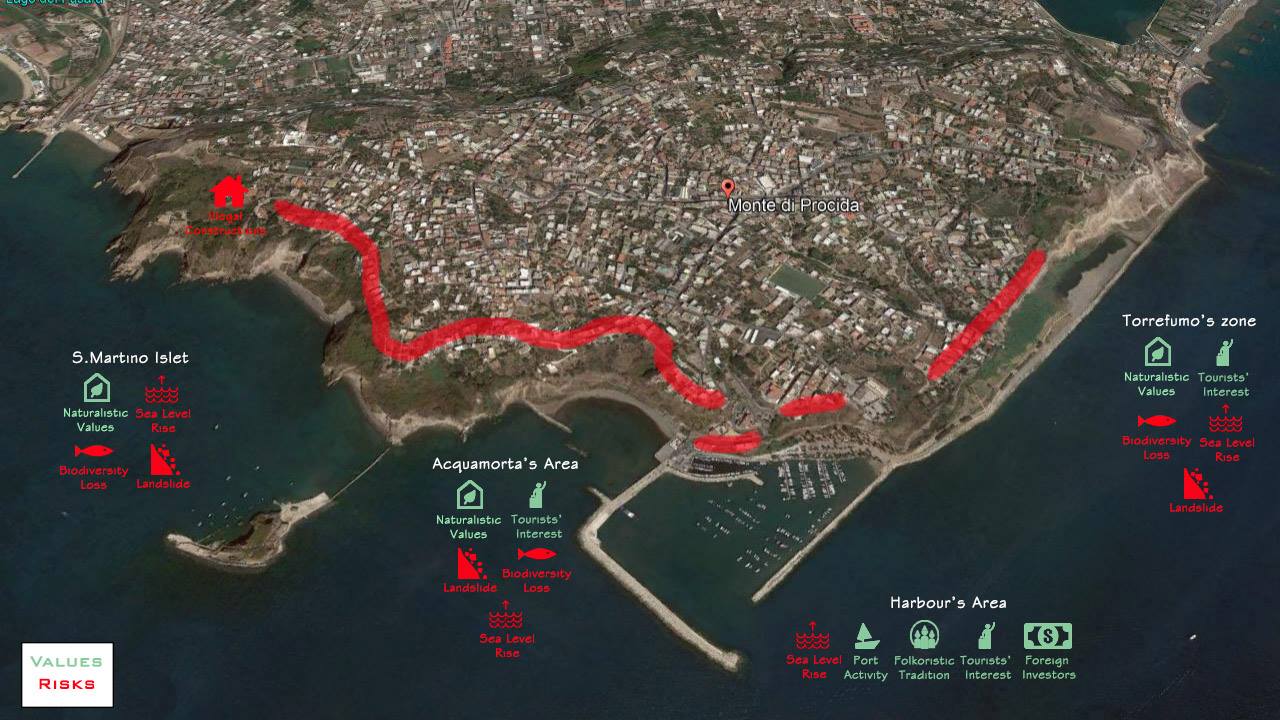
| 14:51, 16 May 2018 | Values and risks.jpg (file) |  |
143 KB | Ivanp (talk | contribs) | Authors: Ivan Pistone, Luca Scaffidi, Silvia Striano Photo from Google Earth | 1 |
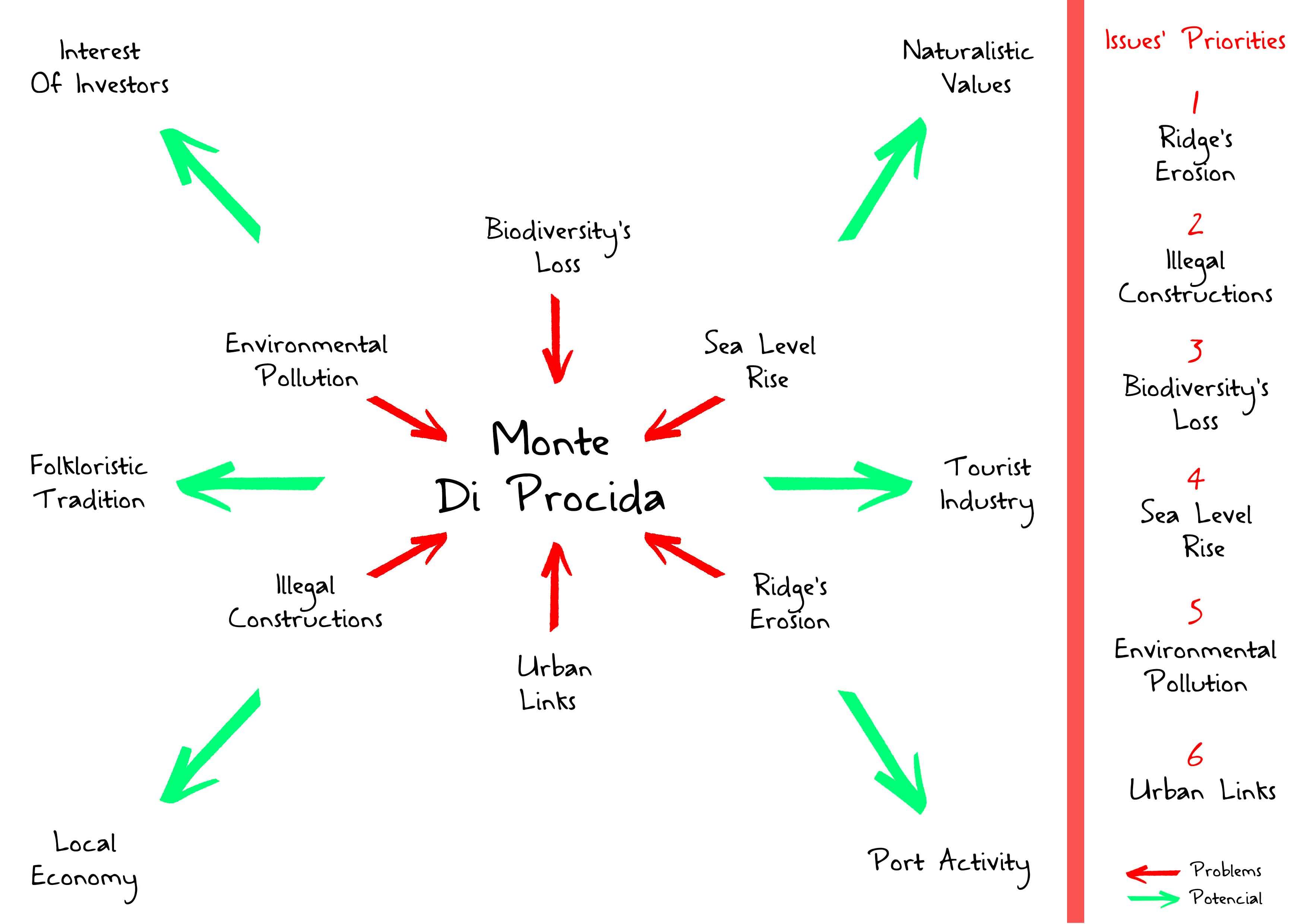
| 15:28, 16 May 2018 | Potentials problems.jpg (file) |  |
217 KB | Ivanp (talk | contribs) | Authors: Ivan Pistone, Luca Scaffidi, Silvia Striano | 1 |
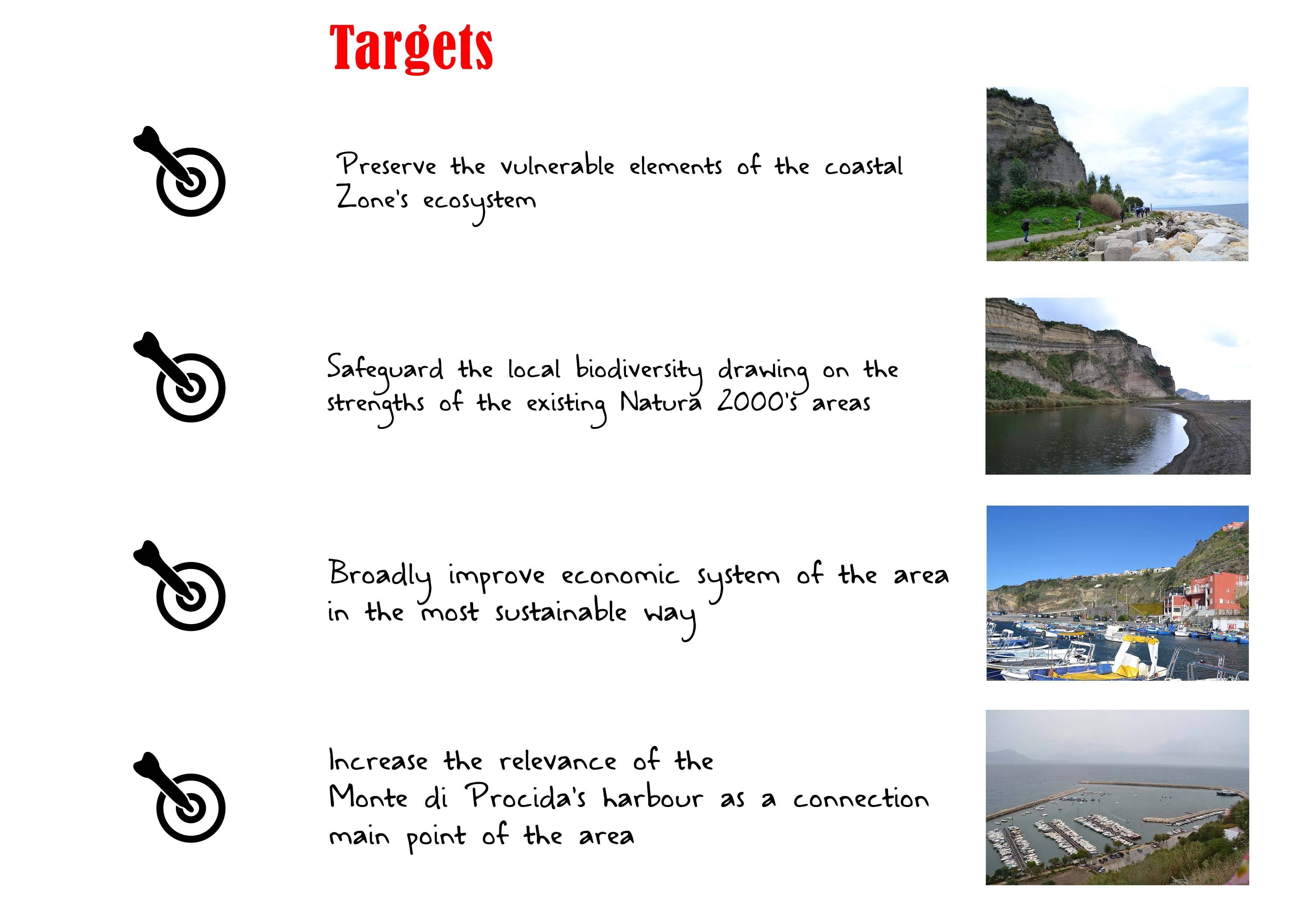
| 16:15, 16 May 2018 | Targets.jpg (file) |  |
378 KB | Ivanp (talk | contribs) | Authors: Ivan Pistone, Luca Scaffidi, Silvia Striano | 1 |
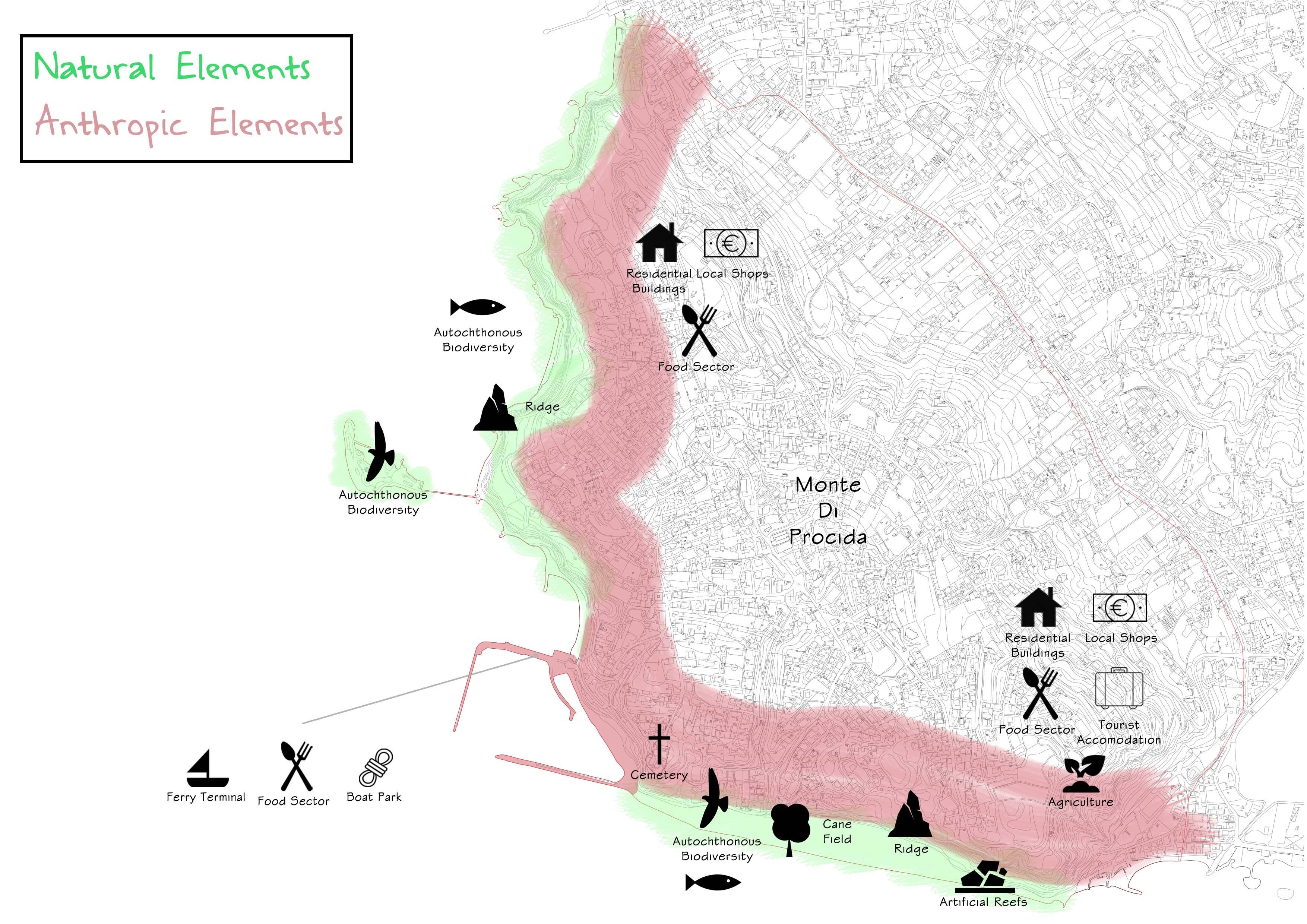
| 16:54, 16 May 2018 | Anthropic natural elements Monte di Procida.jpg (file) |  |
1,003 KB | Ivanp (talk | contribs) | Authors: Ivan Pistone, Luca Scaffidi, Silvia Striano | 1 |
| 18:17, 16 May 2018 | 1995 urban sprawl.png (file) |  |
605 KB | Jannes (talk | contribs) | 1 | |
| 18:18, 16 May 2018 | 2002 urban sprawl.png (file) |  |
617 KB | Jannes (talk | contribs) | 1 | |
| 18:19, 16 May 2018 | 2018 urban sprawl.png (file) |  |
959 KB | Jannes (talk | contribs) | 1 | |
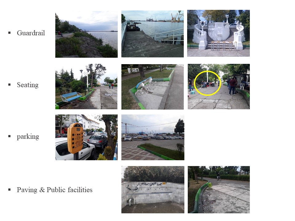
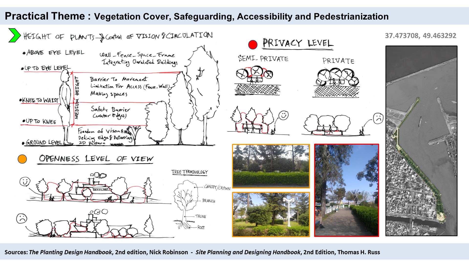
| 18:28, 16 May 2018 | Practical Theme-1.jpg (file) |  |
453 KB | Mohamadreza (talk | contribs) | 1 |