File:Parnu corinemap mariep.jpg: Difference between revisions
Jump to navigation
Jump to search
Map of landuse of the case study area. Source:http://www.arcgis.com/home/webmap/viewer.html?webmap=6866b2f3a44c4ee3bde8edd1b0782fb2 (16.4.2018) |
Mariep uploaded a new version of File:Parnu corinemap mariep.jpg |
(No difference)
| |
Latest revision as of 23:35, 18 April 2018
Map of landuse of the case study area. Source:http://www.arcgis.com/home/webmap/viewer.html?webmap=6866b2f3a44c4ee3bde8edd1b0782fb2 (16.4.2018)
File history
Click on a date/time to view the file as it appeared at that time.
| Date/Time | Thumbnail | Dimensions | User | Comment | |
|---|---|---|---|---|---|
| current | 23:35, 18 April 2018 | 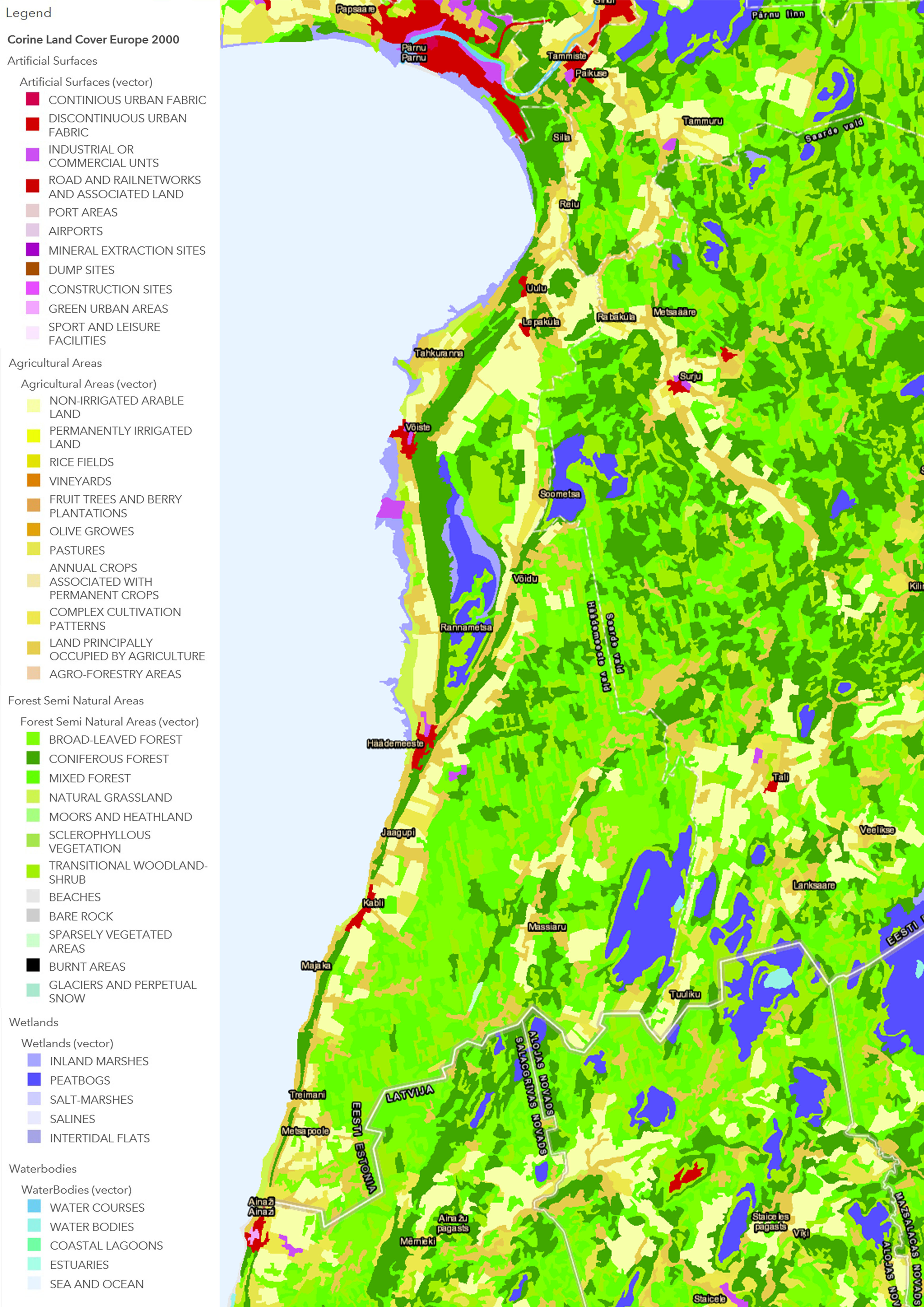 | 3,508 × 4,961 (1.85 MB) | Mariep (talk | contribs) | Map of land use (CORINE) Source : http://www.arcgis.com/home/webmap/viewer.html?webmap=6866b2f3a44c4ee3bde8 |
| 12:46, 18 April 2018 |  | 3,508 × 4,961 (1.85 MB) | Mariep (talk | contribs) | Map of landuse of the case study area. Source:http://www.arcgis.com/home/webmap/viewer.html?webmap=6866b2f3a44c4ee3bde8edd1b0782fb2 (16.4.2018) |
You cannot overwrite this file.
File usage
There are no pages that use this file.