This special page shows the last uploaded files.
-
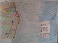
Targets MISENO.jpg
Sabrinas
16:22, 17 May 2018
9,362 × 6,622; 1.46 MB
-
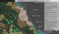
Table Problems Potentials.png
Jannes
16:21, 17 May 2018
3,508 × 2,479; 241 KB
-
Targetsmiseno.jpg
Chiarap
16:07, 17 May 2018
9,362 × 6,622; 1.46 MB
-
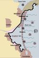
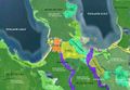
Map3 Navodari-Mamaia.jpg
Marianab
15:49, 17 May 2018
310 × 455; 40 KB
-
Target goals.png
Nawwars
15:48, 17 May 2018
1,670 × 1,114; 160 KB
-
Problems & potentials.jpeg
Shimay
15:44, 17 May 2018
1,920 × 1,080; 88 KB
-
Mapping 3 Navodari-Mamaia.jpg
Marianab
15:44, 17 May 2018
310 × 455; 40 KB
-
Problems.jpg
Chiarap
15:29, 17 May 2018
9,362 × 6,622; 1.34 MB
-
Problems potentials Miseno.jpg
Chiarap
15:25, 17 May 2018
9,362 × 6,622; 1.34 MB
-
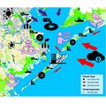
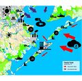
Problems Potentials Aqaba.png
Nawwars
15:23, 17 May 2018
1,450 × 772; 183 KB
-
Presentazione standard1.jpg
Chiarap
15:23, 17 May 2018
960 × 720; 83 KB
-
Cultural Ecosystems Aqaba.jpg
Nawwars
15:20, 17 May 2018
1,469 × 927; 741 KB
-
Cultural Ecosystem.jpg
Nawwars
15:19, 17 May 2018
1,469 × 927; 741 KB
-
Miseno.jpg
Chiarap
15:17, 17 May 2018
3,370 × 2,384; 771 KB
-
Idea target.jpeg
Shimay
15:01, 17 May 2018
1,109 × 577; 42 KB
-
Problems and potentials.jpeg
Shimay
14:57, 17 May 2018
1,920 × 1,080; 88 KB
-
Ecosystem services- tourism.jpeg
Shimay
14:55, 17 May 2018
1,338 × 725; 102 KB
-
Problems Navodari-Mamaia.jpg
Marianab
14:06, 17 May 2018
1,113 × 579; 50 KB
-
-
Mapping2 Navodari-Mamaia.jpg
Marianab
13:44, 17 May 2018
608 × 467; 57 KB
-
Ship wreks.jpg
Ionutb
13:42, 17 May 2018
300 × 469; 209 KB
-
Mapping 1 Navodari-Mamaia.jpg
Marianab
13:38, 17 May 2018
583 × 512; 53 KB
-
Protected areas.jpg
Ionutb
13:34, 17 May 2018
960 × 720; 128 KB
-
Economic sector.jpg
Ionutb
13:31, 17 May 2018
960 × 720; 162 KB
-
Proiorities problem Huiquan Bay.jpg
Yinglanl
12:36, 17 May 2018
3,507 × 2,480; 1.15 MB
-
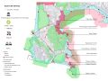
Cultural heritage map.jpg
Mafaldal
12:32, 17 May 2018
1,252 × 717; 573 KB
-
Accessible map.jpg
Mafaldal
12:32, 17 May 2018
1,768 × 1,403; 388 KB
-
Kallaste character map.jpg
Mafaldal
12:31, 17 May 2018
1,768 × 1,403; 842 KB
-
Wreckship"s.jpg
Ionutb
10:42, 17 May 2018
300 × 469; 84 KB
-
Problems potentials PRIORITIES.jpg
Angelar
10:37, 17 May 2018
6,400 × 4,526; 962 KB
-
Section.jpg
Yinglanl
10:36, 17 May 2018
3,508 × 2,480; 1.6 MB
-
Historical landuse.jpg
Yinglanl
10:33, 17 May 2018
3,508 × 2,480; 1.44 MB
-
Current and erosion map.jpg
Ionutb
10:32, 17 May 2018
2,448 × 3,264; 916 KB
-
Mappa 2.jpg
Luciat
10:27, 17 May 2018
3,316 × 3,874; 1.24 MB
-
Mappa 1.jpg
Luciat
10:24, 17 May 2018
2,584 × 3,870; 1.12 MB
-
DPSIR Gruppo 1.jpg
Angelar
10:23, 17 May 2018
2,670 × 2,362; 1.06 MB
-
CCA.jpg
Luciat
10:20, 17 May 2018
1,309 × 1,443; 309 KB
-
2008historial map.jpg
Yinglanl
09:52, 17 May 2018
2,079 × 2,953; 1.04 MB
-
-
-
Goals Group06.png
Haniyehg
08:27, 17 May 2018
3,420 × 2,430; 487 KB
-
Landscape character.jpg
Shimay
08:16, 17 May 2018
1,265 × 879; 70 KB
-
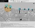
Priorities and targets.JPG
Maggiew
00:11, 17 May 2018
931 × 550; 75 KB
-
Threats-opportunities.jpg
Maggiew
21:52, 16 May 2018
2,792 × 2,747; 1.43 MB
-
Threats gb.jpg
Maggiew
21:03, 16 May 2018
2,792 × 2,747; 1.42 MB
-
Problems Potentials.jpg
Jannes
20:30, 16 May 2018
3,508 × 2,479; 753 KB
-
Ecosystem services gb.jpg
Maggiew
20:10, 16 May 2018
2,792 × 2,747; 1.41 MB
-
Projected land use.jpg
Maggiew
20:06, 16 May 2018
2,792 × 2,747; 935 KB
-
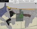
Existing land use.jpg
Maggiew
19:58, 16 May 2018
2,792 × 2,747; 1.33 MB
-
Practical Theme-2.jpg
Mohamadreza
18:32, 16 May 2018
1,920 × 1,080; 460 KB


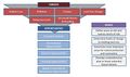
 Problem definition and priority setting Group06.png Haniyehg


