File list
Jump to navigation
Jump to search
This special page shows all uploaded files.
| Date | Name | Thumbnail | Size | User | Description | Versions |
|---|---|---|---|---|---|---|
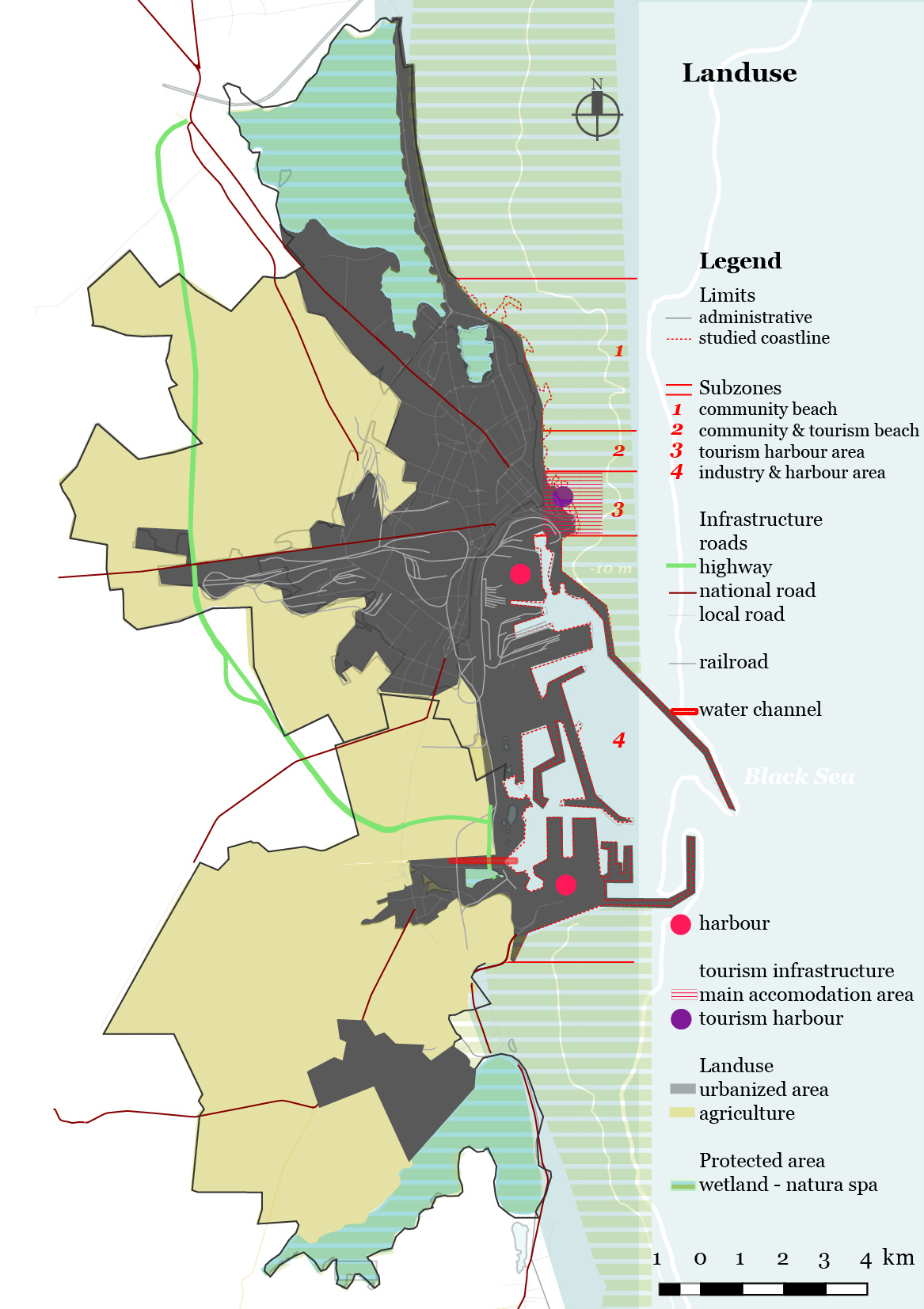
| 19:37, 10 June 2018 | Landuse1.jpg (file) |  |
418 KB | Ioanao (talk | contribs) | 1 | |
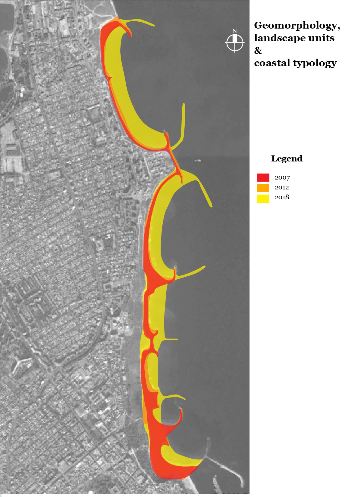
| 19:33, 10 June 2018 | Landscapeunits2.jpg (file) |  |
472 KB | Ioanao (talk | contribs) | 1 | |
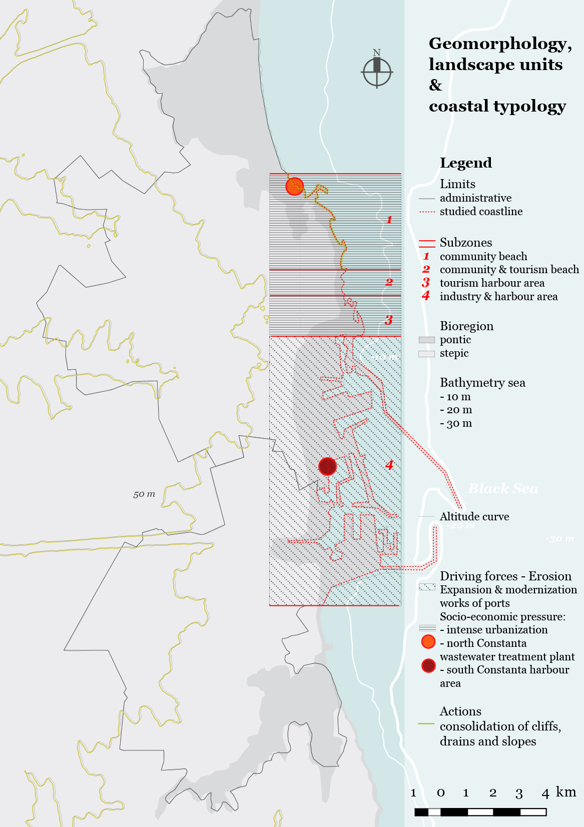
| 14:12, 10 June 2018 | Landscapeunits.jpeg (file) |  |
436 KB | Ioanao (talk | contribs) | 1 | |
| 16:31, 5 June 2018 | Narva-3.JPG (file) |  |
592 KB | Rajendrab (talk | contribs) | 3 | |
| 16:23, 5 June 2018 | Narva-2.JPG (file) |  |
950 KB | Rajendrab (talk | contribs) | 2 | |
| 16:02, 5 June 2018 | GREEN-BLUE-INFR (1).jpg (file) | .jpg) |
1.27 MB | Rajendrab (talk | contribs) | 3 | |
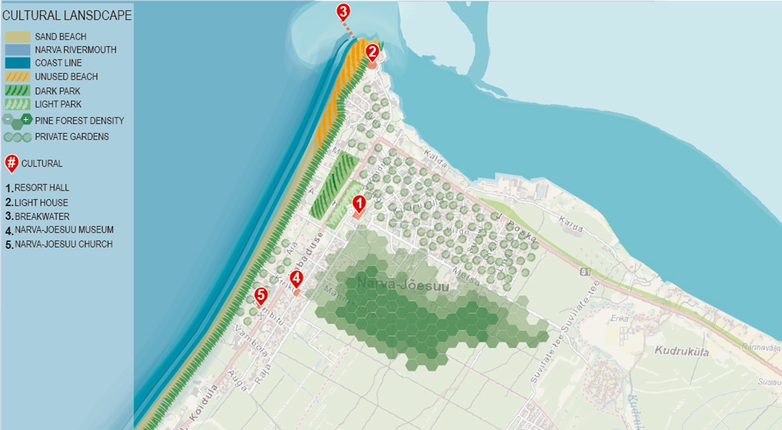
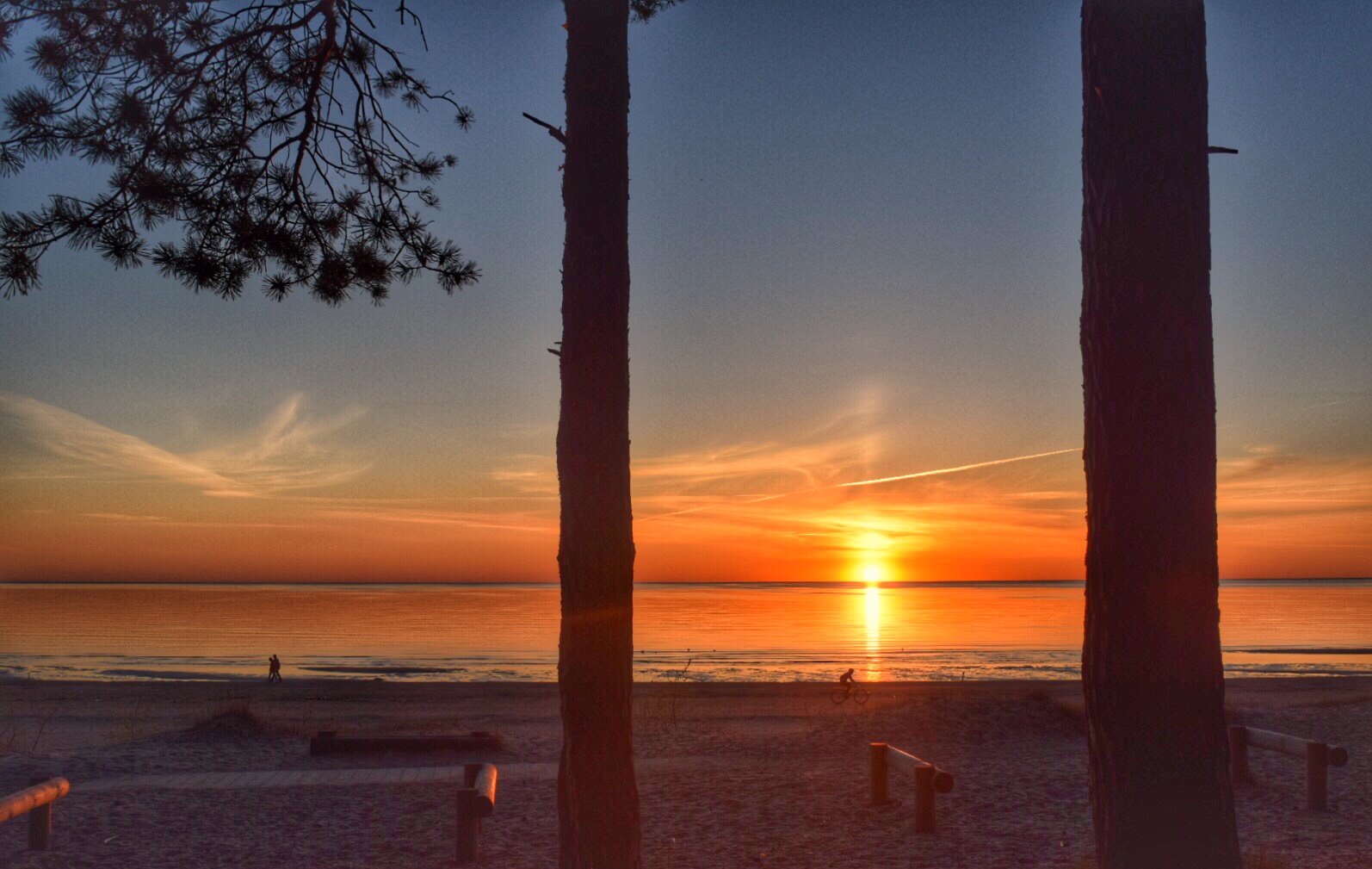
| 15:49, 5 June 2018 | Evening view of the Narva-Joesuu Beach.jpg (file) |  |
76 KB | Rajendrab (talk | contribs) | 3 | |
| 15:32, 5 June 2018 | Evening view of Beach.jpg (file) |  |
384 KB | Rajendrab (talk | contribs) | 1 | |
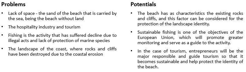
| 19:42, 2 June 2018 | Potential-Problem Map algarve.JPG (file) |  |
55 KB | Tatianan (talk | contribs) | Reverted to version as of 19:40, 2 June 2018 (UTC) | 6 |
| 09:14, 2 June 2018 | Mapping Fishery Algarve.jpeg (file) |  |
189 KB | Tatianan (talk | contribs) | 2 | |
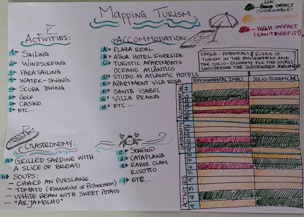
| 08:59, 2 June 2018 | Mapping turism algarve.jpeg (file) |  |
280 KB | Tatianan (talk | contribs) | 1 | |
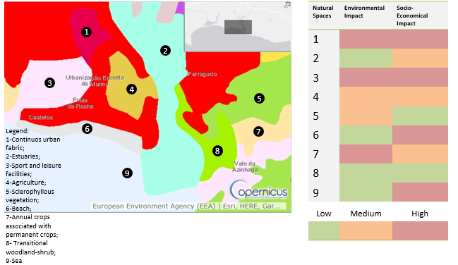
| 08:58, 2 June 2018 | Mapping natural spaces algarve.png (file) |  |
87 KB | Tatianan (talk | contribs) | 1 | |
| 09:08, 29 May 2018 | Finfin.png (file) |  |
1.73 MB | Mariep (talk | contribs) | 1 | |
| 09:04, 29 May 2018 | Bestofliisi.png (file) |  |
1.31 MB | Mariep (talk | contribs) | 1 | |
| 09:04, 29 May 2018 | Bestofcurrents.png (file) |  |
1.37 MB | Mariep (talk | contribs) | 1 | |
| 09:01, 29 May 2018 | M2.png (file) |  |
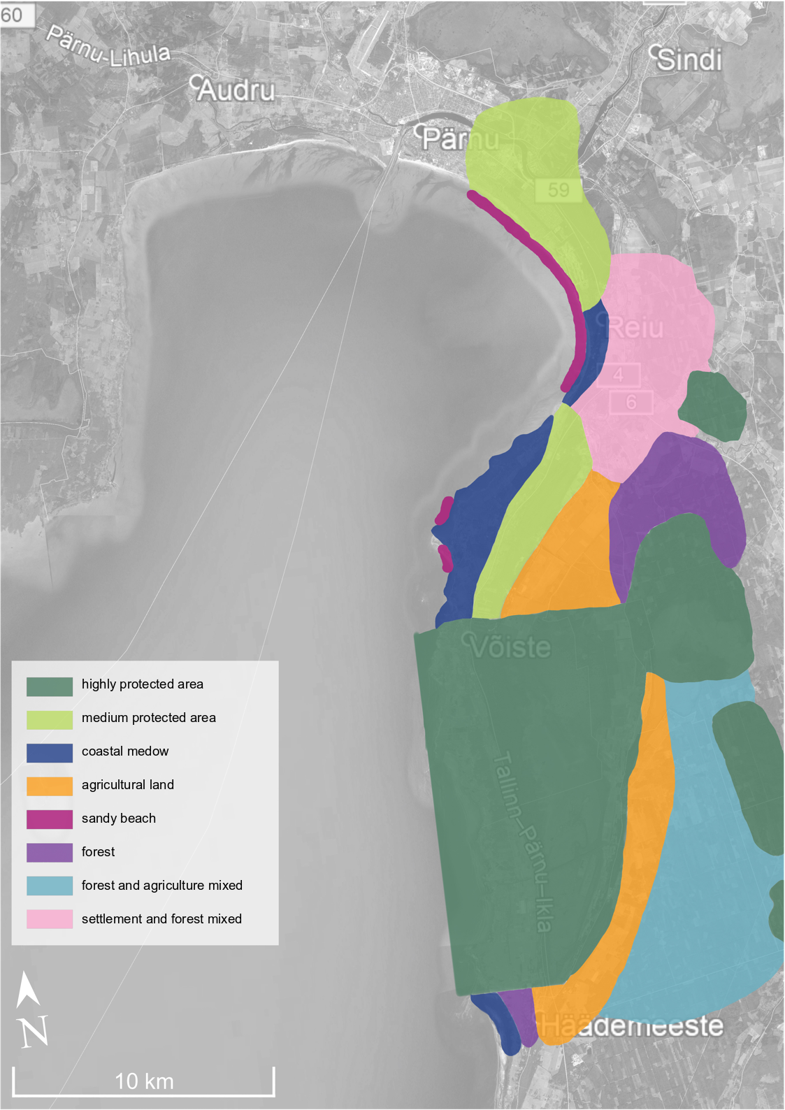
1.13 MB | Mariep (talk | contribs) | landscape character assessment related to level of protection in certain areas | 1 |
| 09:34, 25 May 2018 | Zone A.jpg (file) |  |
40 KB | Monicai (talk | contribs) | 1 | |
| 09:32, 25 May 2018 | +si-.jpg (file) |  |
1.95 MB | Monicai (talk | contribs) | 1 | |
| 09:25, 25 May 2018 | Zone afectate M.jpg (file) |  |
1.93 MB | Monicai (talk | contribs) | 1 | |
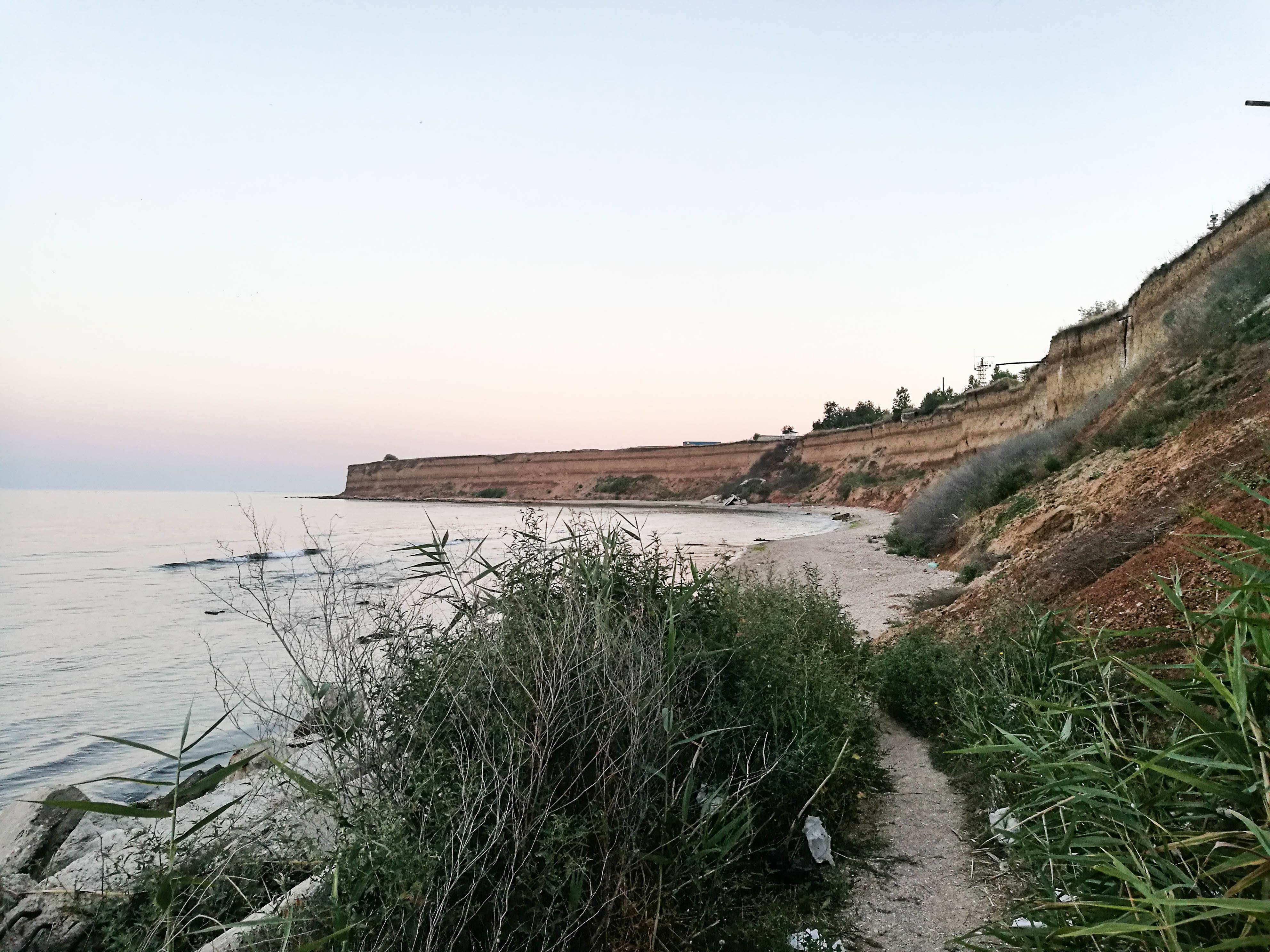
| 21:11, 24 May 2018 | Representative picture-Limanu.jpg (file) |  |
1.1 MB | Anagabrielaz (talk | contribs) | 1 | |
| 21:10, 24 May 2018 | 30825301 1494322154030117 2102422444 o.jpg (file) |  |
1.1 MB | Anagabrielaz (talk | contribs) | 1 | |
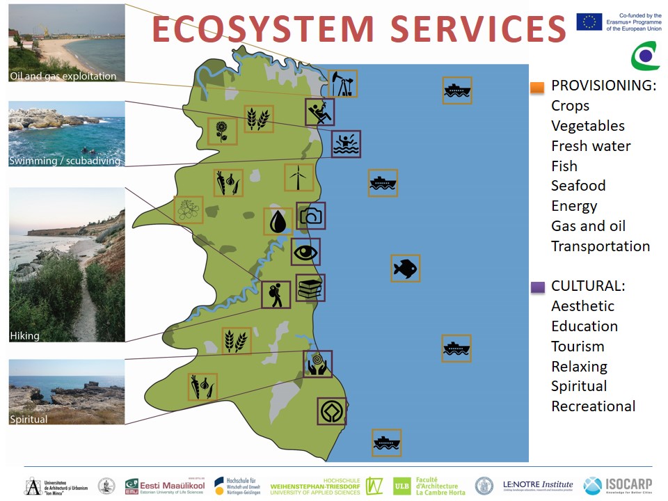
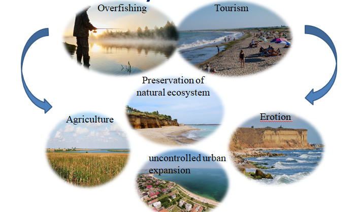
| 20:36, 24 May 2018 | Ecosystem services-Limanu Shabla.jpg (file) |  |
148 KB | Anagabrielaz (talk | contribs) | Mapping-ecosystem services | 1 |
| 19:45, 24 May 2018 | Ana.jpg (file) |  |
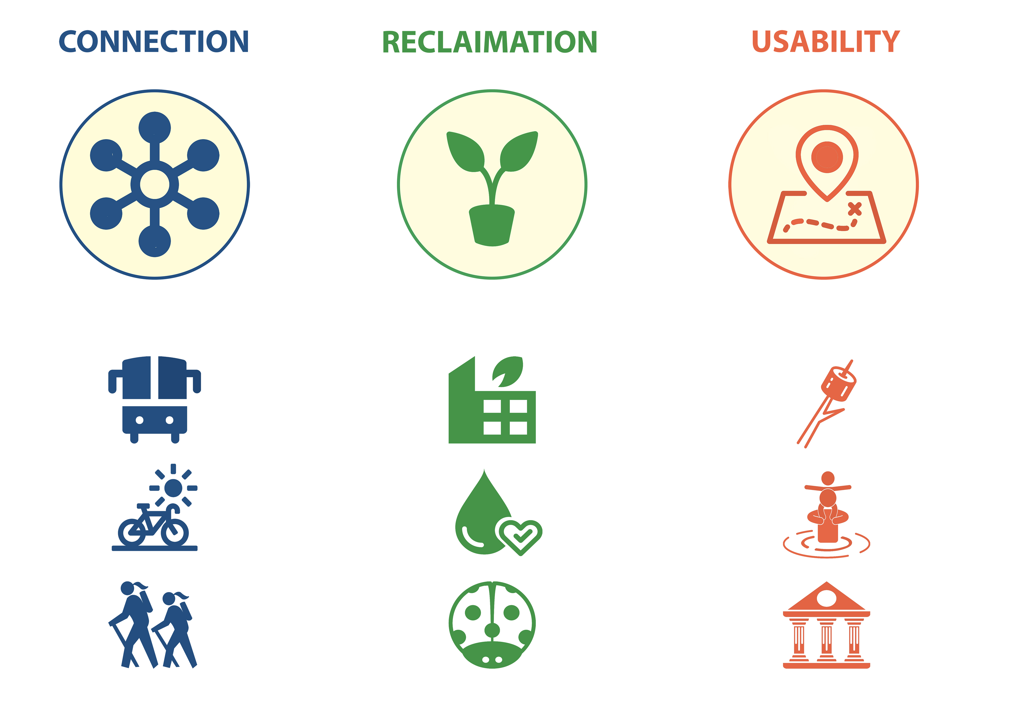
138 KB | Biancai (talk | contribs) | Land use and urban development - risks and potential | 1 |
| 19:41, 24 May 2018 | Coland.png (file) |  |
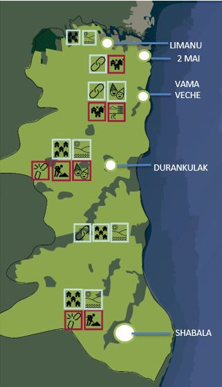
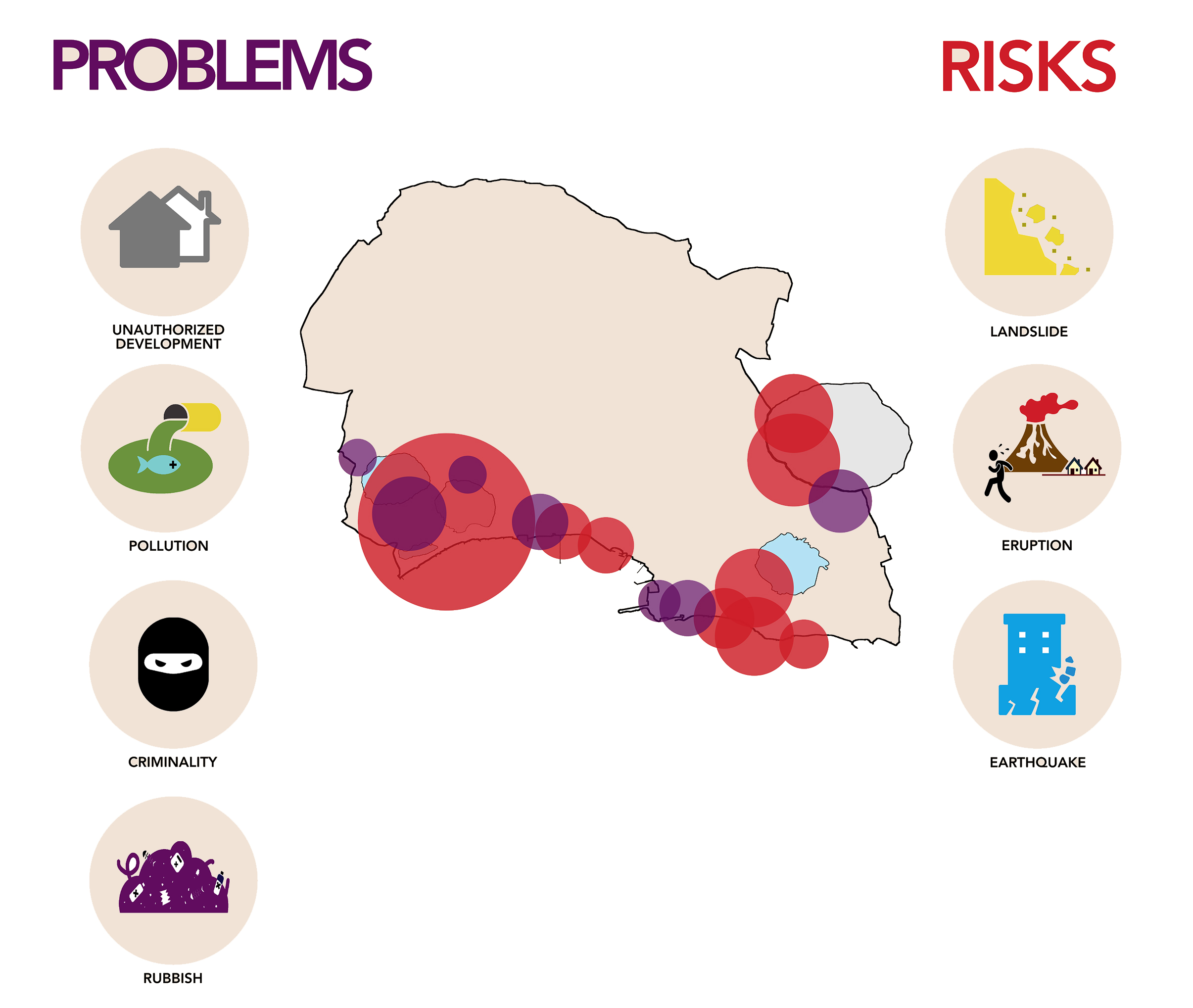
373 KB | Ioneliat (talk | contribs) | Problems/risks in Limanu Shabla area | 1 |
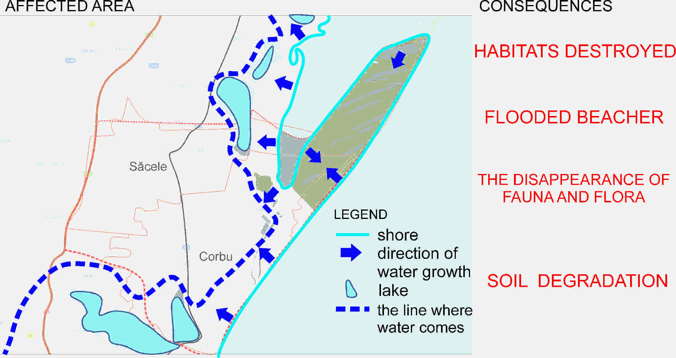
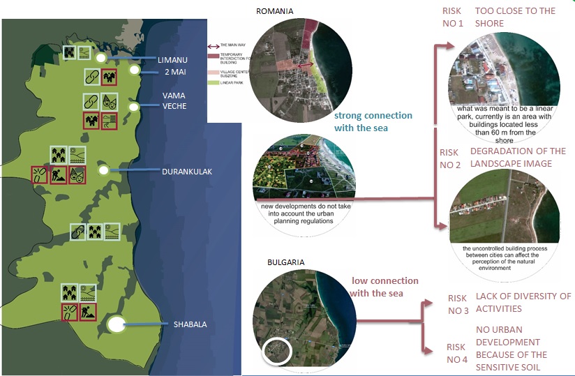
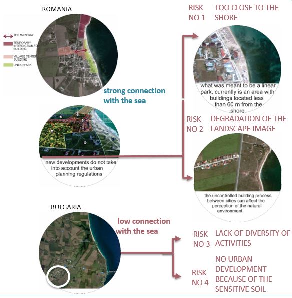
| 19:37, 24 May 2018 | Risk detail-Limanu-Shabla.JPG (file) |  |
66 KB | Biancai (talk | contribs) | Risks | 1 |
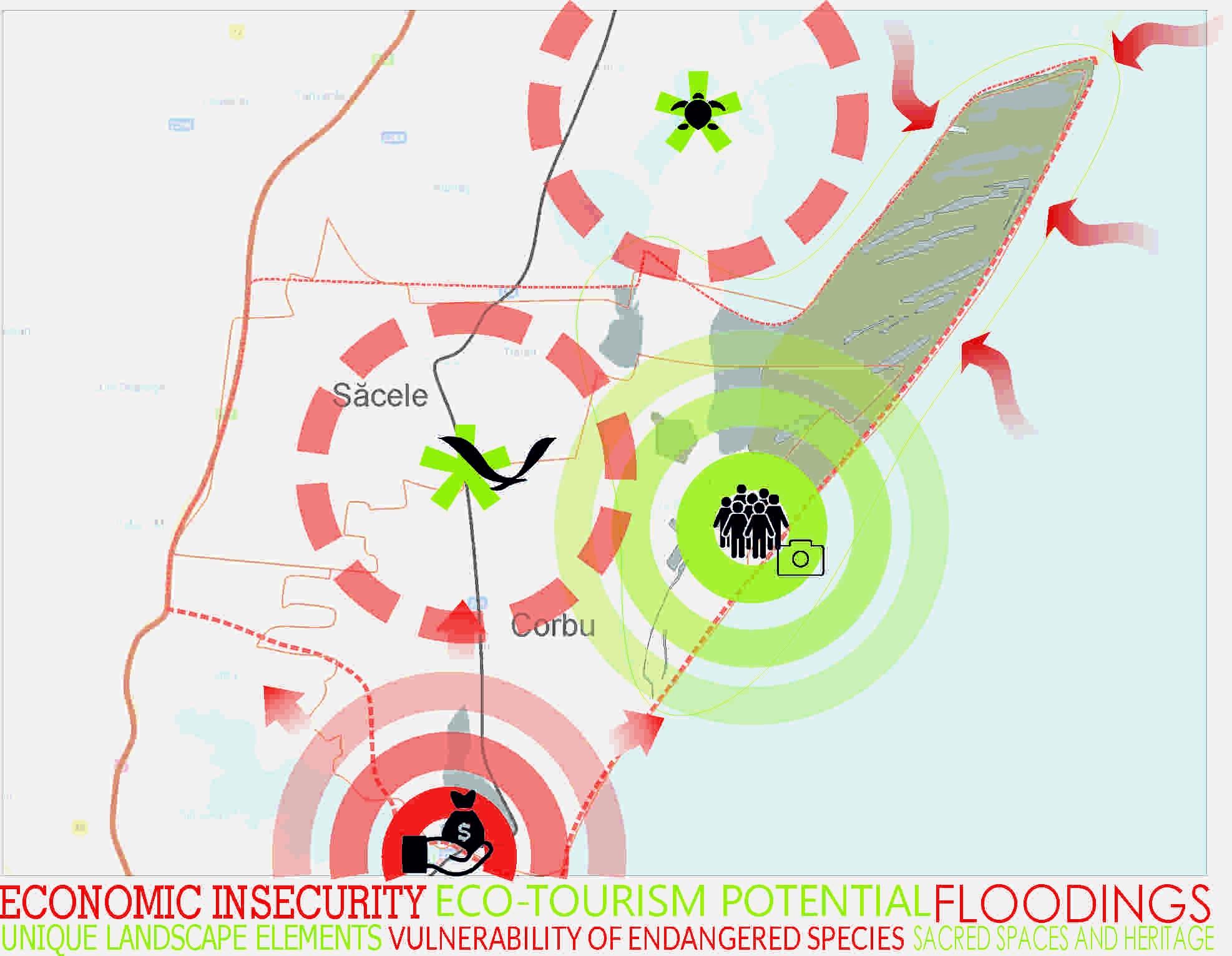
| 19:36, 24 May 2018 | Potential and risks- Limanu-Shabla.JPG (file) |  |
32 KB | Biancai (talk | contribs) | Land use and urban development | 1 |
| 21:54, 21 May 2018 | Case 3.2.jpg (file) |  |
69 KB | Negarr (talk | contribs) | 1 | |
| 21:53, 21 May 2018 | Case 3.1.jpg (file) |  |
75 KB | Negarr (talk | contribs) | 1 | |
| 21:52, 21 May 2018 | Case one.jpg (file) |  |
78 KB | Negarr (talk | contribs) | 1 | |
| 12:54, 18 May 2018 | Example22.jpg (file) |  |
1.96 MB | Monicai (talk | contribs) | 1 | |
| 12:46, 18 May 2018 | Fedeballo.jpg (file) |  |
520 KB | Pasqualei (talk | contribs) | 1 | |
| 12:45, 18 May 2018 | Fedeblallo.jpg (file) |  |
520 KB | Pasqualei (talk | contribs) | 3 | |
| 12:40, 18 May 2018 | Goraffa.gif (file) |  |
1.19 MB | Pasqualei (talk | contribs) | 1 | |
| 12:32, 18 May 2018 | GALS.jpg (file) |  |
728 KB | Pasqualei (talk | contribs) | 3 | |
| 12:31, 18 May 2018 | Narva-4.JPG (file) |  |
66 KB | Rajendrab (talk | contribs) | 1 | |
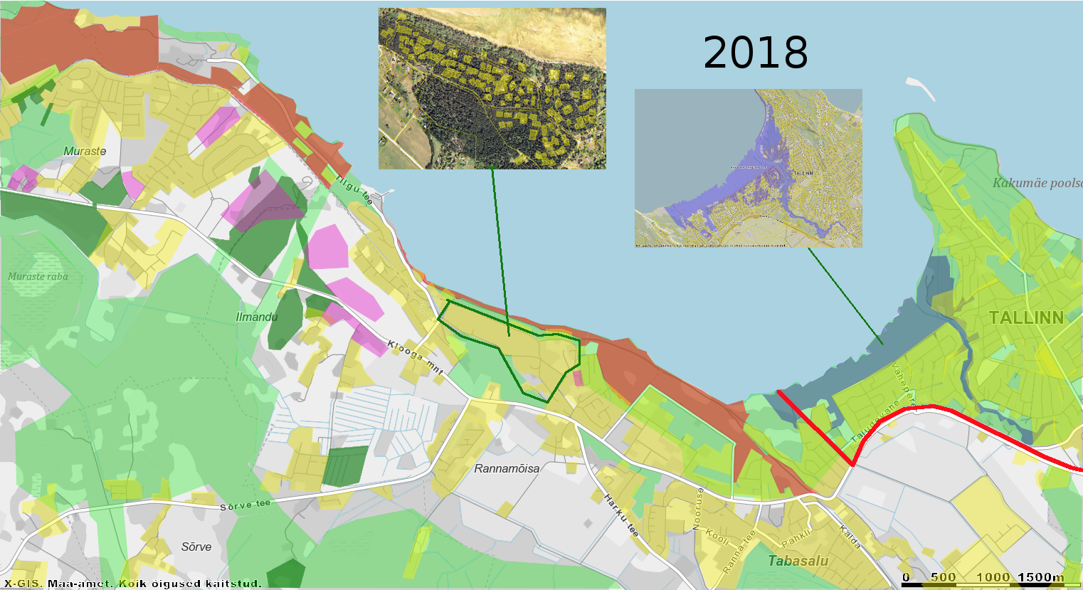
| 12:30, 18 May 2018 | Urban sprawl 2018 situation.png (file) |  |
967 KB | Jannes (talk | contribs) | 1 | |
| 12:26, 18 May 2018 | Agiffgiraffa.gif (file) |  |
1.21 MB | Pasqualei (talk | contribs) | 1 | |
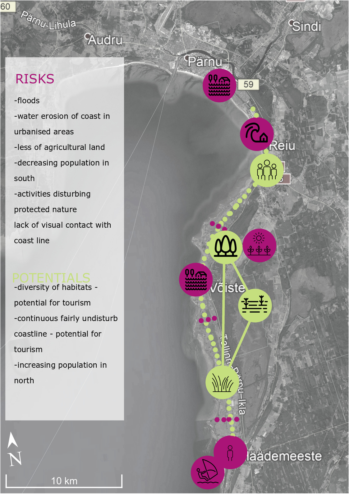
| 12:26, 18 May 2018 | Risk and Potential map.jpeg (file) |  |
157 KB | Rajendrab (talk | contribs) | 1 | |
| 12:12, 18 May 2018 | GOAS.jpg (file) |  |
1.9 MB | Pasqualei (talk | contribs) | 2 | |
| 12:09, 18 May 2018 | Blallo.jpg (file) |  |
1.32 MB | Pasqualei (talk | contribs) | 1 | |
| 12:08, 18 May 2018 | POTENTIAL.jpg (file) |  |
1.32 MB | Pasqualei (talk | contribs) | 1 | |
| 12:07, 18 May 2018 | VISUAL IMPACT.png (file) |  |
1.34 MB | Pasqualei (talk | contribs) | 1 | |
| 12:05, 18 May 2018 | Recupero.jpg (file) |  |
1.8 MB | Pasqualei (talk | contribs) | 1 | |
| 12:02, 18 May 2018 | Inquadramento.jpg (file) |  |
1.78 MB | Pasqualei (talk | contribs) | 1 | |
| 11:59, 18 May 2018 | POTENTIALS.jpg (file) |  |
1.68 MB | Pasqualei (talk | contribs) | 4 | |
| 11:50, 18 May 2018 | STRATEGy.png (file) |  |
298 KB | Maytheg (talk | contribs) | 1 | |
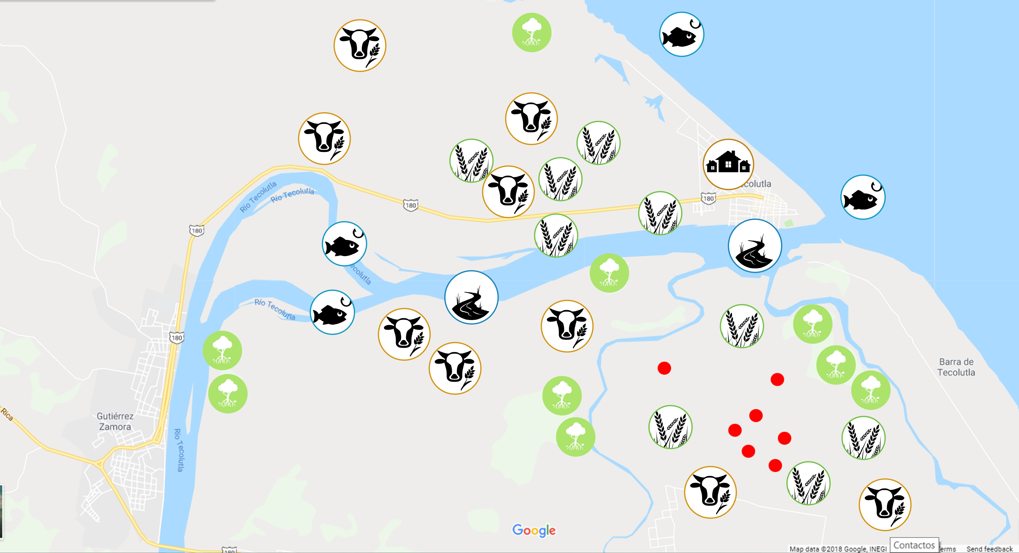
| 11:44, 18 May 2018 | Problems tec.png (file) |  |
1.37 MB | Maytheg (talk | contribs) | 1 | |
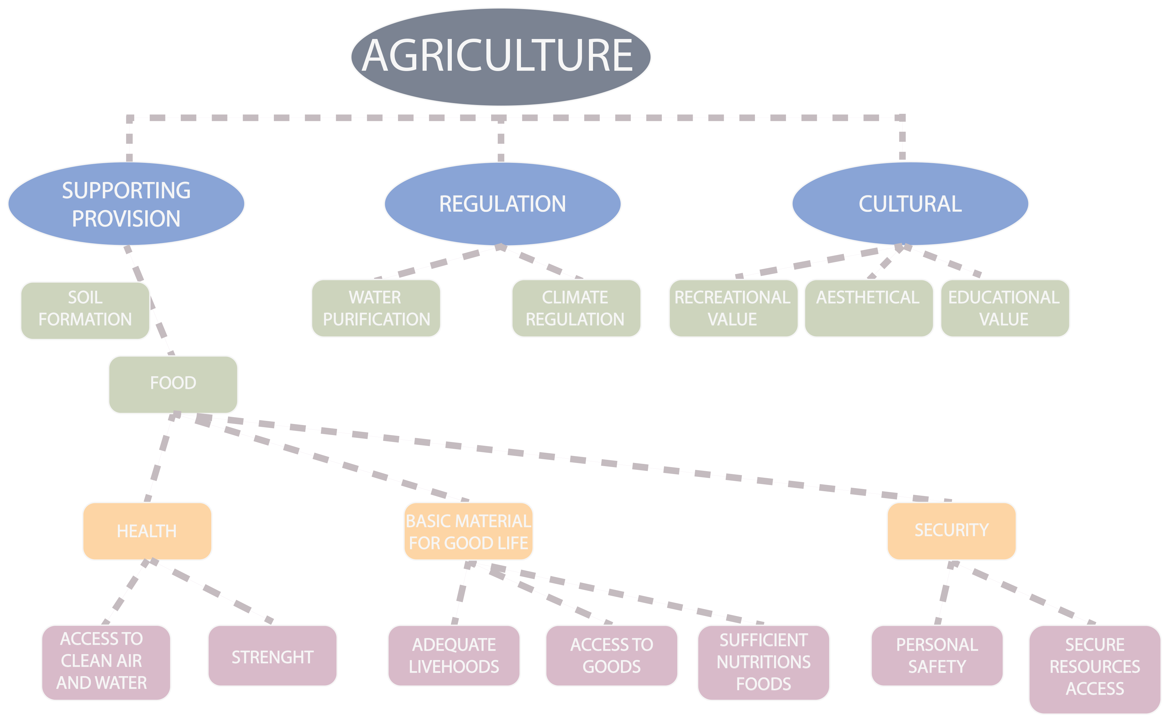
| 11:43, 18 May 2018 | ES CLASSIFICATION AGR.png (file) |  |
445 KB | Maytheg (talk | contribs) | 1 | |
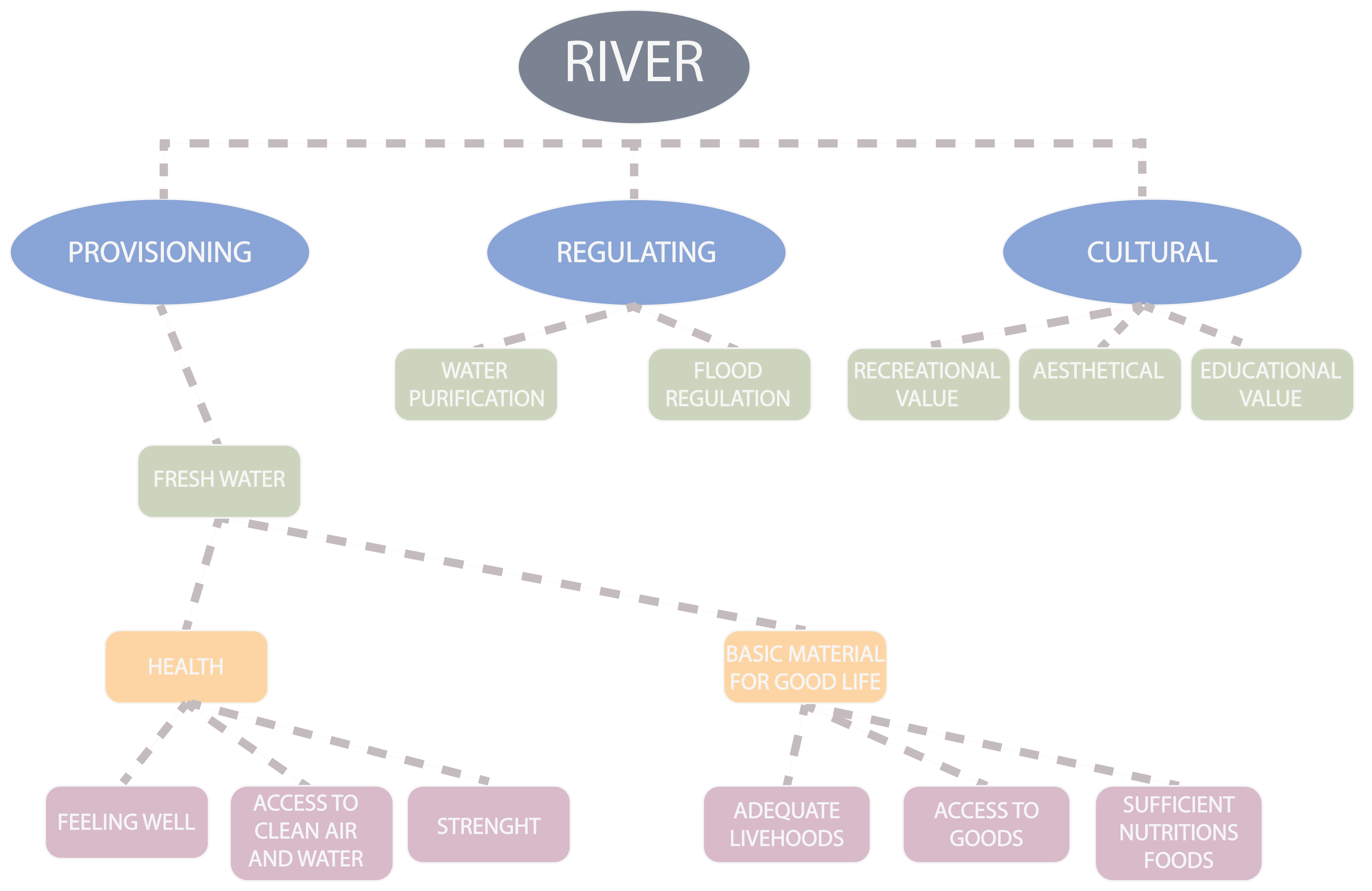
| 11:41, 18 May 2018 | ES CLASSIFICATION RIVER.png (file) |  |
368 KB | Maytheg (talk | contribs) | 1 | |
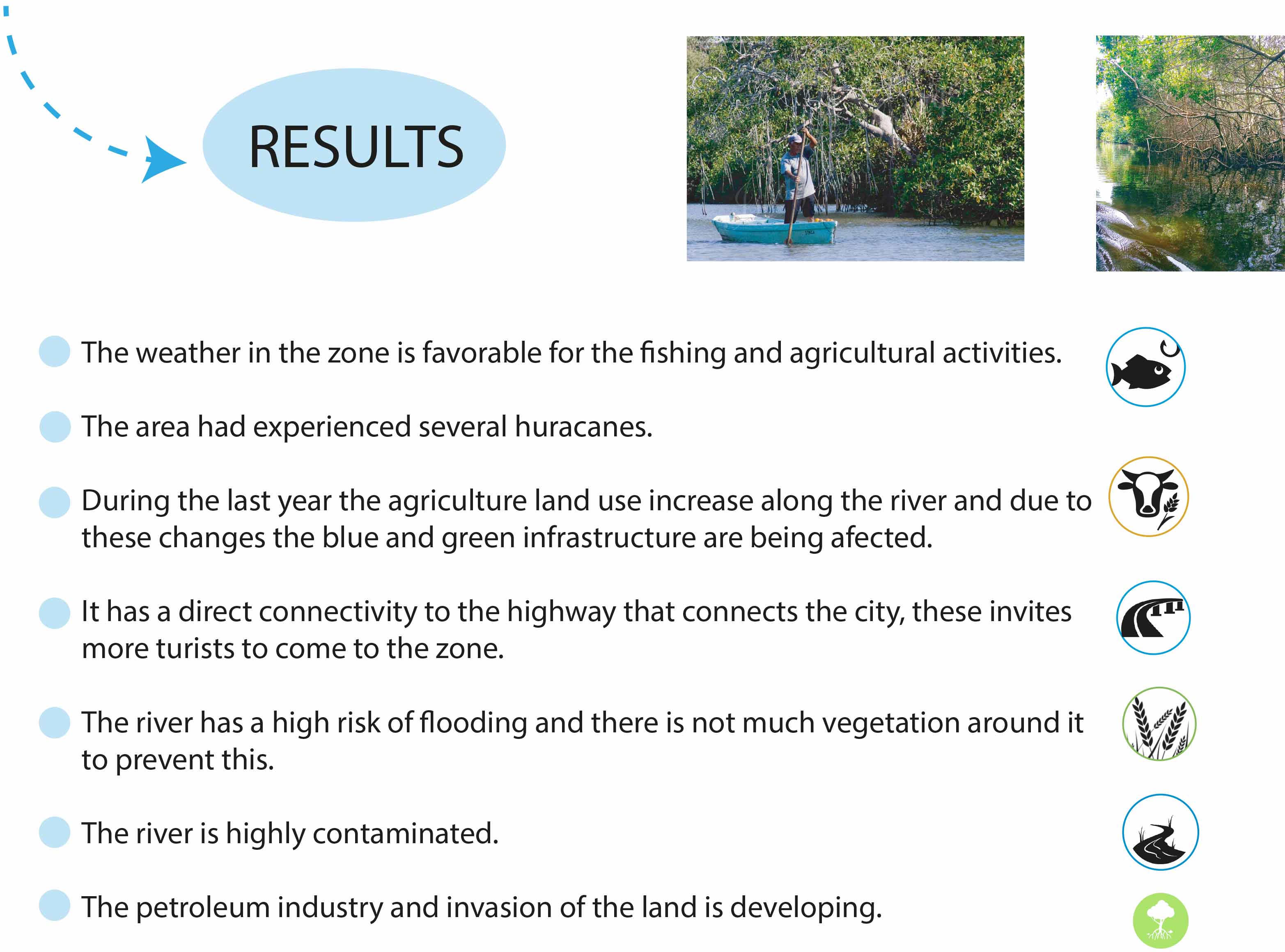
| 11:40, 18 May 2018 | RESULTS.jpg (file) |  |
483 KB | Maytheg (talk | contribs) | 1 |