Unused files
Jump to navigation
Jump to search
The following files exist but are not embedded in any page. Please note that other websites may link to a file with a direct URL, and so may still be listed here despite being in active use.
Showing below up to 50 results in range #1 to #50.
-
 Testupload.png 48 × 48; 727 bytes
-
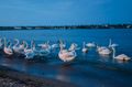 Mangalia Swans.jpg 640 × 423; 42 KB
-
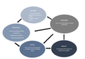 Dpsir.PNG 1,222 × 855; 55 KB
-
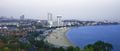 HuiquanBay Overview.jpg 690 × 295; 125 KB
-
 Mariep casestudyimage.jpg 2,048 × 1,152; 186 KB
-
 DPSIR.jpg 960 × 600; 166 KB
-
 Prova.JPG 2,304 × 3,456; 896 KB
-
 Navodari Mamaia case study.png 686 × 413; 358 KB
-
 Anzali 1.JPG 1,080 × 607; 90 KB
-
 Anzali 2.JPG 1,080 × 607; 85 KB
-
 San Martino ruin.jpg 5,602 × 3,734; 1.56 MB
-
 Tasaul Lake Navodari Mamaia case study.jpg 468 × 463; 59 KB
-
 Narva joessu rajen.jpg 1,334 × 890; 434 KB
-
 Loksa and lahemaa.jpeg 768 × 431; 95 KB
-
 Loksa.jpg 1,265 × 879; 922 KB
-
 Power map.png 3,508 × 2,480; 261 KB
-
 Hele-Mai+Alamaa .jpg 1,600 × 900; 224 KB
-
 Light house rajen.jpg 1,334 × 890; 395 KB
-
 Narva-joesuu.jpg 320 × 213; 54 KB
-
 Heritage and sacred spaces.png 932 × 547; 660 KB
-
 Coastal area of Peipsi.png 150 × 200; 58 KB
-
 LAND USE.jpg 1,634 × 2,001; 500 KB
-
 Hypothesis.jpg 3,508 × 2,480; 266 KB
-
 DPSIR Monte di Procida.jpg 3,508 × 2,480; 252 KB
-
 23 August-Eforie Map.png 899 × 476; 660 KB
-
 LAND USEOK.jpg 2,059 × 2,001; 625 KB
-
 G&B.jpg 2,058 × 2,001; 592 KB
-
 Eforie-sunset.JPG 4,608 × 3,072; 476 KB
-
 Land use Mongte di Procida.png 3,508 × 2,374; 206 KB
-
 Currently situation-hypothesis.jpg 3,508 × 2,480; 1.53 MB
-
 Fucture develop.jpg 3,508 × 2,480; 1.53 MB
-
 Land use RO.jpg 889 × 1,088; 1.8 MB
-
 LandUse map.PNG 2,528 × 1,490; 1.62 MB
-
 Photo 2018-04-18 22-24-29.jpg 864 × 1,080; 121 KB
-
 GREEN-BLUE-INFR.jpg 1,136 × 471; 1.05 MB
-
 1024px-Bolvare Bandar-e Anzali.jpg 1,024 × 768; 125 KB
-
 Parnu corinemap mariep.jpg 3,508 × 4,961; 1.85 MB
-
 Sacred spaces map.JPG 585 × 516; 51 KB
-
 Sacred spaces map1.JPG 696 × 586; 66 KB
-
 Powermap of Kakumäe area showing actors and stakeholders.jpg 2,219 × 1,760; 553 KB
-
 A1.1Geomorphology.jpg 2,000 × 1,125; 295 KB
-
 A1.1Topography.jpg 2,000 × 2,819; 378 KB
-
 Land use Monte di Procida 1.jpg 3,508 × 2,374; 149 KB
-
 DPSIR model jpg.jpg 3,307 × 2,339; 1.27 MB
-
 Dpsri.jpg 1,123 × 794; 66 KB
-
 Asezare pe Insula Ostrov din lacul Tașaul.jpg 1,280 × 960; 271 KB
-
 Natura2000map.jpg 790 × 706; 73 KB
-
 Lahemaa soode kaart.JPG 808 × 486; 87 KB
-
 P9160365.JPG 4,608 × 3,456; 1.78 MB
-
 Green infra map.jpg 790 × 706; 76 KB


