Uncategorized files
Jump to navigation
Jump to search
Showing below up to 50 results in range #1,401 to #1,450.
-
 Middelkerke heritage.png 768 × 483; 278 KB
-
 Middelkerke land use.jpg 6,622 × 4,677; 1.33 MB
-
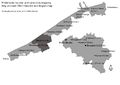 Middelkerke location and connection mapping-min.jpg 6,622 × 4,677; 362 KB
-
 Middelkerke location and connection mapping.jpg 6,622 × 4,677; 1.29 MB
-
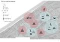
 Middelkerke masterplan-min.jpg 6,622 × 4,677; 1.06 MB
-
 Middelkerke models.jpg 2,321 × 985; 164 KB
-
 Middelkerke nature reserve.JPG 664 × 359; 32 KB
-
 Middelkerke planning flowchart.jpg 1,393 × 1,025; 387 KB
-
 Middelkerke risk and potential-min.jpg 6,622 × 4,677; 1.21 MB
-
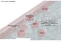 Middelkerke risk and potential.jpg 6,622 × 4,677; 1.09 MB
-
 Middelkerke risk and potential (2).jpg 6,622 × 4,677; 1.19 MB
-
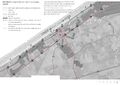 Middelkerke road and transportation.jpg 6,622 × 4,677; 1.48 MB
-
 Middelkerke street view.JPG 796 × 509; 110 KB
-
 Middelkerke town hall.png 442 × 340; 159 KB
-
 Middelkerke transportation and connection mapping-min.jpg 6,622 × 4,677; 1.41 MB
-
 Middelkerke transportation and connection mapping.jpg 6,622 × 4,677; 1.5 MB
-
 Middelkerke transportation and connection mapping (machine oriented)-min.jpg 6,622 × 4,677; 1.36 MB
-
 Middelkerke view.jpg 1,774 × 1,181; 1.31 MB
-
 Middelkerkemmm.jpg 4,800 × 2,735; 724 KB
-
 Military fartifications 1.JPG 1,732 × 1,154; 479 KB
-
 Military fartifications 2.JPG 1,732 × 1,154; 544 KB
-
 Mina 2020-05-16 at 11.34.02 PM.png 1,596 × 1,206; 710 KB
-
 Mina class stratgey.JPG 897 × 894; 148 KB
-
 Mina landuse casestudy.JPG 1,201 × 871; 176 KB
-
 Mina narrative.JPG 445 × 525; 37 KB
-
 Miseno.jpg 3,370 × 2,384; 771 KB
-
 Mix maamet and corine.PNG 286 × 377; 211 KB
-
 Mobility and connection mapping of Baia city case study.jpg 2,099 × 1,486; 1,021 KB
-
 Mobility base.jpg 3,308 × 2,339; 283 KB
-
 Model.jpeg 960 × 720; 93 KB
-
 Model of group working process.PNG 366 × 547; 8 KB
-
 Model of ideal spatial planning and stakeholders.jpg 2,479 × 3,508; 738 KB
-
 Mole Bandar-e Anzali.jpg 2,816 × 2,112; 1.88 MB
-
 Mole Ooster.jpg 1,080 × 799; 74 KB
-
 Monkey.jpeg 960 × 633; 171 KB
-
 Montaza 2.jpg 564 × 412; 32 KB
-
 Montaza 3.jpg 535 × 347; 70 KB
-
 Montaza park.jpg 960 × 375; 75 KB
-
 Monte di Procia.jpg 341 × 148; 8 KB
-
 Monte di Procida Ecosystem services.jpg 3,511 × 2,047; 607 KB
-
 Monte di Procida dock.JPG 3,456 × 2,304; 991 KB
-
 Monte di procida.jpg 2,206 × 572; 1.18 MB
-
 Monte di procida green infrastructure.jpg 3,508 × 2,480; 1.06 MB
-
 Mountain.jpg 1,200 × 633; 156 KB
-
 Mountains placeholder.jpg 1,600 × 1,067; 35 KB
-
 Mud pool in Solfatara crater.jpg 1,920 × 1,275; 630 KB
-
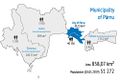 Municipality of pärnu.jpg 1,000 × 667; 64 KB
-
 Myrtle.jpg 1,920 × 1,440; 371 KB
-
 Naples2.jpg 550 × 389; 62 KB
-
 Naples 6 Infrastructure.jpg 3,209 × 1,667; 1.35 MB


.jpg)


-min.jpg)


