Uncategorized files
Jump to navigation
Jump to search
Showing below up to 50 results in range #1,901 to #1,950.
-
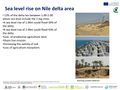 Rise sea level 2.jpg 2,000 × 1,500; 934 KB
-
 Risk.jpg 1,909 × 1,359; 196 KB
-
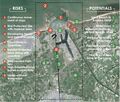 Risk & Potential Map.jpg 1,948 × 1,654; 1.71 MB
-
 Risk and Potential map.jpeg 1,856 × 737; 157 KB
-
 Risk and potential.jpg 2,838 × 2,480; 896 KB
-
 Risk and potential2.jpg 788 × 552; 160 KB
-
 Risk and potential3.jpg 788 × 552; 168 KB
-
 Risk and potentials2 Fardokht and Yasaman.jpg 960 × 720; 108 KB
-
 Risk and potentials 1 Fardokht and Yasaman.jpg 960 × 720; 118 KB
-
 Risk and potentials 2 Fardokht and Yasaman.JPG 960 × 720; 96 KB
-
 Risk and potentials Fardokht and Yasaman.JPG 960 × 720; 108 KB
-
 Risk detail-Limanu-Shabla.JPG 583 × 595; 66 KB
-
 Risk values.jpg 1,280 × 720; 104 KB
-
 Riskandpotentials.png 1,123 × 1,588; 1.73 MB
-
 Risks & potentials.jpg 591 × 591; 322 KB
-
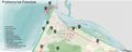
 Risks and potentials jpg.jpg 1,243 × 789; 271 KB
-
 RisksandPot..png 813 × 629; 633 KB
-
 River.jpg 400 × 254; 31 KB
-
 River and the sea.jpeg 554 × 348; 38 KB
-
 River placeholder.jpg 1,600 × 1,067; 38 KB
-
 Road and green Areas in Northern Ireland.jpg 4,134 × 2,326; 1.49 MB
-
 Road connections.jpg 1,266 × 910; 388 KB
-
 Road infrastructure.png 2,096 × 1,406; 1.11 MB
-
 Roads Professorite küla.jpg 1,140 × 837; 376 KB
-
 Roads and accessibility.jpg 3,307 × 2,339; 579 KB
-
 Roads map Professorite küla.jpg 1,140 × 837; 459 KB
-
 Rocha-5621P.jpg 800 × 570; 370 KB
-
 Routes.JPG 729 × 928; 45 KB
-
 Royals DePanne foto.jpg 426 × 600; 163 KB
-
 Rt.png 449 × 637; 467 KB
-
 Rubric for Evaluation of CO-LAND Student Work Project IP De Panne Seite 1.jpg 3,532 × 2,489; 635 KB
-
 Ruins sketch colorr.jpg 3,688 × 2,384; 591 KB
-
 Réseau hydrologique.jpg 550 × 471; 102 KB
-
 SDG.jpg 1,188 × 726; 379 KB
-
 SECTION2.png 537 × 458; 214 KB
-
 SECTIONMISENO.jpg 2,251 × 1,196; 621 KB
-
 SECTIONPORT.jpg 2,503 × 1,191; 558 KB
-
 SECTION 1.png 893 × 461; 223 KB
-
 SECTION A - The Hill B&W.jpg 1,538 × 1,163; 382 KB
-
 SECTION B - The Coast B&W.jpg 1,534 × 1,164; 143 KB
-
 SECTION C - The Garages B&W.jpg 1,533 × 1,163; 188 KB
-
 SERVIZI.jpg 3,543 × 3,543; 1.57 MB
-
 SLIDE2.jpg 1,600 × 1,131; 333 KB
-
 SOCIAL MAP.jpg 3,508 × 1,890; 1.65 MB
-
 STK2.jpg 1,600 × 1,129; 344 KB
-
 STRATEGy.png 3,483 × 2,235; 298 KB
-
 SWOT-Analysis.jpg 758 × 765; 369 KB
-
 SWOT.jpg 4,365 × 1,904; 868 KB
-
 SWOT - objectives.jpg 3,508 × 2,479; 805 KB
-
 SWOT method to indetify the potentials and risks.png 790 × 428; 45 KB


