File list
Jump to navigation
Jump to search
This special page shows all uploaded files.
| Date | Name | Thumbnail | Size | User | Description | Versions |
|---|---|---|---|---|---|---|
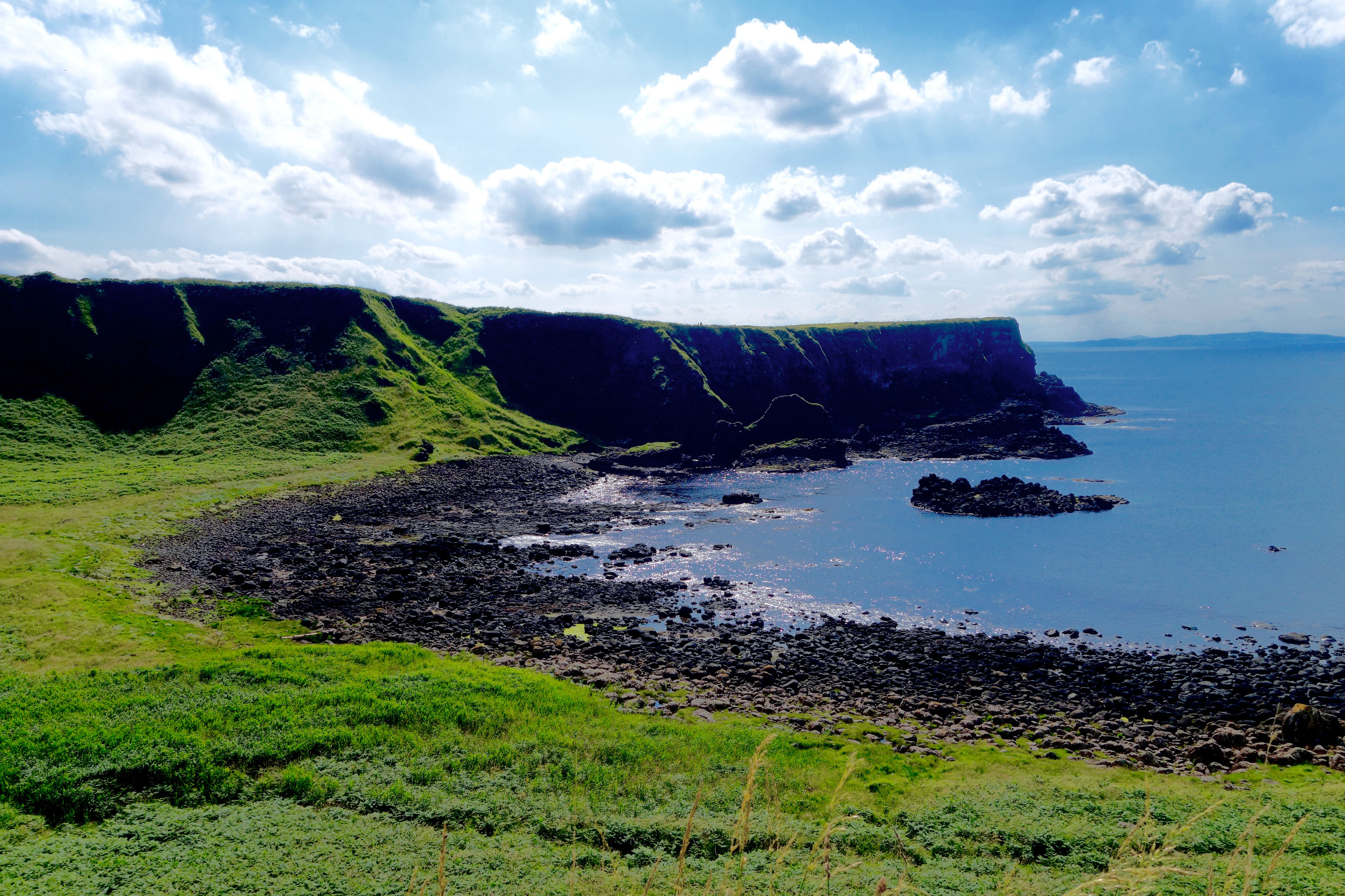
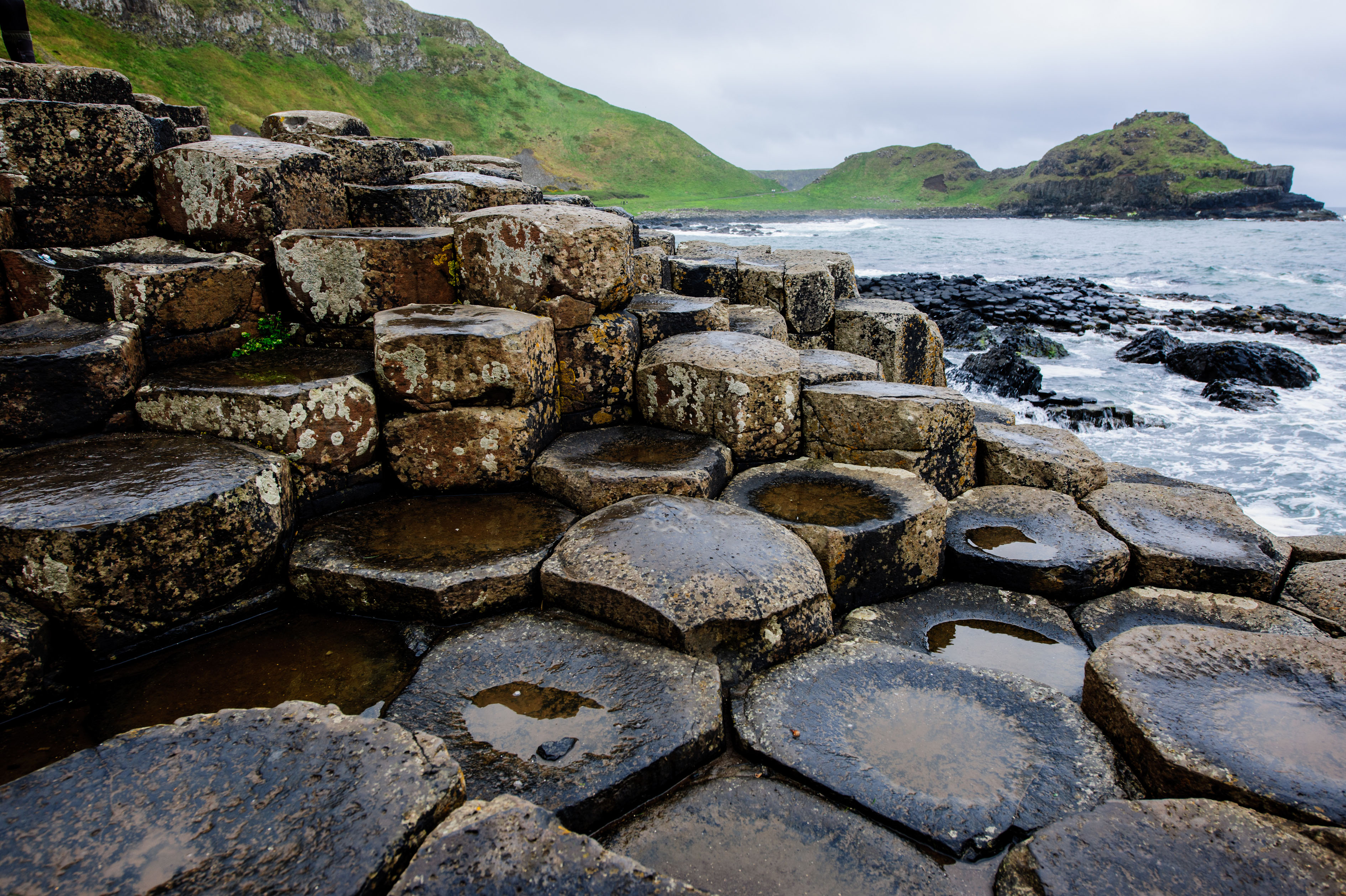
| 17:59, 19 April 2018 | View to the Giant's Causeway.jpg (file) |  |
1.78 MB | Melanies (talk | contribs) | author: Lynn Gallagher link: https://flic.kr/p/XPqB9E | 1 |
| 17:54, 19 April 2018 | Future Antrim Area.jpg (file) |  |
219 KB | Melanies (talk | contribs) | 1 | |
| 17:52, 19 April 2018 | Today Antrim Area.jpg (file) |  |
185 KB | Melanies (talk | contribs) | 1 | |
| 17:49, 19 April 2018 | Former Antrim Area.jpg (file) |  |
166 KB | Melanies (talk | contribs) | 1 | |
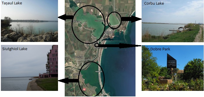
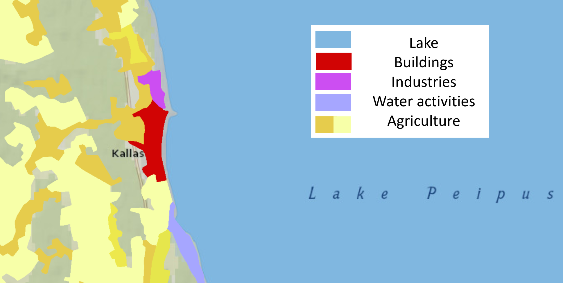
| 17:45, 19 April 2018 | Navodari-MamaiaArea.PNG (file) |  |
451 KB | Eugenn (talk | contribs) | Năvodari-Mamaia area | 1 |
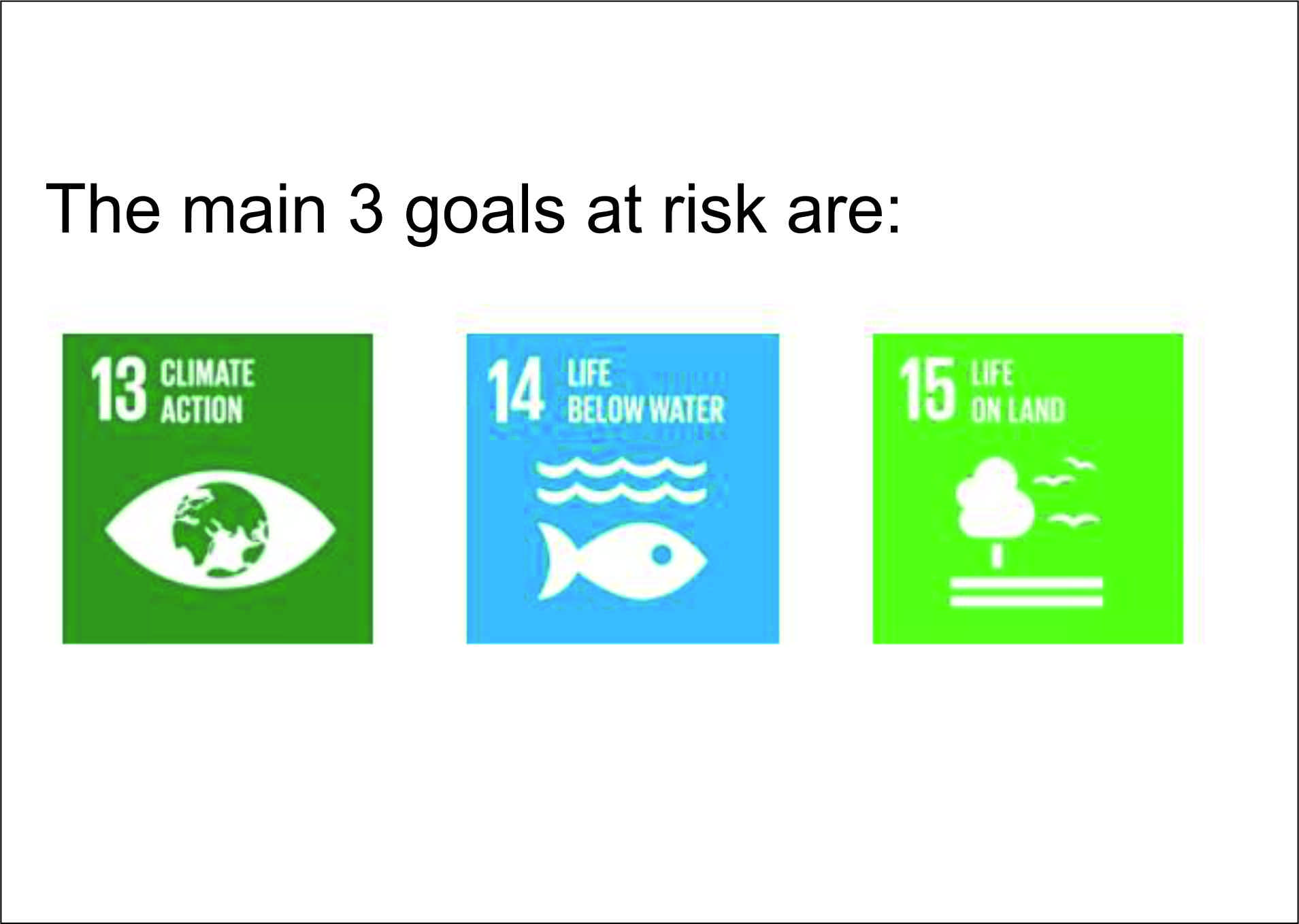
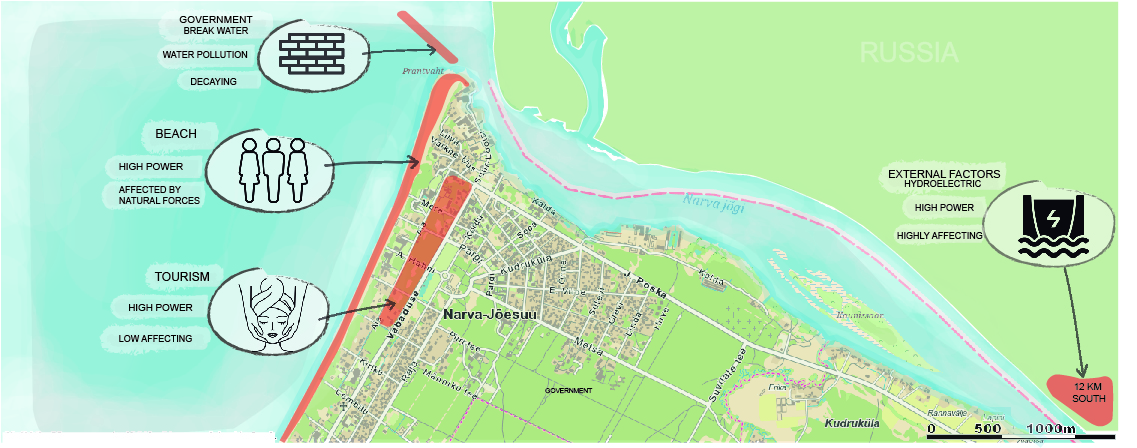
| 17:36, 19 April 2018 | Risk.jpg (file) |  |
196 KB | Monicai (talk | contribs) | 1 | |
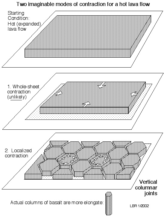
| 17:31, 19 April 2018 | Formation of basalt columns.png (file) |  |
94 KB | Melanies (talk | contribs) | link: https://sites.google.com/site/geo327pam/litlanesfoss-waterfalls | 1 |
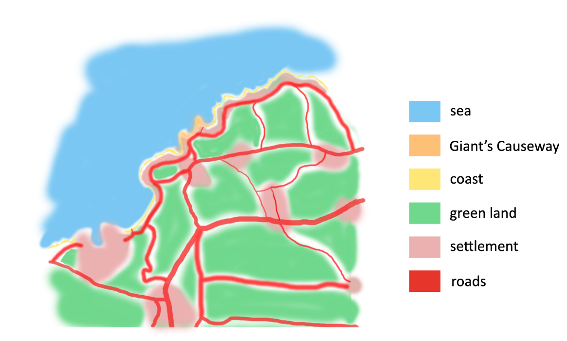
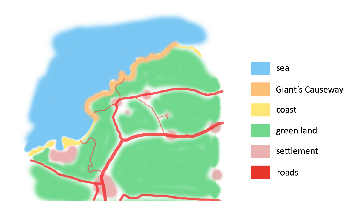
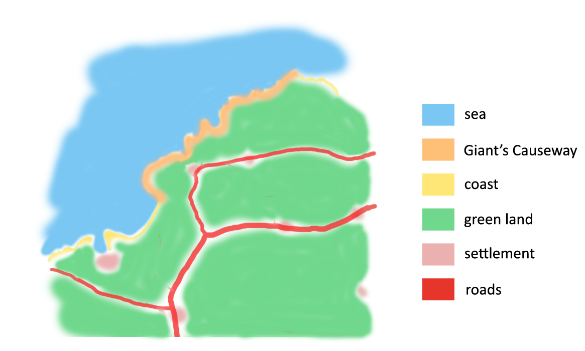
| 17:28, 19 April 2018 | Coast typology Giant's Causeway.jpg (file) |  |
1.98 MB | Melanies (talk | contribs) | author: Ilee_wu link: https://flic.kr/p/bUsYBo | 1 |
| 17:17, 19 April 2018 | Power map Mamaia Navodari.PNG (file) |  |
12 KB | Eugenn (talk | contribs) | Power map Mamaia-Navodari Area | 1 |
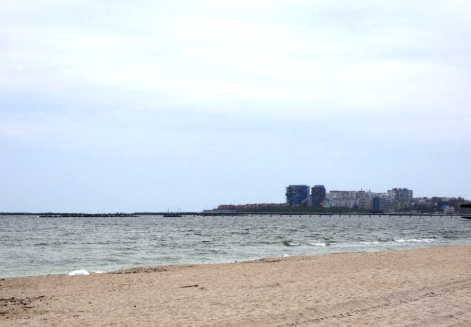
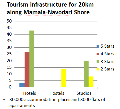
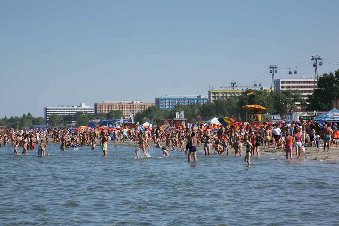
| 17:14, 19 April 2018 | Mamaia beach.jpg (file) |  |
76 KB | Eugenn (talk | contribs) | Mamaia beach congestion | 1 |
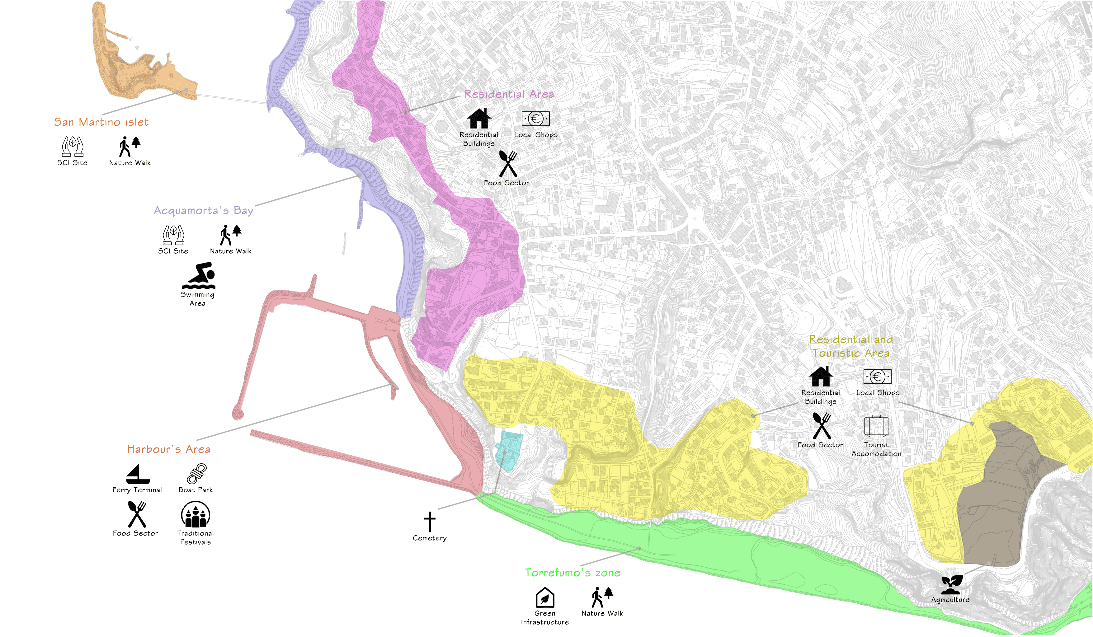
| 17:07, 19 April 2018 | Landuse.JPG (file) |  |
45 KB | Mafaldal (talk | contribs) | 1 | |
| 17:07, 19 April 2018 | Kabli beach photo by Heidi Tooming.png (file) |  |
1.85 MB | Eelarm (talk | contribs) | 1 | |
| 17:02, 19 April 2018 | Green-Blue Infrastructure Mamaia Navodari.jpg (file) |  |
84 KB | Marianab (talk | contribs) | Green Blue Infrastructure Mamaia Navodari | 1 |
| 16:54, 19 April 2018 | Example.jpg (file) |  |
109 KB | Monicai (talk | contribs) | 1 | |
| 16:53, 19 April 2018 | Hypothesis Eforie 23Arges.jpg (file) |  |
1.9 MB | Anamariamo (talk | contribs) | 1 | |
| 16:44, 19 April 2018 | Mamaia beach view.PNG (file) |  |
1,018 KB | Eugenn (talk | contribs) | Mamaia beach area | 1 |
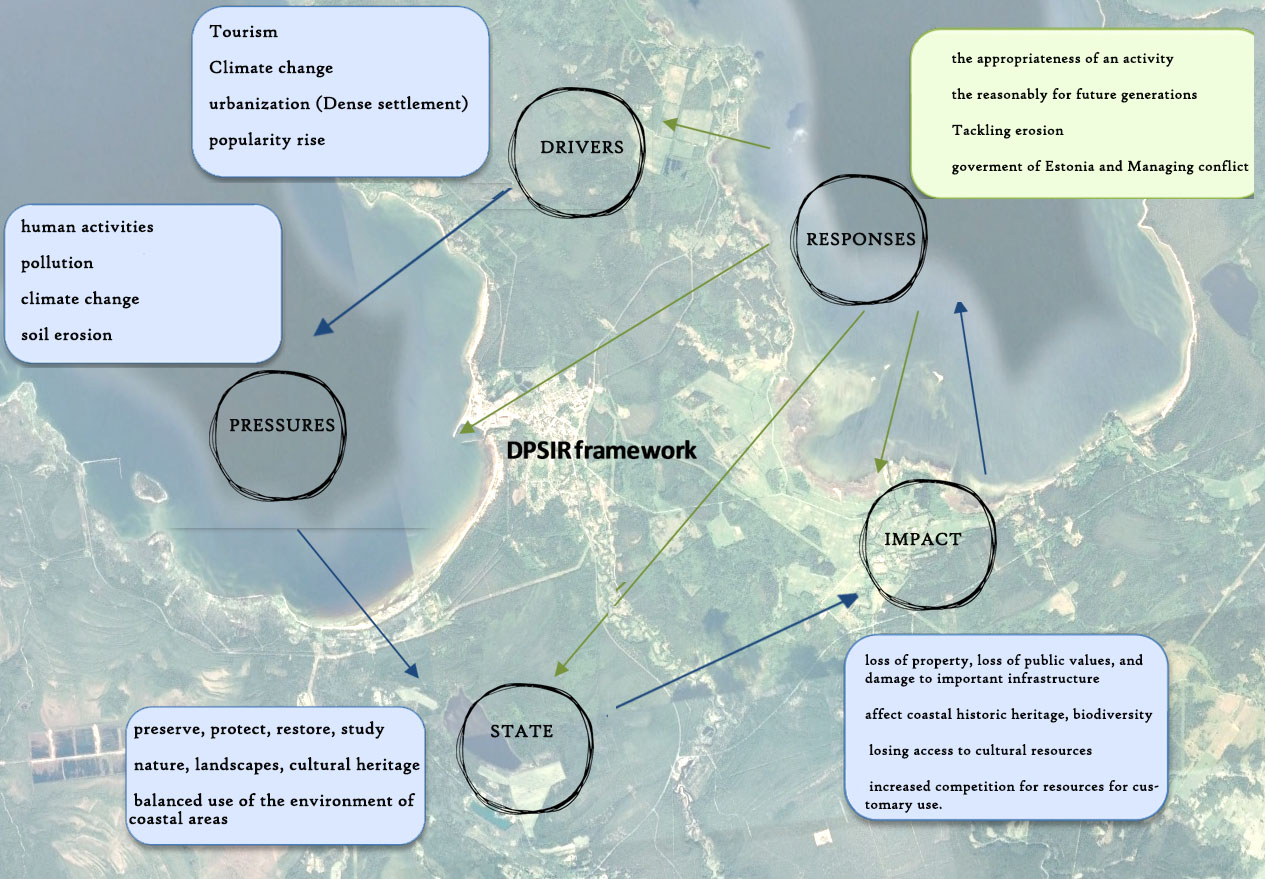
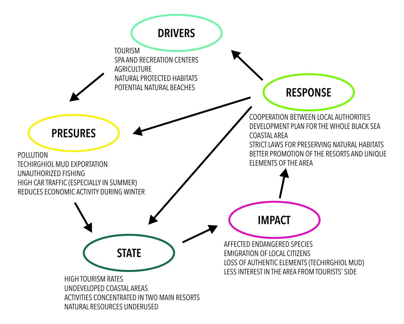
| 16:43, 19 April 2018 | Diagram dpsr.jpg (file) |  |
132 KB | Pasqualei (talk | contribs) | 1 | |
| 16:36, 19 April 2018 | 30742747 10215897726625772 790517047548182528 n.png (file) |  |
257 KB | Pasqualei (talk | contribs) | 1 | |
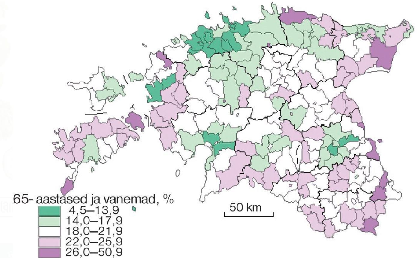
| 16:36, 19 April 2018 | People over 65.JPG (file) |  |
152 KB | Mafaldal (talk | contribs) | 1 | |
| 16:33, 19 April 2018 | TARGET.jpg (file) |  |
751 KB | Shimay (talk | contribs) | 1 | |
| 16:09, 19 April 2018 | Cartografia.jpg (file) |  |
1.13 MB | Pasqualei (talk | contribs) | 1 | |
| 15:58, 19 April 2018 | Powermappeips.jpg (file) |  |
553 KB | Alvars (talk | contribs) | 1 | |
| 15:54, 19 April 2018 | Diagram.jpg (file) |  |
252 KB | Shimay (talk | contribs) | 1 | |
| 15:48, 19 April 2018 | Powermappeipsi.jpg (file) |  |
302 KB | Alvars (talk | contribs) | 1 | |
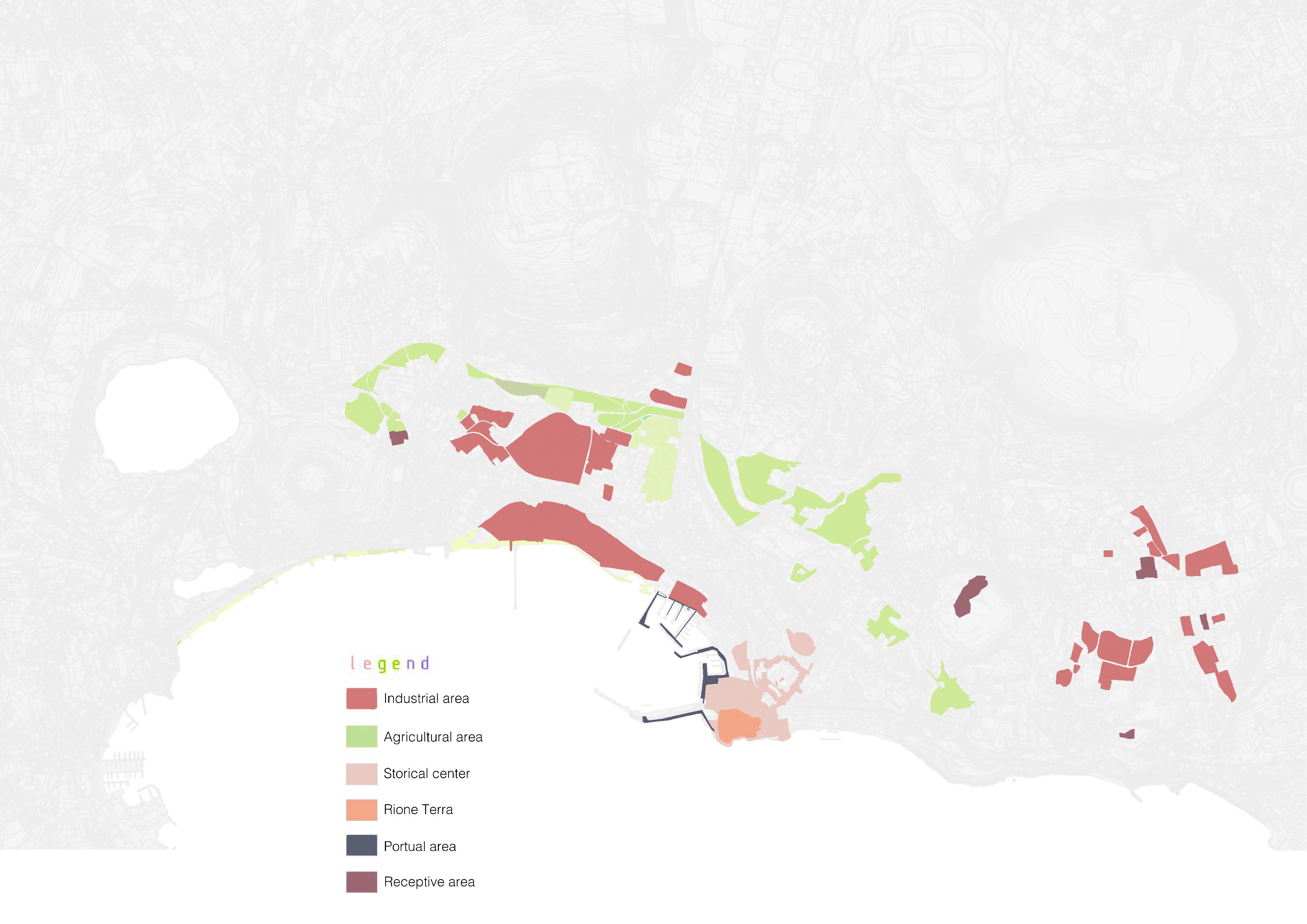
| 15:45, 19 April 2018 | Land use map.PNG (file) |  |
368 KB | Juliettem (talk | contribs) | 1 | |
| 15:13, 19 April 2018 | DPSIR MODEL EFORIE 23AUGUST.jpg (file) |  |
1.9 MB | Anamariamo (talk | contribs) | 1 | |
| 14:59, 19 April 2018 | Veduta frontale di capo Miseno.JPG (file) |  |
718 KB | Sergiog (talk | contribs) | https://upload.wikimedia.org/wikipedia/commons/thumb/6/6d/Veduta_frontale_di_capo_Miseno.JPG/2048px-Veduta_frontale_di_capo_Miseno.JPG | 1 |
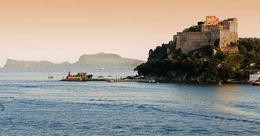
| 14:46, 19 April 2018 | Baiacastle.jpg (file) |  |
59 KB | Sergiog (talk | contribs) | source: https://eventinapoli.com/fuori-porta/castello-aragonese-di-baia | 1 |
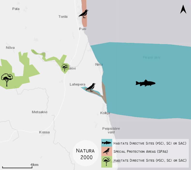
| 14:40, 19 April 2018 | Natura 2000 mapa final2.jpg (file) |  |
74 KB | Mafaldal (talk | contribs) | 1 | |
| 14:39, 19 April 2018 | Green infra map2.jpg (file) |  |
82 KB | Mafaldal (talk | contribs) | 1 | |
| 14:38, 19 April 2018 | Blue infra map2.jpg (file) |  |
85 KB | Mafaldal (talk | contribs) | 1 | |
| 14:38, 19 April 2018 | Blue infra map.jpg (file) |  |
74 KB | Mafaldal (talk | contribs) | Reverted to version as of 11:42, 19 April 2018 (UTC) | 3 |
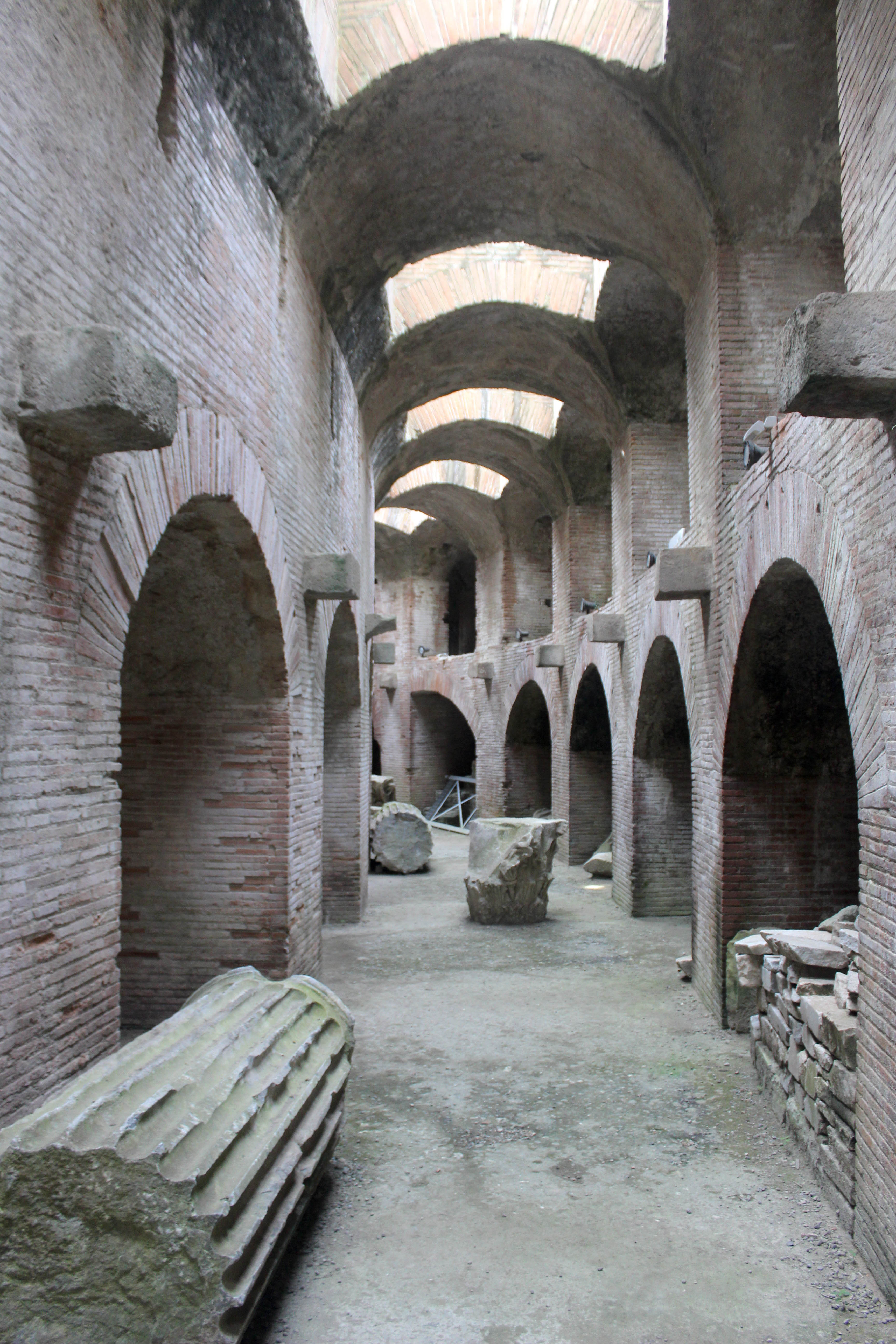
| 14:37, 19 April 2018 | Pozzuoli anfiteatro subterráneos 46.JPG (file) |  |
1.44 MB | Pasqualei (talk | contribs) | 1 | |
| 14:34, 19 April 2018 | Sangennaro.jpg (file) |  |
489 KB | Pasqualei (talk | contribs) | 1 | |
| 14:33, 19 April 2018 | Sanprocolo.jpg (file) |  |
352 KB | Pasqualei (talk | contribs) | 1 | |
| 14:29, 19 April 2018 | Omacellyum.jpg (file) |  |
70 KB | Pasqualei (talk | contribs) | 1 | |
| 14:28, 19 April 2018 | Asolfatar.jpg (file) |  |
36 KB | Pasqualei (talk | contribs) | 1 | |
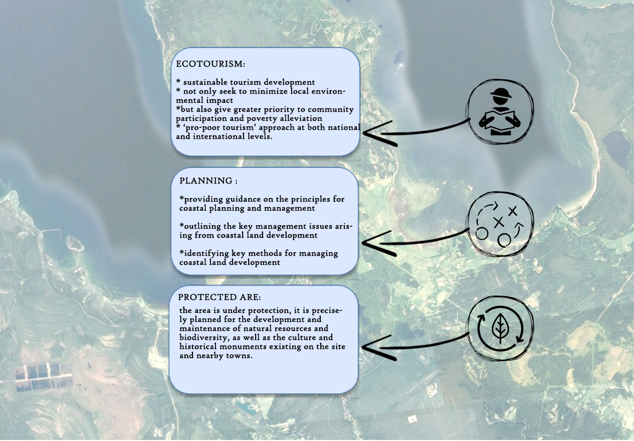
| 14:05, 19 April 2018 | Hypothesis' concept.png (file) |  |
950 KB | Ivanp (talk | contribs) | Author: Ivan Pistone and Luca Scaffidi | 2 |
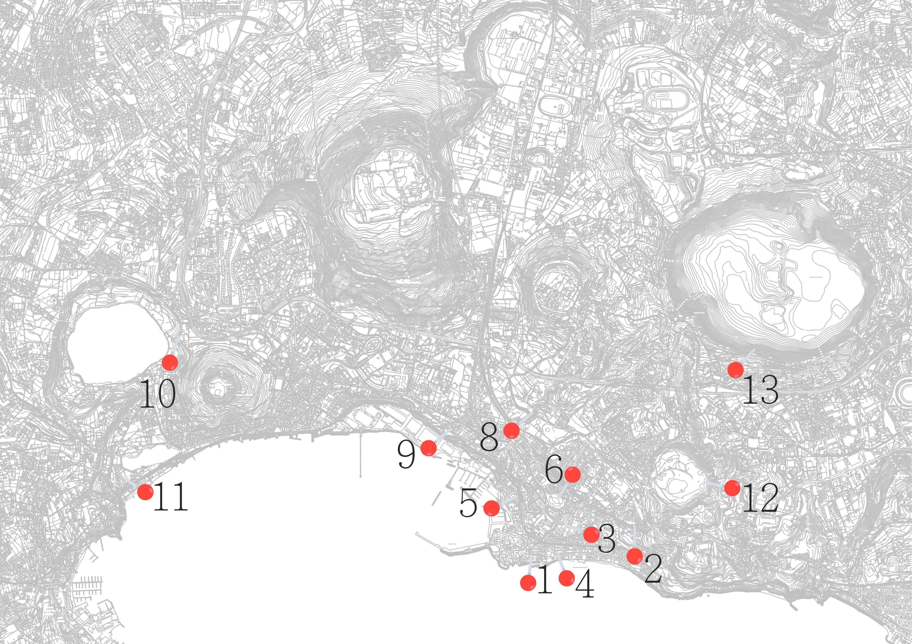
| 13:56, 19 April 2018 | Power Map.jpg (file) |  |
1.17 MB | Rajendrab (talk | contribs) | 1 | |
| 13:50, 19 April 2018 | Land-use map.png (file) |  |
1.51 MB | Ivanp (talk | contribs) | Authors: Ivan Pistone and Luca Scaffidi | 1 |
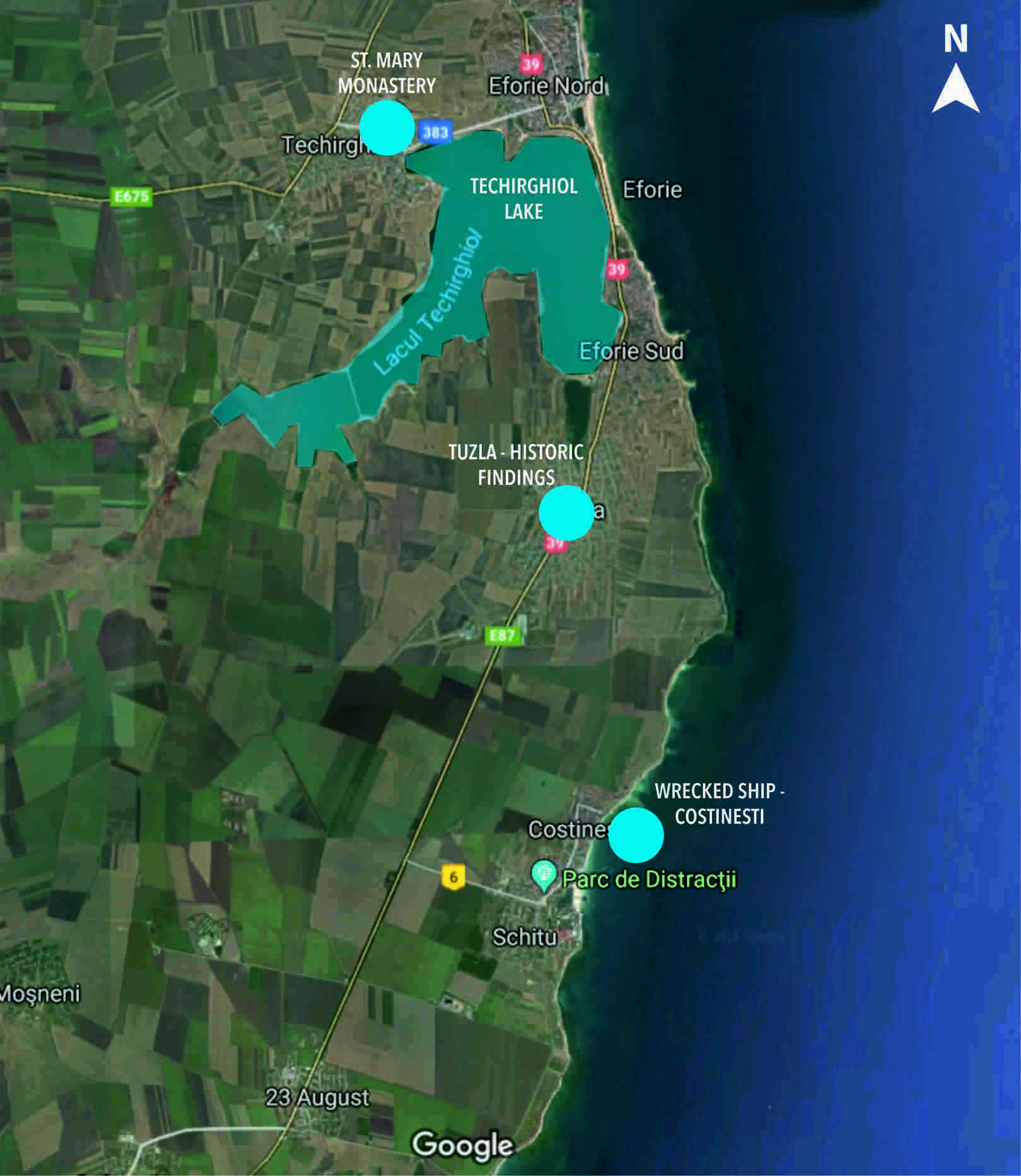
| 13:50, 19 April 2018 | Heritage Map Eforie 23August.jpg (file) |  |
1.9 MB | Anamariamo (talk | contribs) | 1 | |
| 13:45, 19 April 2018 | Usisuolo.jpg (file) |  |
308 KB | Pasqualei (talk | contribs) | 1 | |
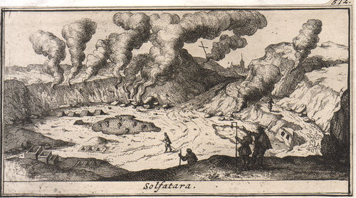
| 13:44, 19 April 2018 | Solfatara-delice-grande m.jpg (file) |  |
55 KB | Pasqualei (talk | contribs) | 1 | |
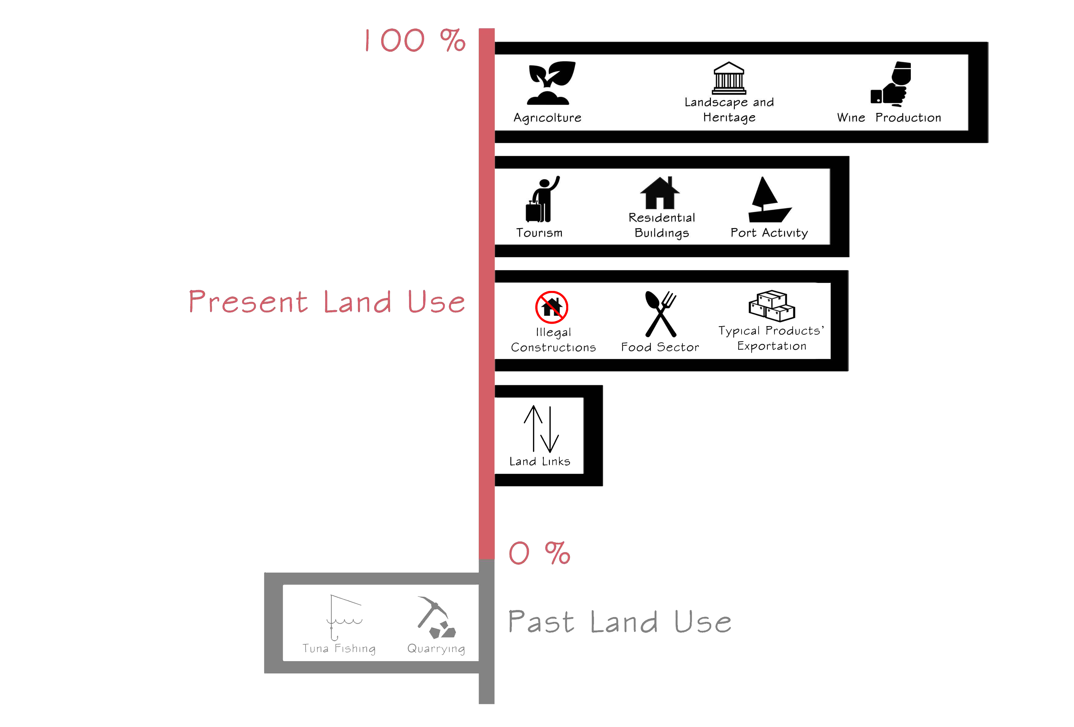
| 13:43, 19 April 2018 | Past and Present Land use diagram.png (file) |  |
468 KB | Ivanp (talk | contribs) | Authors: Ivan Pistone and Luca Scaffidi | 1 |
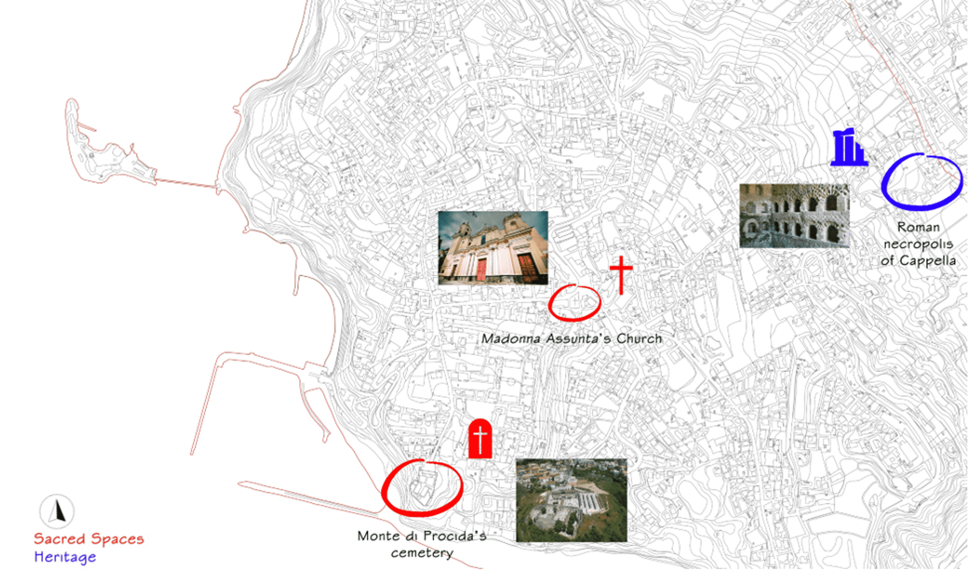
| 13:41, 19 April 2018 | Heritage and sacred spaces .png (file) |  |
1.47 MB | Ivanp (talk | contribs) | Authors: Ivan Pistone, Luca Scaffidi and Silvia Striano | 1 |
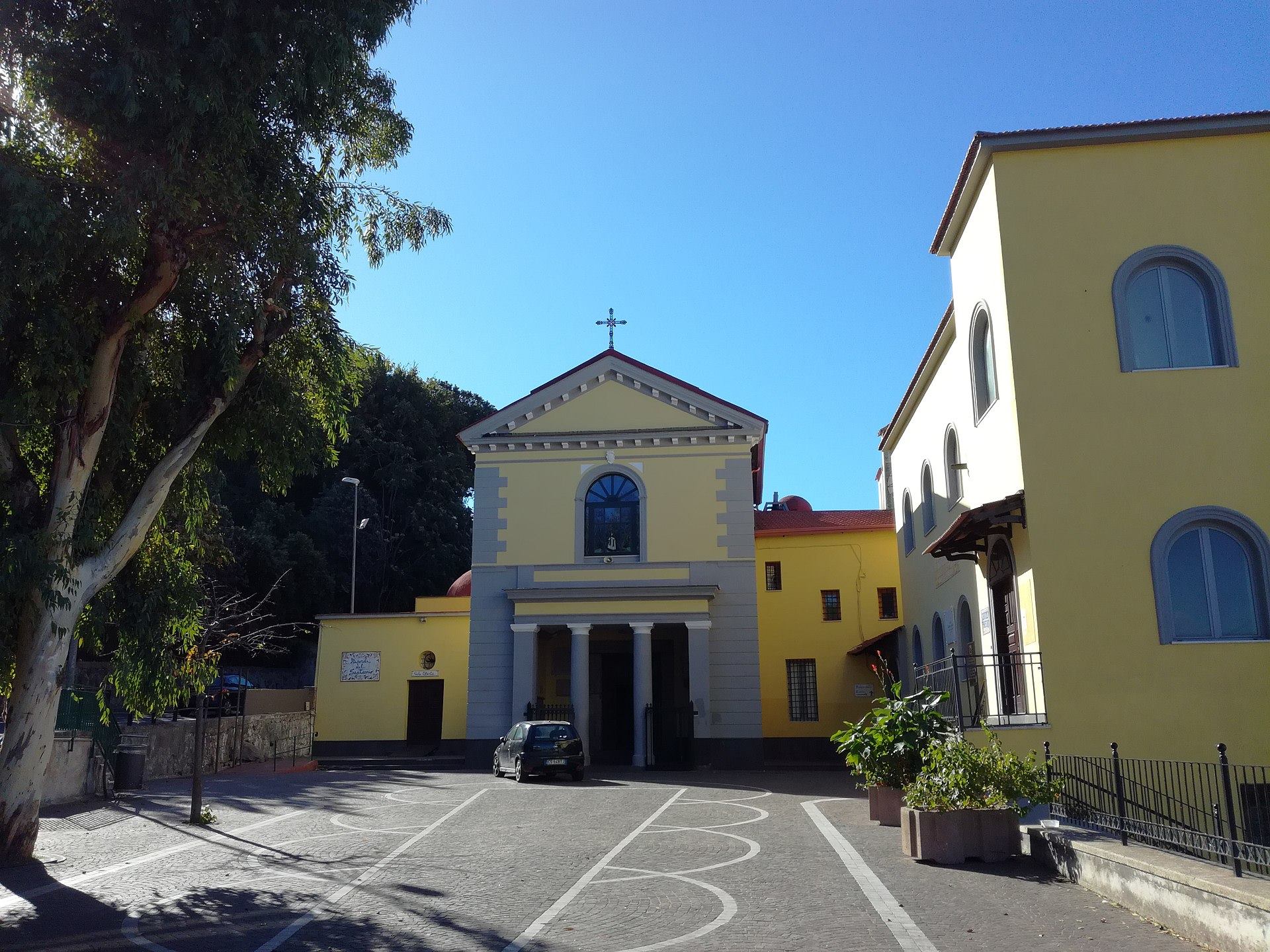
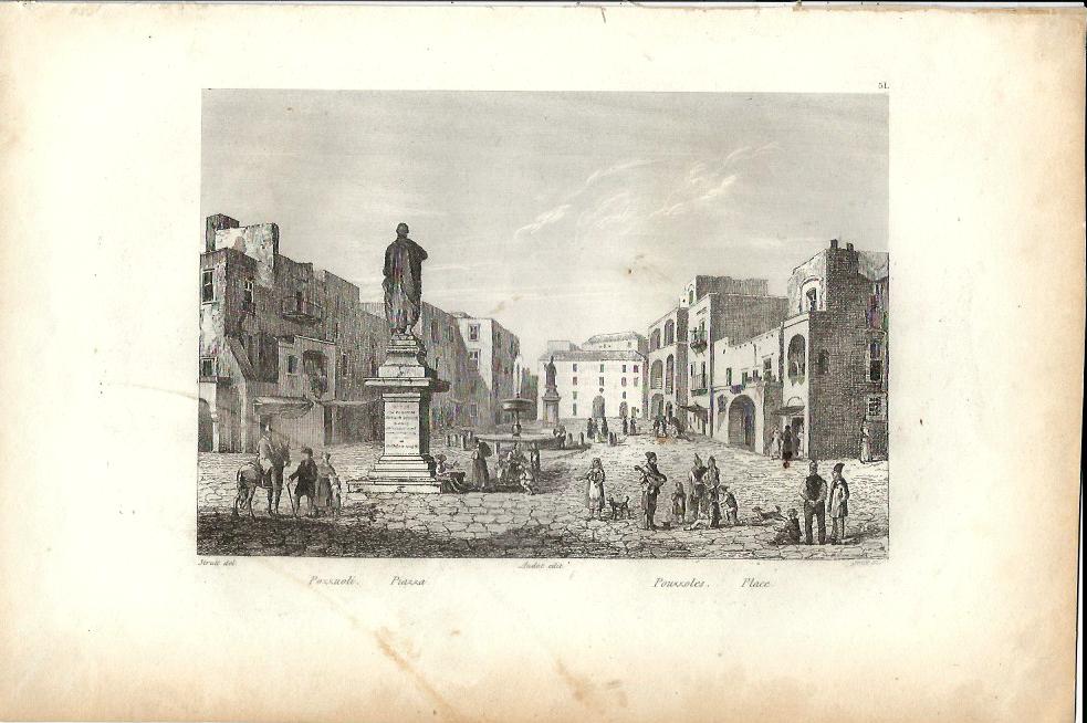
| 13:40, 19 April 2018 | Pozzuoli piazza audotfr.jpg (file) |  |
96 KB | Pasqualei (talk | contribs) | 1 | |
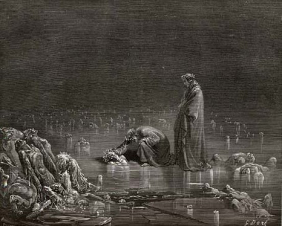
| 13:37, 19 April 2018 | Tampierigustave dore inferno32 4.jpg (file) |  |
67 KB | Pasqualei (talk | contribs) | 1 | |
| 13:33, 19 April 2018 | Goethe, Die Solfatara von Pozzuoli, 1787.jpg (file) |  |
113 KB | Pasqualei (talk | contribs) | 1 | |
| 13:32, 19 April 2018 | Carelli - Il porto di Pozzuoli (41x55).jpg (file) | .jpg) |
36 KB | Pasqualei (talk | contribs) | 1 | |
| 13:23, 19 April 2018 | VIABILITà.jpg (file) |  |
1.8 MB | Pasqualei (talk | contribs) | 1 |