Unused files
Jump to navigation
Jump to search
The following files exist but are not embedded in any page. Please note that other websites may link to a file with a direct URL, and so may still be listed here despite being in active use.
Showing below up to 50 results in range #251 to #300.
-
 Building and road types a.png 4,016 × 2,126; 153 KB
-
 Settlement.png 2,391 × 1,350; 1.48 MB
-
 Map Recreation Activities.jpg 1,393 × 788; 676 KB
-
 Kopli problems wiki.png 829 × 500; 286 KB
-
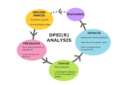 20190502 DPSIR.png 3,508 × 2,480; 307 KB
-
 Beach areas.jpg 3,411 × 2,409; 1.04 MB
-
 Cultural heritage preservation.jpg 3,375 × 2,384; 833 KB
-
 Roads map Professorite küla.jpg 1,140 × 837; 459 KB
-
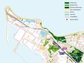
 Green Averno 1-10.000.jpg 6,131 × 8,640; 1.92 MB
-
 Opportunities.png 1,014 × 793; 733 KB
-
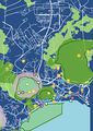
1. Averno Strategy.png 4,360 × 3,040; 1.03 MB
-
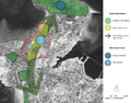
5. Averno Assessment.png 4,360 × 3,040; 1.16 MB
-
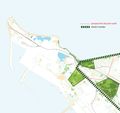
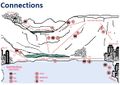
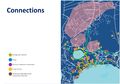 3. Averno Connections.jpg 2,180 × 1,520; 1.46 MB
-
 Connection .jpg 689 × 521; 144 KB
-
 Analyze1 Local life.jpg 2,362 × 1,896; 1.37 MB
-
 Analyze3 biodiversity2.jpg 3,000 × 2,367; 1.42 MB
-
 Map Ecosystem Services.jpg 1,393 × 788; 674 KB
-
 78EDB537-21E2-492A-919F-8749512A5ECC.jpeg 1,536 × 1,020; 461 KB
-
 Timeline-001.jpg 1,754 × 1,240; 150 KB
-
 Tallin Kopli linid Development.jpg 1,754 × 1,240; 150 KB
-
 Accessibilité koplie 1.jpg 2,466 × 1,849; 1.74 MB
-
 Vision kopli.jpg 2,466 × 2,321; 1.45 MB
-
 Cemetery park group - Landscape Evaluation and Assessment Friday, May 3, 2019.jpg 2,049 × 1,500; 984 KB
-
 Visual connections in area.JPG 583 × 413; 52 KB
-
 Accesibility.JPG 960 × 720; 113 KB
-
 Folie8.JPG 960 × 720; 123 KB
-
 Assessment map b.png 4,725 × 2,245; 633 KB
-
 Risk and potential2.jpg 788 × 552; 160 KB
-
 Goal 1.jpg 3,508 × 2,480; 1.56 MB
-
 Goal1.png 1,064 × 1,172; 315 KB
-
 Goal1.jpg 1,125 × 1,221; 940 KB
-
 Goal2.jpg 711 × 839; 781 KB
-
 The vision small.png 1,388 × 978; 650 KB
-
 Planning Strategy.jpg 1,123 × 794; 112 KB
-
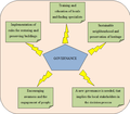
 Governance model 20190527.png 1,914 × 849; 125 KB
-
 TimelinePaljassaare.jpg 2,480 × 1,754; 247 KB
-
 Transect 1 final.jpg 2,086 × 930; 156 KB
-
 Transect n2 v2.jpg 1,370 × 673; 109 KB
-
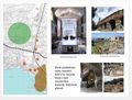
 Sketch interventions Lia Chowdhury.jpg 4,961 × 3,508; 1.13 MB
-
 Goal setting.jpg 2,899 × 2,480; 1.02 MB
-
 Image transect.jpg 3,508 × 2,481; 601 KB
-
 Governance Kopli.png 605 × 530; 20 KB
-
 Bray Dunes afv.jpg 220 × 147; 13 KB
-
 Beach in De Panne-2.jpg 2,048 × 1,536; 538 KB
-
 Reiu image case study template.jpg 3,300 × 2,550; 320 KB
-
 Powermap of western Dunkirk.JPG 624 × 416; 34 KB
-
 Powermap3.JPG 623 × 414; 32 KB
-
 DPSI(R) model.JPG 4,800 × 4,705; 1.06 MB
-
 Ecologie-solutions-825x510-740x370.jpg 740 × 370; 47 KB
-
 Futur-Grand-Site-de-France vignette 680x512.jpg 680 × 512; 193 KB


_model.JPG)

