Unused files
Jump to navigation
Jump to search
The following files exist but are not embedded in any page. Please note that other web sites may link to a file with a direct URL, and so may still be listed here despite being in active use.
Showing below up to 50 results in range #301 to #350.
- Table of distribution of the patrimony according to the centuries.jpg 2,967 × 949; 302 KB
- Geographical distribution of wealth.png 3,278 × 1,660; 637 KB
- Belfry of Gravelines.jpg 187 × 280; 9 KB
- Lighthouse Petit-Fort-Philippe.JPG 3,456 × 5,184; 624 KB
- Fort Vauban of Gravelines.JPG 5,184 × 3,456; 1.26 MB
- Middelkerkemmm.jpg 4,800 × 2,735; 724 KB
- Reiu Raeküla Monument 2.png 420 × 567; 627 KB
- Raeküla Reiu LANDSCAPEANALYSE SUMMERY & TARGETS.jpg 4,958 × 3,508; 1.6 MB
- Raeküla ReiuCOASTAL DYNAMICS.jpg 1,260 × 897; 238 KB
- Reiu Raeküla SUMMARY OF LANDSCAPE SYSTEM ANALYSIS.jpg 4,958 × 3,508; 1.6 MB
- Reiu Raeküla Landuse Map.JPG 697 × 888; 195 KB
- Green-blue map.jpeg 880 × 688; 122 KB
- Beaufort de panne jos de gruyter harald thys-4.jpg 771 × 370; 162 KB
- Landuse01 team7.jpg 2,048 × 1,702; 396 KB
- Error creating thumbnail: File with dimensions greater than 12.5 MPPoza 1.png 9,984 × 4,376; 1.1 MB
- Error creating thumbnail: File with dimensions greater than 12.5 MPPoza 1.1.png 6,882 × 2,498; 660 KB
- Church of sint antonious.jpeg 331 × 302; 21 KB
- Church of sint antonius.jpeg 331 × 302; 21 KB
- Blankenberge's Pier.jpeg 550 × 334; 38 KB
- Manifesto2.jpg 3,508 × 2,480; 1.46 MB
- Land today.jpg 1,463 × 835; 325 KB
- Land 60 1.jpg 1,463 × 835; 197 KB
- 3197005744 f8475cbda5 z.jpg 640 × 361; 39 KB
- Sustainable Development Goals-.png 1,650 × 1,275; 268 KB
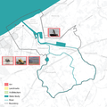
- Nieuwpoort Art.png 2,340 × 2,340; 999 KB
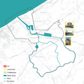
- Nieuwpoort Landmarks.png 2,340 × 2,340; 957 KB
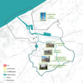
- Nieuwpoort Architecture.png 2,340 × 2,340; 1.46 MB
- Nieuwpoort Impacts.png 2,460 × 1,792; 113 KB
- Blue Infrastructure Zeeburgee.jpg 2,752 × 2,481; 1.32 MB
- Green Infrastructure Zeeburgge.jpg 1,500 × 1,061; 1.43 MB
- Sustainable development goals at risk.png 1,000 × 485; 84 KB
- Power map Brugge.JPG 1,348 × 835; 80 KB
- Middelkerke road and transportation.jpg 6,622 × 4,677; 1.48 MB
- Problems potentials identified.png 1,016 × 764; 250 KB
- Middelkerke transportation and connection mapping.jpg 6,622 × 4,677; 1.5 MB
- Middelkerke green infrastructure mapping.jpg 6,622 × 4,677; 1.06 MB
- Middelkerke risk and potential.jpg 6,622 × 4,677; 1.09 MB
- Middelkerke green infrastructure mapping 2.jpg 6,622 × 4,677; 1.08 MB
- DePanne value map v.jpg 1,653 × 1,171; 1.93 MB
- SWOT method to indetify the potentials and risks.png 790 × 428; 45 KB
- Accessibilità leg.jpg 976 × 772; 600 KB
- Middelkerke risk and potential (2).jpg 6,622 × 4,677; 1.19 MB
- Services users and activities.jpg 545 × 893; 73 KB
- Values.jpg 547 × 933; 105 KB
- Reiu-Raeküla-Values.jpg 547 × 933; 105 KB
- Connectivity Map Bus route.jpg 1,170 × 1,170; 440 KB
- Middelkerke location and connection mapping.jpg 6,622 × 4,677; 1.29 MB
- Middelkerke transportation and connection mapping-min.jpg 6,622 × 4,677; 1.41 MB
- Middelkerke location and connection mapping-min.jpg 6,622 × 4,677; 362 KB
- Middelkerke green infrastructure mapping 3-min.jpg 6,622 × 4,677; 1.23 MB


