Unused files
Jump to navigation
Jump to search
The following files exist but are not embedded in any page. Please note that other websites may link to a file with a direct URL, and so may still be listed here despite being in active use.
Showing below up to 50 results in range #51 to #100.
-
 58611573.jpg 1,024 × 682; 190 KB
-
 Stabilimento di pozzuoli.jpg 800 × 586; 131 KB
-
 Oldmarine.jpg 1,600 × 964; 579 KB
-
 Armstrongfabrik.jpg 979 × 593; 181 KB
-
 Tampierigustave dore inferno32 4.jpg 552 × 443; 67 KB
-
 Solfatara-delice-grande m.jpg 500 × 278; 55 KB
-
 Blue infra map.jpg 790 × 706; 74 KB
-
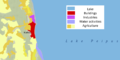 Land use map.PNG 1,938 × 975; 368 KB
-
 Powermappeipsi.jpg 1,079 × 1,417; 302 KB
-
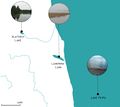
 Future Antrim Area.jpg 1,165 × 700; 219 KB
-
 Power Map Giant's Causeway.jpg 5,847 × 4,133; 1.14 MB
-
 Giant's Causeway Power Map.jpg 5,847 × 4,133; 1.14 MB
-
Giant's Causeway Power Map Version.png 5,847 × 4,133; 1.11 MB
-
 DPSI(R).jpg 960 × 544; 86 KB
-
 Dev3-min.jpg 7,263 × 6,820; 423 KB
-
 Dev4-min.jpg 7,775 × 6,852; 509 KB
-
 Dev.jpg 7,263 × 6,820; 423 KB
-
 Montaza 2.jpg 564 × 412; 32 KB
-
 Dev4-min (1).jpg 7,775 × 6,852; 509 KB
-
 Aqaba3.jpg 7,263 × 6,820; 423 KB
-
 DPSIR method .jpg 960 × 720; 164 KB
-
 CO-LAND Group Presentation 1 - Landscape System Analysis.pptx.jpg 960 × 720; 59 KB
-
 Landscape system analysis Fardokht and Yasaman.jpeg 960 × 720; 84 KB
-
 1Forests & water bodies in the Limanu - Shabla area .jpg 1,289 × 1,652; 1.96 MB
-
 Land use Fardokht and Yasaman.jpg 960 × 720; 133 KB
-
 Rationale Fardokht and Yasaman.jpg 960 × 720; 91 KB
-
 Soils.jpg 3,508 × 2,379; 1.64 MB
-
 Green infrastructure test.jpg 2,326 × 1,583; 561 KB
-
 Mati-Kose luitemaa-Copyright-protected-image.JPG 1,020 × 684; 90 KB
-
 Sontra penisula.jpg 1,800 × 1,200; 1.09 MB
-
 Pag-novalja.jpg 800 × 534; 104 KB
-
 Algarve Hypotisis.jpg 666 × 593; 654 KB
-
 Giant's Causeway Visitor Centre.jpg 1,280 × 802; 97 KB
-
 Sacred Spaces.jpg 1,165 × 700; 159 KB
-
 Case study1.jpg 960 × 540; 68 KB
-
 Case study3.JPG 960 × 720; 133 KB
-
 Case study30.JPG 960 × 720; 138 KB
-
 Natural and Anthropic Elements Mapping.jpg 3,508 × 2,480; 981 KB
-
 Ecosystem services.jpg 3,511 × 2,047; 607 KB
-
 Monte di Procida Ecosystem services.jpg 3,511 × 2,047; 607 KB
-
 Risk values.jpg 1,280 × 720; 104 KB
-
 1995 urban sprawl.png 1,522 × 829; 605 KB
-
 2002 urban sprawl.png 1,522 × 829; 617 KB
-
 2018 urban sprawl.png 1,522 × 829; 959 KB
-
 Problems Potentials.jpg 3,508 × 2,479; 753 KB
-
 Threats gb.jpg 2,792 × 2,747; 1.42 MB
-
 Goals Group06.png 3,420 × 2,430; 487 KB
-
 2008historial map.jpg 2,079 × 2,953; 1.04 MB
-
 Wreckship"s.jpg 300 × 469; 84 KB
-
 Kallaste character map.jpg 1,768 × 1,403; 842 KB


.jpg)


.jpg)


