File:Land use 2017.JPG
No higher resolution available.
Land_use_2017.JPG (634 × 558 pixels, file size: 108 KB, MIME type: image/jpeg)
Summary
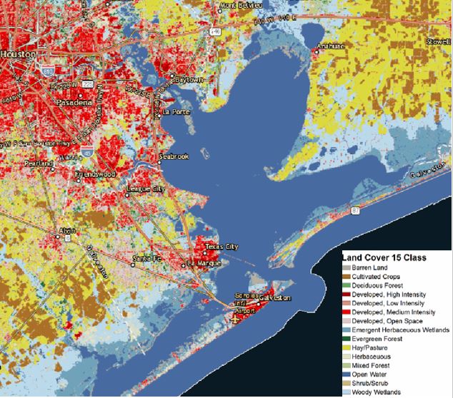
Land use: H-GAC’s interactive map Acquired from: h-gac.com/community/socioeconomic/land-use-data/default.aspx
Licensing
File history
Click on a date/time to view the file as it appeared at that time.
| Date/Time | Thumbnail | Dimensions | User | Comment | |
|---|---|---|---|---|---|
| current | 21:59, 18 April 2018 | | 634 × 558 (108 KB) | Maggiew (talk | contribs) | Land use: H-GAC’s interactive map Acquired from: h-gac.com/community/socioeconomic/land-use-data/default.aspx |
You cannot overwrite this file.
File usage
The following page uses this file: