South of Pärnu
>>>back to working groups overview
| Area | South from Pärnu to the borders with Latvia | |
| Place | Pärnumaa, Pärnu lahe hoiuala | |
| Country | Estonia | |
| Topics | Baltic sea, Rail Baltic, recreation area, border area | |
| Author(s) | Marie, Kristel, Eelar, Liisi | |
| ||
Rationale
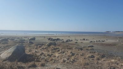
Estonian coast of the Baltic sea, south from Pärnu to the borders with Latvia, is an area shaped by many different factors and offering many possibilities, issues and topics. Water plays and important role here, not only in the form of sea but also bogs or floods. Other main topics may be Rail Baltic and the major influence of tourism and its seasonality.
Location and scope
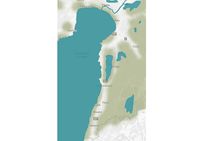
You can edit this map with the map editor
A Landscape System Analysis
A.1 Landscape layers and their system context
Geomorphology, landscape units and coastal typology
- Description of evolution, status quo and driving forces, is the coastal typology changing? Why is that? (approx 200 signs)
- add 1-2 graphical representations to the image gallery, you can add more if you like
- Yourcase landscapeunits1.jpg
add a caption
- Yourcase landscapeunits2.jpg
add a caption
Land use
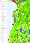
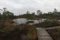
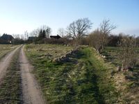
Most of the area especially in the south is covered by forest or agro-forestry land. Agricultural land is spread out around Uulu and in a stripe parallel with the coast in the south. An Important part of this area is peat bogs and inland marshes located between Võiste and Häädemeeste and north of Pärnu. The direct coast is mostly intertidal flats, grasslands or forests. There is no important resources extraction or energetics activity going on. But the national plan gives space for potential wind farm construction on the sea, south from Kihnu island. The population of this area is decreasing and with it the active (agricultural and industrial) use and maintenance of the land. The major potential factors that could change the land use is spreading tourism from Pärnu to other parts of the coast, increasing work opportunities, the construction of Rail Baltic. Settlements: Settlements in the area are: Pärnu, Reiu, Uulu, Laadi, Tahkuranna, Võiste, Leina, Soometsa, Piirumi, Rannametsa, Papisilla, Häädemeeste, Arumetsa, Jaagupi, Kabli, Majaka, Orajõe, Treimani, Metsapoole, Ikla The most important settlements are Pärnu (third biggest city in Estonia, Summer capital and a popular tourist/recreation area), Uulu (crossroad of main important communications, growing industry and possible job opportunities) and Häädemeeste (bigger settlement, located in the centre of the studied area with near proximity to the bog lands) Road E67 runs parallel to the coast from Latvia to Pärnu. The west side of this road is generally more inhabited and used for agriculture, the east side is more forest and natural areas (LKA, hoiuala) Infrastructure: Road 331 directly on the coast, road E67 approximately 2-3 km from the coast. Both parallel. The Connection of road 6 from central Estonia in the northern part (Uulu). No Rail so far but planned Rail Baltic (both potential positive factor and a source of distraction and interruption of the area). Natural areas: Pärnu MKA, Vaskjõe LKA, Valgeraba hoiuala, Uulu-Võiste hoiuala, Siiraku LKA, Luitemaa LKA, Luitemaa hoiuala, Tolkuse LKA, Neptemurru hoiuala, Nigula LKA, Laulaste LKA, Kiusumetsa hoiuala, Massiaru hoiuala Natura2000 areas: Quite a big part of the area is rated as Habitats Directive Sites (pSCI, SCI or SAC) or Birds Directive Sites (SPA) or both by Natura2000. These parts are mostly around boglands in the northern part of the analysed area and forests in the southeast of the area. Also a big part of the Pärnu Gulf - The Pärnu Bay Conservation Area - is rated as Birds Directive Sites (SPA)
Green/blue infrastructure
Mainly there are two major green/blue structure elements, first the river of pärnu and the greenbelt around it not to mention the numerous streams coming into the bay. The second dominant element is the forest covering the land. Concerning different variables the Rail Baltic may be considered the biggest impact to those, otherwise, influence with that significance couldn’t drive the changes to that extent where it’s affecting the coastal area. As long as there are people around taking care of the neighborhood, things will be fine because individuals who could transform the area eventually have to live at that place.
- Your case green blue infrastructure3.jpg
add a caption
Actors and stakeholders
The changes are driven mostly by the local people whose actions, whether concerning to the taking care of the pasturelands or managing the forest or developing the tourism in the area, are relevant. Additionally, there aren’t any major stakeholders who could by owning the vast pieces of land significantly alter it. Lots of locals do have activities associated with tourism which tend to be seasonal. It affects everyone starting from locals down to the tourist as well. Usually, people from outside could have a high power position and at the same time not being affected. It includes the companies on both private and the state level whose interests lie with the current site but when it comes to money there’s inevitably a risk of withdrawal of resources(benefits). For example, the Rail Baltic has only one stop planned in the city of Pärnu and rest of the area where it passes by doesn’t have any benefits whatsoever for locals. It’s just that thing there.
- Your case your powermap.jpg
add a caption
Sacred spaces and heritage
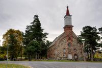
Along the coastal area, there are several national heritage objects situated mostly between the shoreline and road E67 (Via Baltica). Majority of national heritage objects are churches and cemeteries, but we can find also the memorial pillar of Konstantin Päts, one of the founders of Estonian Republic and former captains house in Kabli. In the coastal zone, there are lots of unofficial (not under protection) heritage objects mapped by State Forest Management Centre. These heritage objects like old buildings, old harbours, trees, place names, etc., are part of our national identity, the traces of life and activities of ancestors on the landscape. Pärnu county plan has marked the whole coastal zone from the Pärnu city to the Estonian-Latvian border as a valuable landscape, what is the bearer of the region's cultural-historical identity – traditional land use and settlement, sand beaches, beautiful road views and picturesque places. They hold cultural value at first for the locals as they are characteristic of the area.
Visual appearance and landscape narrative
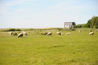
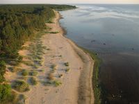
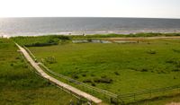
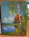
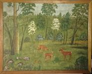
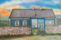
Essential landscape characters of the case study area are sandy beaches, pine woods, old settlement structure and open views along the coast. There are several hobby artists who have painted views of case study area in the Häädemeeste municipality. Dora-Alviine Kesper has painted many sailboats built in Kabli, also her ancestor`s captain house (under national protection) in Kabli. She has also written about the life in Kabli. The surrounding of their home has also been depicted by Johannes Müller and Valter Soomre in their paintings. Mati Kose, a local ornithologist and nature protector, has photographed coast and the nature of the case study area. There are many novels, novellas, and poems that describe the places in our case study area. Imre Kaas`s novel “Minu esimesed liblikad” (My First Butterflies) is based on real life and talks about writers childhood in Kabli, the late 1990s. In Elss Järvi kids book “Lapsepõlvelood” (Childhood stories) has mentioned Kabli and Orajõe. Poems are mostly inspired by the sea, written by for example Tiit Merenäkk who`s summer cottage was in Kabli, Manivald Kesamaa “Töökas mees on kõigist ees” (A Hard-working Man is in Front of Everyone), Uno Laht “Tahkuranna idüll” (Idyll of Tahkuranna).
A.2 Summary of you landscape system analysis and your development Targets
The area is geographically and economically separated. It should be connected more in itself as well as with its surrounding. This can be managed by using the potential of natural areas and coast to increase the tourism, restoring the traditional ways of maintaining the landscape (grassland management) and developing job opportunities. This should be implemented with the consideration of local culture and traditions so that they are preserved and become the representative symbol of the area. The amount of initiative of local people proves the need for action and change in the area. In former Häädemeeste parish had 60 non-profit organisations listed in the year 2016, about a third of them were apartment associations. Most of these organisations were of of local importance nevertheless showing care and interest in the environment and local communities (e.g. cultural and sports activities, village communities, non-profit boat harbour, Häädemeeste beach area development, coastal meadows maintenance organisation) When considering the Sustainable Developement Goals we could say that these might be slightly at risk or at least a little bit forgotten: 1.No poverty, 3. Good health and well being, 4. Quality education, 8. Decent work and economic growth (very much at risk), 9. Industry innovation and infrastructure.
- You can summarize your findings with an DPSI(R) Model or a Spider Diagram
- Link back to the Sustainable Development Goals: Which goals are at risk?
- What is your hypothesis for this landscape?
- Visualise your hypothesis with one graphic/pict
- Are there any existing initiatives taking action in this landscape? Do you have a critical perspective on that?
- Add text and visuals
- Your case your spider diagram or dpsir model.jpg
explain your analysis briefly in the caption
- Your case your hypothesis visual.jpg
explain your hypthesis briefly in the caption
A.3 Theory reflection
- Reflect on at least three international policy documents in relation to their local landscape case
- choose one international, one European and one national document
- You can choose references from our reading list
- Scope: 250 words
A.4 References
- give a full list of the references you have used for this section
Phase B: Landscape Evaluation and Assessment
B.1 Assessment Strategy
- Based on the hypothesis derived from your previous landscape systems analysis you are now asked to define the goals for assessing the landscape. Your assessment is the basis for evaluating the landscape status.
- Which elements and phenomena need to be mapped, why and how?
- This a text contribution, max 250 words
B.2 Mapping
- As defined by your assessment strategy you conduct the mapping and present your findings here
- As a minimum, at least three different themes need to be mapped, you may choose more if needed
- Your case your assessment mapping themel.jpg
briefly explain the findings of your mapping
- Your case your assessment mapping theme2.jpg
briefly explain the findings of your mapping
- Your case your assessment mapping theme3.jpg
briefly explain the findings of your mapping
B.3 Problem definition and priority setting
- Give a summary of the major findings of your mapping process, what are the problems/potentials identified?
- Draw a problems/potentials map
- Set priorities for the most relevant issues
- Your case problems potentials map.jpg
add caption here
B.4 Theory reflection
- Please reflect the assessment and evaluation methods used based on at least three readings
- Did you encounter limitations'
- 200 words test contribution
B.5 References
- give a full list of the references you have used for this section
Phase C – Strategy and Master Plan
C.1 Goal Setting
- Define strategic planning objectives based on the evaluation findings
- Link back to your original targets from section one and the Development Goals
- 150 words text contribution
C.2 Spatial Strategy and Transect
- translate your strategic goals into a vision
- develop a spatial translation of your vision
- exemplify your vision in the form of a transect with concrete interventions
- add map(s) and visualizations
- Your case spatial translaton vision.jpg
add caption here
- Your case transect.jpg
add caption here
- Your case transect detail1.jpg
add caption here
- Your case transect detail2.jpg
add caption here
C.3 From Theory of Change to Implementation
- For implementing your vision: Which partnerships are needed? Which governance model is required?
- Who needs to act and how? Draw and explain a change/process model/timeline
- Which resources are needed? On which assets can you build?
- add 150 words text and visuals
- Your case spatial your governance model.jpg
add caption here
- Your case spatial your process model.jpg
add caption here
C.4 References
- give a full list of the references you have used for this section
D. Process Reflection
- Reflect in your intercultural and interdisciplinary team on the outcomes of your study
- Which limitations were you facing?
- What have you learnt from each other?
- What would you do differently next time?
- You can also use diagrams/visuals
- 250 words text
