File:Mobility and connection mapping of Baia city case study.jpg
Original file (2,099 × 1,486 pixels, file size: 1,021 KB, MIME type: image/jpeg)
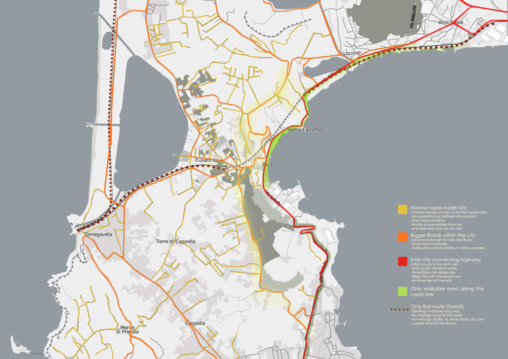
This map illustrates the Existing transportation route and mobility analysis. The yellow lines demonstrate the 'Narrow roads inside a city' and they mainly provide access to the households, -No pedestrians or defined bicycle path, have poor road condition, hardly accommodates two cars, one bike and one car can do). The orange route shows-"Bigger Roads within the city"(They are spacious enough for cars and Buses, but some of them lack footpaths, have adequate surface parking in various pauses) The Redline to show the route of 'Inter-city connecting highway'(It Has access fo Bus and cars, main public transport route, adequate pedestrians, direct link with the beach are, exciting view of the sea) The only walkable area along the coastline is adjacent to this highway marked with a light green patch. The dark brown dotted line illustrates 'Only Rail route' or Transit. It has exciting underpass for a long way, no stoppage close to the coast, not enough facility to serve inside the city and coastal zone for the tourist)
File history
Click on a date/time to view the file as it appeared at that time.
| Date/Time | Thumbnail | Dimensions | User | Comment | |
|---|---|---|---|---|---|
| current | 09:36, 3 May 2019 | | 2,099 × 1,486 (1,021 KB) | Amrita.ali (talk | contribs) | This map illustrates the Existing transportation route and mobility analysis. The yellow lines demonstrate the 'Narrow roads inside a city' and they mainly provide access to the households, -No pedestrians or defined bicycle path, have poor road condit... |
You cannot overwrite this file.
File usage
The following page uses this file: