Uploads by Jannes
Jump to navigation
Jump to search
This special page shows all uploaded files.
| Date | Name | Thumbnail | Size | Description | Versions |
|---|---|---|---|---|---|
| 09:16, 15 June 2018 | Urban accupuncture designs.jpg (file) | 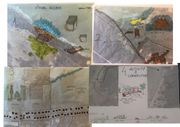 |
1.07 MB | 1 | |
| 08:38, 15 June 2018 | Powermap new.jpg (file) | 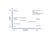 |
251 KB | 1 | |
| 08:02, 15 June 2018 | Transect location.png (file) |  |
1.98 MB | 1 | |
| 07:59, 15 June 2018 | C3 model last.png (file) | 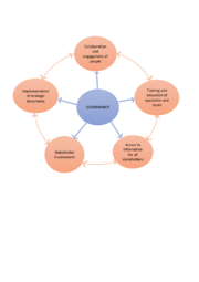 |
286 KB | 1 | |
| 07:57, 15 June 2018 | Model of ideal spatial planning and stakeholders.jpg (file) | 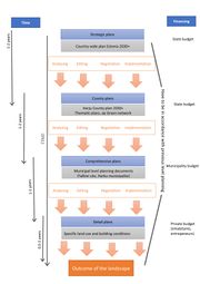 |
738 KB | 1 | |
| 06:26, 15 June 2018 | Transect tiskre grassland.jpg (file) | 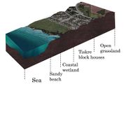 |
128 KB | 1 | |
| 06:25, 15 June 2018 | Transect tabasalu.jpg (file) | 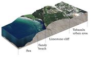 |
120 KB | 1 | |
| 06:24, 15 June 2018 | Transect tiskre houses.jpg (file) | 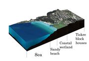 |
88 KB | 1 | |
| 19:59, 14 June 2018 | Kakumäe area goal tree.jpg (file) | 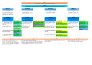 |
1.31 MB | 1 | |
| 19:53, 14 June 2018 | Kakumäe 1-25000 urbanisation VISION.png (file) |  |
662 KB | 1 | |
| 10:51, 14 June 2018 | C3 model 2.png (file) | 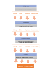 |
154 KB | 1 | |
| 10:50, 14 June 2018 | C3 model 1.png (file) | 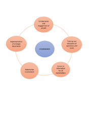 |
239 KB | 1 | |
| 12:30, 18 May 2018 | Urban sprawl 2018 situation.png (file) |  |
967 KB | 1 | |
| 19:31, 17 May 2018 | Urban sprawl 2018 new.png (file) |  |
965 KB | 1 | |
| 16:33, 17 May 2018 | Landscape character assesment areas.png (file) |  |
636 KB | 1 | |
| 16:32, 17 May 2018 | Accessibility to the sea and coast area.jpg (file) |  |
820 KB | 1 | |
| 16:25, 17 May 2018 | Urban sprawl 2018.png (file) |  |
957 KB | 1 | |
| 16:24, 17 May 2018 | Urban sprawl 2002.png (file) |  |
623 KB | 1 | |
| 16:23, 17 May 2018 | Urban sprawl 1995.png (file) |  |
629 KB | 1 | |
| 16:21, 17 May 2018 | Table Problems Potentials.png (file) |  |
241 KB | 1 | |
| 20:30, 16 May 2018 | Problems Potentials.jpg (file) | 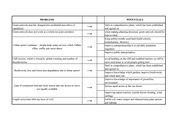 |
753 KB | 1 | |
| 18:19, 16 May 2018 | 2018 urban sprawl.png (file) |  |
959 KB | 1 | |
| 18:18, 16 May 2018 | 2002 urban sprawl.png (file) |  |
617 KB | 1 | |
| 18:17, 16 May 2018 | 1995 urban sprawl.png (file) |  |
605 KB | 1 | |
| 07:10, 20 April 2018 | Street in Kakumäe.png (file) | 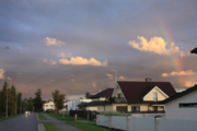 |
690 KB | Street in Kakumäe. 16 September 2009. Photo by Jaanus Silla. [https://en.wikipedia.org/wiki/Kakum%C3%A4e#/media/File:Kakum%C3%A4e_Tallinn_Estonia.jpg] | 1 |
| 07:06, 20 April 2018 | Kakumäe peninsula seen from Tabasalu cliff.png (file) | 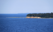 |
841 KB | Kakumäe peninsula seen from Tabasalu cliff. 2 August 2010. Photo by Ingvar Pärnamäe. [https://en.wikipedia.org/wiki/Kakum%C3%A4e#/media/File:Kakum%C3%A4e_poolsaar.JPG]. | 1 |
| 07:03, 20 April 2018 | Kakumäe beach in the end of summer, Tallinn.png (file) | 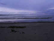 |
168 KB | Tiskre: Flat sandy foreshore. 23. august 2011. Photo by Piret Kuub. [https://et.wikipedia.org/wiki/Kakum%C3%A4e_(Tallinn)#/media/File:Kakum%C3%A4e_rand.JPG] | 1 |
| 06:57, 20 April 2018 | Land use in 2012.png (file) |  |
144 KB | Land use in 2012. CORINE land cover map [https://land.copernicus.eu/pan-european/corine-land-cover] | 1 |
| 06:52, 20 April 2018 | Land use in 1990.png (file) |  |
157 KB | Land use in 1990. CORINE land cover map [https://land.copernicus.eu/pan-european/corine-land-cover] | 1 |
| 11:28, 19 April 2018 | 1024px-Kakumäe liivakivipank Tallinnas.JPG (file) | 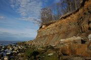 |
176 KB | 1 | |
| 08:21, 19 April 2018 | Cliff edge of Kakumäe peninsula.png (file) | 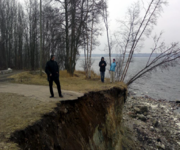 |
1.1 MB | Less than 10 m left until the edge of the 9-meter-high cliff reaches to Kakumäe Peninsula, Tallinn. Reference: Impact of climate change on Estonian coastal and inland wetlands-a summary with new results, http://www.borenv.net/BER/pdfs/ber12/ber12-653.... | 1 |
| 08:18, 19 April 2018 | Erosion of the Kakumae Cliff in Tallinn City .png (file) |  |
826 KB | The erosion of the Kakumae Cliff in Tallinn City area. The boulder located at the shoreline in 1998 (left). Nowadays the shoreline is retreated about 8 m from the boulder (right). Photos: Tonis Saadre, Sten Suuroja. Reference: The Gulf of Finland asses... | 1 |
| 07:31, 19 April 2018 | DPSI(R) MODEL.jpg (file) | 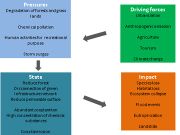 |
27 KB | DPSI(R) model showing driving forces, pressures, state of situation and impact. | 1 |
| 07:26, 19 April 2018 | Powermap of Kakumäe area showing actors and stakeholders.jpg (file) |  |
553 KB | 1 | |
| 19:49, 18 April 2018 | Hypothesis visual. Changes from 1995 to 2018.png (file) |  |
1.76 MB | 1 | |
| 09:13, 18 April 2018 | EugenDycker1866 Tiskre.png (file) | 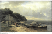 |
738 KB | Painting by Eugen Gustav Dücker. Reference: A. Eilart, A. Kokk. 2012. Pintsliga tõmmatud Eesti. Lk 247. | 1 |
| 12:02, 17 April 2018 | Green structure skeem influences and results.jpg (file) | 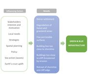 |
605 KB | Factors influencing the green structure network and results that occure. | 2 |
| 11:36, 17 April 2018 | Cotoneaster niger P13.jpg (file) | 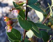 |
83 KB | Dark-seed Cotoneaster (Cotoneaster niger) is under III protection category in Estonia. It is threatened by clear cutting the forest and building action [https://et.wikipedia.org/wiki/Must_tuhkpuu]. | 1 |
| 11:31, 17 April 2018 | Northern bat.JPG (file) | 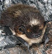 |
27 KB | Northern bat (Eptesicus nilssonii) is considered under II protection category in Estonia [https://en.wikipedia.org/wiki/Northern_bat] | 1 |
| 18:13, 16 April 2018 | Green&blue infrastructure kakumäe bay janne schasmin.jpg (file) |  |
1.69 MB | 1 | |
| 15:05, 16 April 2018 | Kakumäe Mustkivi Tallinnas.JPG (file) | 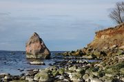 |
1.84 MB | 1 | |
| 15:04, 16 April 2018 | Tilgu koobas.jpg (file) |  |
158 KB | 1 | |
| 15:00, 16 April 2018 | Peeter-Suure-merekindlus-Suurupi-helgiheitja.jpg (file) |  |
232 KB | 1 | |
| 07:08, 15 April 2018 | Kaupo Kalda panoraam.jpg (file) |  |
175 KB | 1 | |
| 07:05, 15 April 2018 | KakumäePoolsaarel JAN TAMMIK.jpg (file) |  |
11 KB | 1 | |
| 06:54, 15 April 2018 | Kivirand-kakum-el-li-l-uendil-60x80cm-2016 orig.jpg (file) | 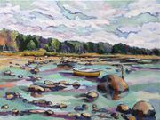 |
186 KB | 1 |