File:Land use in 1990.png
Jump to navigation
Jump to search

Size of this preview: 800 × 393 pixels. Other resolution: 892 × 438 pixels.
Original file (892 × 438 pixels, file size: 157 KB, MIME type: image/png)
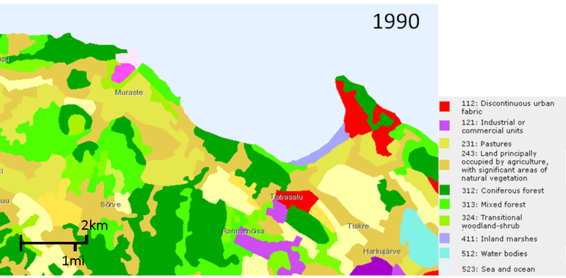
Land use in 1990. CORINE land cover map [1]
File history
Click on a date/time to view the file as it appeared at that time.
| Date/Time | Thumbnail | Dimensions | User | Comment | |
|---|---|---|---|---|---|
| current | 06:52, 20 April 2018 | | 892 × 438 (157 KB) | Jannes (talk | contribs) | Land use in 1990. CORINE land cover map [https://land.copernicus.eu/pan-european/corine-land-cover] |
You cannot overwrite this file.
File usage
The following page uses this file: